| Alipurduar II (CS Block) আলিপুরদুয়ার II সমষ্টি উন্নয়ন ব্লক | |
|---|---|
| Community development block | |
| Coordinates: 26°29′N89°32′E / 26.48°N 89.54°E Coordinates: 26°29′N89°32′E / 26.48°N 89.54°E | |
| Country | |
| State | West Bengal |
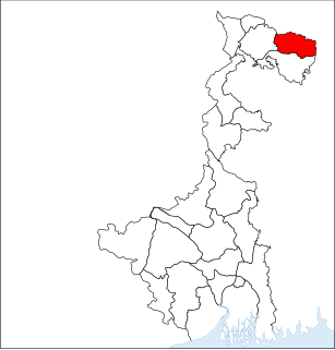
| District | Alipurduar |
| Government | |
| • Type | State govt. |
| • Body | BDO (Sangay Pema Bhutia, WBCS(Exe)) |
| Area | |
| • Total | 321.26 km2 (124.04 sq mi) |
| Population (2001) | |
| • Total | 196,909 |
| • Density | 610/km2 (1,600/sq mi) |
| Languages | |
| • Official | Bengali, English |
| Time zone | UTC+5:30 (IST) |
| ISO 3166 code | IN-WB |
| Lok Sabha constituency | Alipurduars |
| Vidhan Sabha constituency | Alipurduars, Kumargram, Kalchini |
Alipurduar II (community development block) is an administrative division in Alipurduar subdivision of Alipurduar district in the Indian state of West Bengal. Alipurduar police station serves this block. Headquarters of this block is at Josodanga. There is one census towns in this block: Sobhaganj. [1] [2]
Alipurduar District is the 20th district in the state of West Bengal, India. It consists of Alipurduar municipality, Falakata municipality and six community development blocks: Madarihat–Birpara, Alipurduar–I, Alipurduar–II, Falakata, Kalchini and Kumargram. The six blocks contain 66 gram panchayats and nine census towns. The district has its headquarters at Alipurduar. It was made a district on 25 June 2014.
India, also known as the Republic of India, is a country in South Asia. It is the seventh largest country by area and with more than 1.3 billion people, it is the second most populous country and the most populous democracy in the world. Bounded by the Indian Ocean on the south, the Arabian Sea on the southwest, and the Bay of Bengal on the southeast, it shares land borders with Pakistan to the west; China, Nepal, and Bhutan to the northeast; and Bangladesh and Myanmar to the east. In the Indian Ocean, India is in the vicinity of Sri Lanka and the Maldives, while its Andaman and Nicobar Islands share a maritime border with Thailand and Indonesia.
West Bengal is an Indian state, located in Eastern India on the Bay of Bengal. With over 91 million inhabitants, it is India's fourth-most populous state. It has an area of 88,752 km2 (34,267 sq mi). A part of the ethno-linguistic Bengal region of the Indian subcontinent, it borders Bangladesh in the east, and Nepal and Bhutan in the north. It also borders the Indian states of Odisha, Jharkhand, Bihar, Sikkim, and Assam. The state capital is Kolkata (Calcutta), the seventh-largest city in India, and center of the third-largest metropolitan area in the country. As for geography, West Bengal includes the Darjeeling Himalayan hill region, the Ganges delta, the Rarh region, and the coastal Sundarbans. The main ethnic group are the Bengalis, with Bengali Hindus forming the demographic majority.
Sobhaganj is located at 26°29′N89°32′E / 26.48°N 89.54°E .
Alipurduar II community development block has an area of 321.26 km2. [2]
Gram panchayats of Alipurduar II block/ panchayat samiti are: There are 11 numbers of Gram Panchayat these are
A gram panchayat is the only grassroots-level of panchayati raj formalised local self-governance system in India at the village or small-town level, and has a sarpanch as its elected head.
As per 2011 Census of India Alipurduar II CD Block had a total population of 218,272 of which 204,652 were rural and 13,620 were urban. There were 112,434 males and 105,838 females. Scheduled Castes numbered 91,253 and Scheduled Tribes numbered 40,245. [4]
The 15th Indian Census was conducted in two phases, house listing and population enumeration. House listing phase began on 1 April 2010 and involved collection of information about all buildings. Information for National Population Register was also collected in the first phase, which will be used to issue a 12-digit unique identification number to all registered Indian residents by Unique Identification Authority of India (UIDAI). The second population enumeration phase was conducted between 9 and 28 February 2011. Census has been conducted in India since 1872 and 2011 marks the first time biometric information was collected. According to the provisional reports released on 31 March 2011, the Indian population increased to 1.21 billion with a decadal growth of 17.70%. Adult literacy rate increased to 74.04% with a decadal growth of 9.21%. The motto of the census was 'Our Census, Our future'.
The Scheduled Castes (SCs) and Scheduled Tribes (STs) are officially designated groups of historically disadvantaged people in India. The terms are recognised in the Constitution of India and the groups are designated in one or other of the categories. For much of the period of British rule in the Indian subcontinent, they were known as the Depressed Classes. The people in scheduled castes are essentially the lowest part of Hindu society.
State West Bengal
District Alipurduar
Total No. of Police Station 02
Block Alipurduar-II Development Block
Area 312.26 km2
Total No. of Gram Panchayat 11
Total No. of CLRC 03
Total Population 218272
Male Population 112434
Female Population 105838
SC Population 91253
ST Population 40245
Literacy rate 67%
Total No. of Electors 160991
Male Electors 84128
Female Electors 76859
Other Electors 04
Gender Ratio 914 Female /1000 Male
Elector Population Ratio 0.74
Elector at the age of 18-19 3384
Name of Parliament Constituency 02-Alipurduar
Name of Assembly Constituency 10-Kumargram(ST)
11-Kalchini(ST)
12-Alipurduar
Total No. of Sectors 18
Total No. of Polling Station 183
10 Kumargram(ST) (10/181 to 10/295)
11Kalchini (ST)(11/229 to 11/253)
12 Alipurduar (12/231 to 12/273)
(Samuktala PS & Alipurduar PS)
AC No.10/181 to 10/295 (Samuktala PS)
AC No.11/229 to 11/253 (Samuktala PS)
AC No.12/231 to 12/242 (Samuktala PS)
AC No. 12/243 to 12/273 (Alipurduar PS)
Total No. of College 01
Total No. high school 21
Total No. Primary school 248
Total No. of Mouza/ Village 79
Total No. of BPHC 01
Total No. of PHC 02
Total No. of Sub-Centre 36
Total No. of SSK 83
Total No. of MSK 09
Total No. of Madrasa 01
ARO & BDO Sangay Pema Bhutia, WBCS(Exe)
ARO & Jt. BDO Sujoy Dhar, WBCS
As per 2011 census the total number of literates in Alipurduar II CD Block was 146,380, out of which 81,044 were males and 65,336 were females. [4]
NH 317 passes through the block.
Banarhat is a census town in Jalpaiguri district in the state of West Bengal, India. It is a town surrounding 23 tea gardens in the Dooars region of Jalpaiguri district in the state of West Bengal, India. People of twenty three tea gardens in and around are dependent on this town for their essentials. Population of Banarhat is about 25,000 and it is spread in an area of about 900sq. km. Banarhat is 72 km. far from Siliguri and 65 km from Jalpaiguri . This is the melting pot of different cultures where the aborigines, the tea garden workers, Marwaris, Bengalis, Oriya from both side of the border and Nepalese live together in harmony. Banarhat is surrounded by tea gardens and basties (villages). The tea gardens around has ensured that people in this area have a relatively better standard of living. Major occupation of people is service. Although many are engaged in businesses as well. Banarhat is one of the most important towns in Dooars. The town is strategically located on the NH-31C providing close access to major tourist attractions around.
Uttar Kamakhyaguri is a census town under Kumargram police station of Alipurduar subdivision in Alipurduar district in the Indian state of West Bengal.
Malbazar subdivision, also known as Mal subdivision, is a subdivision of the Jalpaiguri district in the state of West Bengal, India. It consists of Malbazar municipality and three community development blocks: Mal, Metiali and Nagrakata. The three blocks contain 22 gram panchayats. The subdivision has its headquarters at Malbazar. It is a newly created subdivision (1990s) and was earlier part of Jalpaiguri Sadar subdivision of Jalpaiguri district. The area is famous for tea gardens and moist deciduous forests. Important towns besides Malbazar town are Lataguri, Chalsa, Damdim and Matelli.
Jalpaiguri Sadar subdivision is a subdivision of the Jalpaiguri district in the state of West Bengal, India. It consists of Jalpaiguri municipal corporation, Mainaguri and Dhupguri municipalities and four community development blocks: Jalpaiguri, Maynaguri and Rajganj and Dhupguri The four blocks contain 62 gram panchayats and five census towns. The subdivision has its headquarters at Jalpaiguri City. Siliguri municipal corporation, which lies mainly in Darjeeling district, has 14 out of 47 wards located in this subdivision.
Kumargarm is an assembly constituency in Alipurduar district in the Indian state of West Bengal. The seat is reserved for scheduled tribes.
Jalpaiguri is an administrative division in Jalpaiguri Sadar subdivision of Jalpaiguri district in the Indian state of West Bengal. Jalpaiguri police station serves this block. Headquarters of this block is at Jalpaiguri.
Maynaguri is an administrative division in Jalpaiguri Sadar subdivision of Jalpaiguri district in the Indian state of West Bengal. Maynaguri police station serves this block. Headquarters of this block is at Mainaguri, a census town in this block:
Dhupguri is an administrative division in Jalpaiguri Sadar subdivision of Jalpaiguri district in the Indian state of West Bengal. Dhupguri and Banarhat police stations serve this block. Headquarters of this block is at Dhupguri. Municipalities include Dhupguri while the census towns in this block are: Banarhat and Binnaguri.
Rajganj(community development block) is an administrative division in Jalpaiguri Sadar subdivision of Jalpaiguri district in the Indian state of West Bengal. Rajganj and Bhaktinagar police stations serve this block. Headquarters of this block is at Rajganj.
Mal is an administrative division in Malbazar subdivision of Jalpaiguri district in the Indian state of West Bengal. Mal police station serves this block. Headquarters of this block is at Malbazar.
Matiali is an administrative division in Malbazar subdivision of Jalpaiguri district in the Indian state of West Bengal. Metiali police station serves this block. Headquarters of this block is at Chalsa.
Nagrakata is an administrative division in Malbazar subdivision of Jalpaiguri district in the Indian state of West Bengal. Nagrakata and Banarhat police stations serve this block. Headquarters of this block is at Nagrakata.
Madarihat-Birpara is an administrative division in Alipurduar subdivision of Alipurduar district in the Indian state of West Bengal. Madarihat and Birpara police stations serve this block. Headquarters of this block is at Madarihat.
Alipurduar I is an administrative division in Alipurduar subdivision of Alipurduar district in the Indian state of West Bengal. Alipurduar police station serves this block. Headquarters of this block is at Panchkalguri. There are four census towns in this block: Paschim Jitpur, Chechakhata, Alipurduar Railway Junction and Bholar Dabri.
Falakata is an administrative division in Alipurduar subdivision of Alipurduar district in the Indian state of West Bengal. Falakata police station serves this block. Headquarters of this block is at Falakata. There is one census town in this block: Falakata.
Kalchini is an administrative division in Alipurduar subdivision of Alipurduar district in the Indian state of West Bengal. Kalchini and Jaygaon police stations serve this block. Headquarters of this block is at Kalchini. There are two census towns in this block: Jaygaon and Uttar Latabari.
Kumargram is an administrative division in Alipurduar subdivision of Alipurduar district in the Indian state of West Bengal. Kumargram police station serves this block. Headquarters of this block is at Kumargram. There is one census town in this block: Uttar Kamakhyaguri.
Dinhata I is an administrative division in Dinhata subdivision of Cooch Behar district in the Indian state of West Bengal. Dinhata police station serves this block. Headquarters of this block is at Dinhata. There is one census town in this block: Bhangri Pratham Khanda.
The New Jalpaiguri–Alipurduar–Samuktala line is a railway line that connects New Jalpaiguri with Alipurduar and Samuktala Road in the Indian state of West Bengal.