Ridgeville, South Carolina

Last updated

Ridgeville, South Carolina
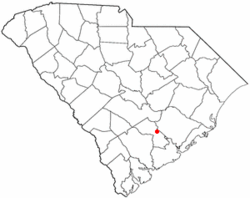
SCMap-doton-Ridgeville.PNG
Location of Ridgeville, South Carolina
Coordinates: 33°5.6′N80°18.8′W / 33.0933°N 80.3133°W / 33.0933; -80.3133
Country United States
State South Carolina
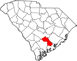
County Dorchester
Area
[1]
  Total1.80 sq mi (4.65 km2)
  Land1.80 sq mi (4.65 km2)
  Water0.00 sq mi (0.00 km2)
Elevation
75 ft (23 m)
Population
 (2020) [2]
  Total1,672
  Density930.96/sq mi (359.40/km2)
Time zone UTC-5 (Eastern (EST))
  Summer (DST) UTC-4 (EDT)
ZIP code
29472
Area code(s) 843, 854
FIPS code 45-60370 [3]
GNIS feature ID1250386 [4]
Website ridgevillegov.com

Ridgeville is a town in Dorchester County, South Carolina, United States. The population was 1,979 at the 2010 census, [5] up from 1,690 at the 2000 census. Ridgeville is part of the Charleston-North Charleston-Summerville metropolitan area.

Contents

History

The Cypress Methodist Camp Ground was added to the National Register of Historic Places in 1978. [6]

Geography

Ridgeville is located near the center of Dorchester County at 33°5.6′N80°18.8′W / 33.0933°N 80.3133°W / 33.0933; -80.3133 (33.0931, -80.3124). [7] South Carolina Highway 27 passes through the town, leading north 1.7 miles (2.7 km) to U.S. Route 78 and 3.2 miles (5.1 km) to Exit 187 on Interstate 26.

According to the United States Census Bureau, the town has a total area of 1.8 square miles (4.7 km2), all land. The town limits extend east to include Lieber Correctional Institution, run by the South Carolina Department of Corrections.

Demographics

Historical population
CensusPop.Note
1880 250
1890 212−15.2%
1900 25017.9%
1910 30020.0%
1920 38528.3%
1930 4188.6%
1940 59341.9%
1950 507−14.5%
1960 61120.5%
1970 563−7.9%
1980 6037.1%
1990 1,625169.5%
2000 1,6904.0%
2010 1,97917.1%
2020 1,672−15.5%
U.S. Decennial Census [8] [2]

As of the census [3] of 2000, there were 1,690 people, 214 households, and 156 families residing in the town. The population density was 930.4 inhabitants per square mile (359.2/km2). There were 232 housing units at an average density of 127.7 per square mile (49.3/km2). The racial makeup of the town was 39.94% White, 58.70% African American, 0.59% Native American, 0.30% from other races, and 0.47% from two or more races. Hispanic or Latino of any race were 0.47% of the population.

There were 214 households, out of which 30.8% had children under the age of 18 living with them, 50.9% were married couples living together, 19.2% had a female householder with no husband present, and 27.1% were non-families. 25.7% of all households were made up of individuals, and 14.5% had someone living alone who was 65 years of age or older. The average household size was 2.63 and the average family size was 3.19.

In the town, the population was spread out, with 8.4% under the age of 18, 11.5% from 18 to 24, 53.2% from 25 to 44, 20.7% from 45 to 64, and 6.3% who were 65 years of age or older. The median age was 36 years. For every 100 females, there were 434.8 males. For every 100 females age 18 and over, there were 542.3 males.

The median income for a household in the town was $32,639, and the median income for a family was $42,188. Males had a median income of $22,500 versus $22,404 for females. The per capita income for the town was $9,186. About 13.6% of families and 18.9% of the population were below the poverty line, including 27.8% of those under age 18 and 21.1% of those age 65 or over.
Government and infrastructure

The South Carolina Department of Corrections operates the Lieber Correctional Institution in Ridgeville. [9]

Related Research Articles

<span class="mw-page-title-main">Dorchester County, South Carolina</span> County in South Carolina, United States

Dorchester County is a county located in the U.S. state of South Carolina. As of the 2020 census, the population was 161,540. Its county seat is St. George.

<span class="mw-page-title-main">Tallahatchie County, Mississippi</span> County in Mississippi, United States

Tallahatchie County is a county in the U.S. state of Mississippi. At the 2020 census, the population was 12,715. Its county seats are Charleston and Sumner.

<span class="mw-page-title-main">Ridgeville, Alabama</span> Town in Alabama, United States

Ridgeville is a town in Etowah County, Alabama, United States. It incorporated in 1969 and is part of the Gadsden Metropolitan Statistical Area. At the 2020 census the population was 83, down from 158 in 2000. It is noteworthy for being the only community in Etowah County to have a black majority. Since 1970, it has also been the least populated community wholly within the county.

<span class="mw-page-title-main">Ridgeville, Indiana</span> Town in Indiana, United States

Ridgeville is a town in Franklin Township, Randolph County, Indiana, United States, along the Mississinewa River. The population was 688 at the 2020 census.

<span class="mw-page-title-main">North Ridgeville, Ohio</span> City in Ohio, United States

North Ridgeville is a city located along the eastern border of Lorain County, Ohio, United States. The city's population was 35,280 as of the 2020 census. A part of the Cleveland metropolitan area, North Ridgeville is the fastest-growing city in northern Ohio. It has been ranked the 13th safest city in the United States and the safest in Ohio.

<span class="mw-page-title-main">Lincolnville, South Carolina</span> Town in South Carolina, United States

Lincolnville is a town in Charleston County, South Carolina, United States. A very small portion of the town extends into Dorchester County. The population was 1,139 at the 2010 census, up from 904 in 2000.

<span class="mw-page-title-main">Great Falls, South Carolina</span> Town in South Carolina, United States

Great Falls is a town in Chester County, South Carolina, United States and is located fourteen miles southwest of Lancaster, South Carolina. The population was 1,951 at the 2020 census.

<span class="mw-page-title-main">Chesterfield, South Carolina</span> Town in South Carolina, United States

Chesterfield is a town in Chesterfield County, South Carolina, United States. The population was 1,472 at the 2010 census. It is the county seat of Chesterfield County. At the time of the 2010 census, Chesterfield was the least populous of all of South Carolina's county seats.

<span class="mw-page-title-main">Turbeville, South Carolina</span> Town in South Carolina, United States

Turbeville is a town in Clarendon County, South Carolina, United States. The population was 766 at the 2010 census, up from 602 in 2000.

<span class="mw-page-title-main">Smoaks, South Carolina</span> Town in South Carolina, United States

Smoaks is a town in Colleton County, South Carolina, United States. The population was 126 at the 2010 census.

<span class="mw-page-title-main">Harleyville, South Carolina</span> Town in Dorchester County, South Carolina, United States

Harleyville is a town in Dorchester County, South Carolina, United States. The population was 677 at the 2010 census, up from 594 at the 2000 census. Harleyville is part of the Charleston-North Charleston-Summerville metropolitan area. As of 2018 the population is 696.

<span class="mw-page-title-main">Reevesville, South Carolina</span> Town in South Carolina, United States

Reevesville is a town in Dorchester County, South Carolina, United States. The population was 196 at the 2010 census. As defined by the U.S. Office of Management and Budget, and used by the U.S. Census Bureau for statistical purposes only, Reevesville is included within the Charleston-North Charleston-Summerville metropolitan area.

<span class="mw-page-title-main">St. George, South Carolina</span> Town in South Carolina, United States

Saint George is a town in Dorchester County, South Carolina, United States. The population was 2,084 at the 2010 census, eight fewer than in 2000 census. It has been the county seat of Dorchester County since the county was formed from Colleton County in 1897.

<span class="mw-page-title-main">Cope, South Carolina</span> Town in South Carolina, United States

Cope is a town in Orangeburg County, South Carolina, United States. The population was 65 at the 2020 census, a decline from 80 in 2010.

<span class="mw-page-title-main">Elloree, South Carolina</span> Town in South Carolina, United States

Elloree is a town in Orangeburg County, South Carolina, United States. The population was 692 at the 2010 census.

<span class="mw-page-title-main">Holly Hill, South Carolina</span> Town in South Carolina, United States

Holly Hill is a town in Orangeburg County, South Carolina, United States. The population was 1,277 at the 2010 census. Prior to 1910 it was located in the northwest portion of Saint James Goose Creek Township.

<span class="mw-page-title-main">Santee, South Carolina</span> Town in South Carolina, United States

Santee is a town in Orangeburg County along the Santee River Valley in central South Carolina, United States. It has become a resort town of note located centrally north-south along the Atlantic Seaboard of South Carolina. The region has been rural, with a primarily agricultural economy typical of Orangeburg County, but is now known primarily for its several golf courses in proximity to Lake Marion, Santee State Park and other Lake Marion attractions. Interstate 95 connects its attractions easily with tourists traveling by automobile. I-95 crosses a narrow arm of the lake into the town lands, along a causeway. Lake Marion is a man-made hydroelectric reservoir, which at 110,000 acres is one of the fifty largest lakes in the country.

<span class="mw-page-title-main">Eastover, South Carolina</span> Town in South Carolina, United States

Eastover is a town in Richland County, South Carolina, United States. The population was 813 at the 2010 census, down from 830 in 2000. It is part of the Columbia, South Carolina, Metropolitan Statistical Area.

<span class="mw-page-title-main">Pinewood, South Carolina</span> Town in South Carolina, United States

Pinewood is a town located on South Carolina Highway 261 at the southern entrance to the High Hills of Santee in Sumter County, South Carolina, United States. The population was 538 at the 2010 census. It is included in the Sumter, South Carolina Metropolitan Statistical Area.

<span class="mw-page-title-main">Ladson, South Carolina</span> Census-designated place in South Carolina, United States

Ladson is a census-designated place (CDP) in Berkeley, Charleston and Dorchester counties in the U.S. state of South Carolina. The population was 13,790 at the 2010 census. It is named in honor of the Ladson family, one of the oldest planter and merchant families in the Charleston area; one of its members was lieutenant governor James Ladson.

References

  1. "ArcGIS REST Services Directory". United States Census Bureau. Retrieved October 15, 2022.
  2. 1 2 "Census Population API". United States Census Bureau. Retrieved October 15, 2022.
  3. 1 2 "U.S. Census website". United States Census Bureau . Retrieved January 31, 2008.
  4. "US Board on Geographic Names". United States Geological Survey. October 25, 2007. Retrieved January 31, 2008.
  5. "Geographic Identifiers: 2010 Demographic Profile Data (G001): Ridgeville town, South Carolina". U.S. Census Bureau, American Factfinder. Archived from the original on February 13, 2020. Retrieved January 6, 2016.
  6. "National Register Information System". National Register of Historic Places . National Park Service. March 13, 2009.
  7. "US Gazetteer files: 2010, 2000, and 1990". United States Census Bureau. February 12, 2011. Retrieved April 23, 2011.
  8. "Census of Population and Housing". Census.gov. Retrieved June 4, 2015.
  9. "Lieber Correctional Institution." South Carolina Department of Corrections. Retrieved on August 17, 2010.