
Mount Marcy is the highest point in New York, with an elevation of 5,343 feet (1,629 m). and an isolation of 130 mile. It is located in the Town of Keene in Essex County. The mountain is in the heart of the Adirondack High Peaks Region of the High Peaks Wilderness Area. Its stature and expansive views make it a popular destination for hikers, who crowd its summit in the summer months.

Heart Mountain is a mountain located in the Bow River valley just south of Exshaw, Alberta. The peak was named in 1957 for the heart shaped layer of limestone near the top.

Mount Townsend, a mountain in the Main Range of the Great Dividing Range, is located in the Snowy Mountains region of New South Wales, Australia.

North Mountain is a peak in the Catskill Mountains of New York, on the border between the towns of Catskill and Hunter, in Greene County. It is part of the Catskill Escarpment. Cairo Round Top is located northeast and Artists Rock is located southeast of North Mountain.
Stinson Lake is a 342-acre (1.38 km2) water body located in the town of Rumney in Grafton County, New Hampshire, United States. The lake is in the southern part of the White Mountains and is the largest lake in the White Mountain National Forest. Water from Stinson Lake flows via Stinson Brook, the Baker River, and the Pemigewasset River to the Merrimack River.

Kaaterskill High Peak is one of the Catskill Mountains, located in the Town of Hunter in Greene County, New York, United States. It was once believed to be the highest peak in the entire range, but its summit, at 3,655 feet in elevation, places it only 23rd among the Catskill High Peaks. It is, however, the fourth most prominent peak in the range. Due to its situation as the easternmost High Peak, it is also the only one completely outside the watersheds of New York City's reservoirs in the region.
Table Top Mountain is a mountain located in Essex County, New York. Table Top Mtn. is flanked to the north by Phelps Mountain, and to the south by Mount Marcy. Table Top has three summits; the southernmost is the highest, followed by the middle peak (1,312 m) and the north peak (1,285 m).

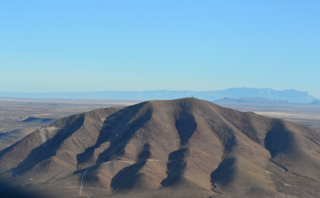
Round Mountain, a mountain of the Snowy Range, a spur of the Great Dividing Range, is located on the Northern Tablelands in the New England region in New South Wales, Australia.

The Round Mountain, one of three peaks of the same name in the region, is a mountain located on the Main Range of the Snowy Mountains, part of the Great Dividing Range, in southeastern New South Wales, Australia.

Alander Mountain, 2,239 feet (682 m) is a prominent peak of the south Taconic Mountains; it is located in southwest Massachusetts and adjacent New York. Part of the summit is grassy and open and part is covered with scrub oak and shrubs; the sides of the mountain are wooded with northern hardwood tree species. Views from the top include the southern Taconic Mountains, the Hudson River Valley including the Catskills. Several trails traverse Alander Mountain, most notably the 15.7 mi (25.3 km) South Taconic Trail, which passes just beneath the summit.

Conococheague Mountain is a long and narrow mountain located in the far western corner of Perry County, Pennsylvania, United States. The highest point on the mountain is a summit known as Round Top which rises to an elevation of 2,190 feet (670 m) and is located at the very southern end of the ridge. The mountain is almost entirely located in the Tuscarora State Forest, and has numerous hiking trails and dirt roads, including Bryner Road, New Germantown Road, and the Iron Horse Trail. The nearest town to the mountain is Blain.

The Mokelumne Wilderness is a 105,165-acre (425.59 km2) federally designated wilderness area located 70 miles (110 km) east of Sacramento, California. It is within the boundaries of three national forests: Stanislaus, Eldorado and Toiyabe. First protected under the Wilderness Act of 1964, the Mokelumne’s borders were expanded under the California Wilderness Act of 1984 with the addition of 55,000 acres. The wilderness takes its name from the Mokelumne River, which was named after a Mi-wok Indian village located on the riverbank in California's Central Valley.
The Watchung Outliers include six areas of isolated low hills and rock outcrops of volcanic and sedimentary origin in the U.S. states of New York, New Jersey, and Pennsylvania. These geologic outliers are primarily diminutive and detached remnants of the Triassic/Jurassic age Watchung Mountain basalt flows with intervening layers of sedimentary rock. All six of the outliers are found along the western edge of the Newark Basin, occupying small synclines adjacent to the Ramapo fault system. The outliers, from north to south, are known as: Ladentown, Union Hill, New Germantown/Oldwick, Prospect Hill, Sand Brook, and Jacksonwald.

Rich Mountain is a mountain located in the North Carolina High Country, northwest of the town of Boone. Its elevation reaches 4,741 feet (1,445 m).
Round Mountain is a town located in north-eastern New South Wales, Australia, in the Tweed Shire.
Round Top Mountain is a mountain that lies at the western end of the Sierra Blanca area in Hudspeth County, Texas near the town of Sierra Blanca, Texas. The area includes the Finlay Mountains, Triple Hill, and Sierra Blanca quadrangles as well as parts of the Fort Quitman and McNary quadrangles. Round Top Mountain is known for containing deposits of Beryllium as well as the largest deposit of heavy rare-earth elements in the United States.

Round Top is a mountain located in Central New York region of New York northwest of Burlington, New York.
Rice Hill is a mountain located in Central New York region of New York east of West Burlington, New York.
Round Top is a mountain in the Central New York region of New York. It is located southeast of East Winfield, New York.

Van Loan Hill is a mountain in Greene County, New York. It is located in the Catskill Mountains southwest of Maplecrest. Round Hill is located west, Elm Ridge is located north-northeast, and East Jewett Range is located south of Van Loan Hill.


