Highway 5 or the Trans-Samaria Highway, is one of Israel's main highways, connecting the Mediterranean coast immediately north of Tel Aviv with the central Sharon plain and eastwards to Ariel and other Israeli settlements in the northern West Bank.

Highway 1 is the main highway in Israel, connecting Tel Aviv and Jerusalem, and continuing eastwards to the Jordan Valley in the West Bank.

Kiryat HaYovel is a neighborhood in southwestern Jerusalem on Mount Herzl. It was built in the early 1950s to house new immigrants. Today, Kiryat HaYovel has a population of 25,000 residents.

The Jerusalem Light Rail is a light rail system in Jerusalem. Currently, the Red Line is the only one in operation, the first of several light rail lines planned in Jerusalem.

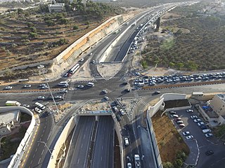
Highway 50, officially called Begin Boulevard and also referred to as Menachem Begin Expressway or Begin Highway, is a north-south urban freeway, through western Jerusalem, named after Israel's sixth Prime Minister, Menachem Begin. Local Jerusalemites simply refer to it as 'Begin'. It enters Area C of the West Bank on the north end and East Jerusalem on both ends.

Route 443 is also known as Ma'ale Beit Horon, following the ancient east-west trade route connecting the Via Maris and the Way of the Patriarchs. It is the main highway connecting Tel Aviv and Gush Dan with Jerusalem via Modi'in. While technically listed as a regional road, it is, for the most part, a divided, four-lane highway which utilizes some grade separation and interchanges, as well as major at-grade intersections, and thus is not classified as a motorway, even though there is a short motorway section on its western end, connecting it to westbound Highway 1.
Karmei Tzur, or Carmei Tzur is an Israeli settlement organized as a community settlement in the West Bank located north of Hebron in the Judean hills between the Palestinian towns of Beit Ummar and Halhul. The National Religious community falls under the jurisdiction of Gush Etzion Regional Council. Under the terms of the Oslo Accords of 1993 between Israel and the Palestine Liberation Organization, Karmei Tzur was designated Area "C" under full Israeli civil and security control. In 2022 it had a population of 980.

Mateh Yehuda Regional Council is a regional council in the Jerusalem District of Israel. In 2024 it was home to 51,125 people.

Highway 3 is a highway in Israel. It begins at Highway 4 on the outskirts of Ashkelon, running east-northeast, passing through Kiryat Malakhi and Latrun, and ending just short of Modi'in.

Highway 38 is an arterial road in the low plains of Judea in Israel. It serves as the main access route to Beit Shemesh and as a main north–south route in the region. Along the route are many nature preserves and archeological sites.

Highway 44 is an arterial road in central Israel. It connects Tel Aviv-Yafo and Holon to Ramla, Lod and the Shefela. It is numbered as a north–south road and follows a north-west to south-east path.

Tzur Hadassah is a local council located in the Jerusalem Corridor, located 12 kilometres (7.5 mi) southwest of Jerusalem, at an altitude of 755 meters above sea level, located on Route 375 west of Betar Ilit, about one kilometer west of the Green Line, adjacent to the Palestinian village of Wadi Fukin. In 2022 it had a population of 12,142. In 2023 it was awarded Local council (Israel) status.

Route 171 is a regional east-west road in southern Israel. It is the only east-west road in the Negev Mountains. It is 33 km long. It goes from Mount Harif junction on Highway 10 adjacent to Israel's border with Egypt to HaRuhot junction with Highway 40 about 5 km north of Mitzpe Ramon. The road passes mostly along the northern edge of Makhtesh Ramon and along the flowing path of Nahal Nitzana. In its eastern portion, it crosses HaRuhot Plain and passes by the Mitzpe Ramon Airport.

Route 411, is the designation of a regional route in the Shephelah region in Israel running southeasterly consolidating previous local roads and new construction. The western section begins at Highway 42 near Kfar Gevirol in western Rehovot and continues just past Route 410. The central section, completed in June 2014, continues to the entrance of Kvutzat Shiller. The eastern section begins just short of Highway 40 south of Rehovot and terminates at Highway 3 towards Jerusalem, bypassing the towns of Kiryat Ekron and Mazkeret Batya.

The Jerusalem corridor is an area between Jerusalem and the Shephelah in Israel. Its northern border is the old road to Jerusalem; its southern border, the Elah Valley; and its western border, Sha'ar HaGai/Bab el-Wad and the road to Beit Shemesh. The largest towns in the Jerusalem corridor are Beit Shemesh, Mevasseret Zion, Abu Ghosh, Tzur Hadassah and Kiryat Ye'arim.

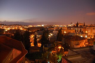
Yefeh Nof is a neighborhood in west Jerusalem, founded in 1929. Together with Ramat Beit HaKerem and Givat Beit HaKerem, it is part of the larger Beit HaKerem neighborhood. Its name is one of the seventy poetic names the Hebrew Bible uses for Jerusalem, and literally means "beautiful view".

Highway 45 is the official designation of a 3.3 km stretch of road forming a continuous connection between Route 443 from the Tel Aviv Metropolitan Area and Highway 50 to central Jerusalem and a 1.4 km spur serving the Atarot Industrial Park.

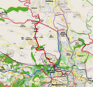
Route 436 is a regional arterial road in Israel and the West Bank between Jerusalem and Givat Ze'ev. The southern portion begins as a major urban artery in Jerusalem's predominantly Hareidi neighborhoods leading to Highway 50, to Highway 1 and to the northern neighborhood of Ramot. Further north, the road runs alongside portions of Israel's West Bank Barrier as it approaches Givat Ze'ev. It crosses Route 443 to the Tel Aviv area and Highway 45 to Atarot and ends at the Beitunia section of the security barrier. The speed limit begins at 50 km/h along its urban section becoming 70 km/h as it passes through Ramot and then becoming 90 km/h as it leaves the Jerusalem municipality northwards. The road officially ends at the Beitunya cargo transfer terminal.

Highway 333, also known as Ben-Gurion Boulevard, is a highway in West Jerusalem. It is the main entrance to the city through Givat Shaul. In the past, the road was part of Highway 1 until the opening of Yitzhak Shamir Road and the diverting of Highway 1 onto it. However, it is often colloquially still referred to as part of the Jerusalem–Tel Aviv Route.


![Sorek Wastewater Treatment Plant in Nahal Sorek, near Road 386 and beside Mount Eitan [he] MountEitanSorekWastewaterTreatmentPlantRoad386NahalSorekJan272023 02.jpg](http://upload.wikimedia.org/wikipedia/commons/thumb/f/f0/MountEitanSorekWastewaterTreatmentPlantRoad386NahalSorekJan272023_02.jpg/220px-MountEitanSorekWastewaterTreatmentPlantRoad386NahalSorekJan272023_02.jpg)


