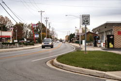
Russells Point, Ohio

Last updated

Russells Point, Ohio
Russells-point-ohio-downtown.jpg
Downtown Russells Point
OHMap-doton-Russells Point.png
Location of Russells Point, Ohio
Detailed map of Russells Point, Ohio.png
Detailed map of Russells Point
Coordinates: 40°28′06″N83°53′38″W / 40.46833°N 83.89389°W / 40.46833; -83.89389
Country United States
State Ohio
County Logan
Townships Washington, Stokes
Area
[1]
  Total1.01 sq mi (2.63 km2)
  Land0.93 sq mi (2.41 km2)
  Water0.08 sq mi (0.22 km2)
Elevation
[2]
1,001 ft (305 m)
Population
 (2020)
  Total1,320
  Density1,419.35/sq mi (548.25/km2)
Time zone UTC-5 (Eastern (EST))
  Summer (DST) UTC-4 (EDT)
ZIP code
43348
Area code(s) 937, 326
FIPS code 39-69302 [3]
GNIS feature ID2399146 [2]
Website russellspoint-oh.gov

Russells Point is a village located in northwest Logan County, Ohio, United States. The population was 1,320 at the 2020 census. It is situated on Indian Lake, which has long been a popular summer resort destination.

Contents

History

A post office called Russells Point has been in operation since 1913. [4] The village was named after James Russell, owner of the town site. [5]

On March 14, 2024, Russell's Point as well as several other communities nearby Indian Lake (Ohio) were struck by a large, considerable tornado at approximately 7:51 pm EST. [6] At least three fatalities were reported as a result of the tornado along with many injuries and a great deal of damage, some catastrophic, to both homes and businesses. It has been reported that some structures were completely destroyed. The tornado was later identified as an EF-3 rated tornado by NWS survey teams. [7]

Geography

According to the United States Census Bureau, the village has a total area of 1.01 square miles (2.62 km2), of which, 0.93 square miles (2.41 km2) is land and 0.08 square miles (0.21 km2) is water. [8]

Demographics

Historical population
CensusPop.Note
1930 344
1940 55461.0%
1950 90964.1%
1960 1,11122.2%
1970 1,104−0.6%
1980 1,1564.7%
1990 1,50430.1%
2000 1,6197.6%
2010 1,391−14.1%
2020 1,320−5.1%
U.S. Decennial Census [9]
Water tower of Russells Point. Russells-point-ohio-water-tower.jpg
Water tower of Russells Point.
Sandy Beach Amusement Park Bridge. Russells-point-ohio-indian-lake-arch.jpg
Sandy Beach Amusement Park Bridge.

2010 census

As of the census [10] of 2010, there were 1,391 people, 618 households, and 342 families living in the village. The population density was 1,495.7 inhabitants per square mile (577.5/km2). There were 1,144 housing units at an average density of 1,230.1 per square mile (474.9/km2). The racial makeup of the village was 97.3% White, 0.6% African American, 0.2% Native American, 0.1% Asian, 0.4% from other races, and 1.3% from two or more races. Hispanic or Latino of any race were 1.1% of the population.

There were 618 households, of which 31.9% had children under the age of 18 living with them, 35.1% were married couples living together, 15.7% had a female householder with no husband present, 4.5% had a male householder with no wife present, and 44.7% were non-families. 38.7% of all households were made up of individuals, and 17.3% had someone living alone who was 65 years of age or older. The average household size was 2.25 and the average family size was 2.97.

The median age in the village was 38 years. 25.7% of residents were under the age of 18; 9.1% were between the ages of 18 and 24; 25.2% were from 25 to 44; 23.3% were from 45 to 64; and 16.9% were 65 years of age or older. The gender makeup of the village was 48.6% male and 51.4% female.

2000 census

As of the census [3] of 2000, there were 1,619 people, 727 households, and 415 families living in the village. The population density was 1,733.1 inhabitants per square mile (669.2/km2). There were 1,081 housing units at an average density of 1,157.2 per square mile (446.8/km2). The racial makeup of the village was 98.15% White, 0.12% African American, 0.19% Native American, 0.43% Asian, 0.49% from other races, and 0.62% from two or more races. Hispanic or Latino of any race were 1.42% of the population.

There were 727 households, out of which 28.5% had children under the age of 18 living with them, 38.5% were married couples living together, 13.8% had a female householder with no husband present, and 42.8% were non-families. 37.7% of all households were made up of individuals, and 17.3% had someone living alone who was 65 years of age or older. The average household size was 2.23 and the average family size was 2.91.

In the village, the population was spread out, with 26.7% under the age of 18, 8.2% from 18 to 24, 24.5% from 25 to 44, 24.3% from 45 to 64, and 16.4% who were 65 years of age or older. The median age was 36 years. For every 100 females, there were 87.0 males. For every 100 females age 18 and over, there were 82.6 males.

The median income for a household in the village was $27,589, and the median income for a family was $37,434. Males had a median income of $35,326 versus $21,667 for females. The per capita income for the village was $15,835. About 17.7% of families and 20.2% of the population were below the poverty line, including 26.3% of those under age 18 and 13.3% of those age 65 or over.

Government

The village of Russells Point also owns local low power WRPO (93.5 FM), operated by Gray Fox Broadcasting as its locally originating community radio station.

Transportation

Due to its location on the south shore of Indian Lake, Russells Point includes several highways. U.S. Route 33 is the main street in Russells Point, and State Routes 366 and 708 are also important. State Route 720 begins on the northwestern side of the village.

Commercial ports

Maritime access is available at several commercial establishments, including restaurants, which have docks for boats. [11]

Related Research Articles

<span class="mw-page-title-main">Indian Point, Missouri</span> Village in Missouri, United States

Indian Point is a village in Stone County, Missouri, United States. The population was 550 at the 2020 census. It is part of the Branson, Missouri Micropolitan Statistical Area.

<span class="mw-page-title-main">Bailey Lakes, Ohio</span> Village in Ohio, United States

Bailey Lakes is a village in Clear Creek Township, Ashland County, Ohio, United States. The population was 349 at the 2020 census.

<span class="mw-page-title-main">Mount Orab, Ohio</span> City in Ohio, United States

Mount Orab is a village in Brown County, Ohio, United States. The population is 4,347 as of the 2020 United States census.

<span class="mw-page-title-main">Russellville, Ohio</span> Village in Ohio, United States

Russellville is a village in Jefferson Township, Brown County, Ohio, United States. The population was 542 at the 2020 census.

<span class="mw-page-title-main">Moscow, Ohio</span> Village in Ohio, United States

Moscow is a village in Clermont County, Ohio. The population was 155 at the time of the 2020 census. The William H. Zimmer Power Station, a coal-fired power plant that was converted from a planned nuclear power plant during construction, is partially located within village limits. It is located near the Ulysses S. Grant Birthplace.

<span class="mw-page-title-main">North Robinson, Ohio</span> Village in Ohio, United States

North Robinson is a village in Crawford County, Ohio, United States. The population was 219 at the 2020 census.

<span class="mw-page-title-main">Bay Village, Ohio</span> City in Ohio, United States

Bay Village is a city in western Cuyahoga County, Ohio, United States. Located along the southern shore of Lake Erie, the city is a western suburb of Cleveland and a part of the Cleveland metropolitan area. The population was 16,163 at the 2020 census.

<span class="mw-page-title-main">Wayne Lakes, Ohio</span> Village in Ohio, United States

Wayne Lakes is a village in Darke County, Ohio, United States. The population was 693 at the 2020 census.

<span class="mw-page-title-main">Senecaville, Ohio</span> Village in Ohio, United States

Senecaville is a village in Guernsey County, Ohio, United States. The population was 422 at the 2020 census.

<span class="mw-page-title-main">Indian Hill, Ohio</span> City in Ohio, United States

The Village of Indian Hill is a city in Hamilton County, Ohio, United States, and a suburb of the Greater Cincinnati area. The population was 6,087 at the 2020 census. Prior to 1970, Indian Hill was incorporated as a village, but under Ohio law became designated as a city once its population was verified as exceeding 5,000. The municipality then changed its name to add "Village", and legally it is known as "The City of The Village of Indian Hill". The Village of Indian Hill is served by the Indian Hill Exempted Village School District.

<span class="mw-page-title-main">Huntsville, Ohio</span> Village in Ohio, United States

Huntsville is a village in Logan County, Ohio, United States. The population was 408 at the 2020 census.

<span class="mw-page-title-main">Lakeview, Ohio</span> Village in Ohio, United States

Lakeview is a village in Logan County, Ohio, United States. The population was 1,184 at the 2020 census.

<span class="mw-page-title-main">Berkey, Ohio</span> Village in the United States

Berkey is a village in Lucas County, Ohio, United States. The population was 275 at the 2020 census.

<span class="mw-page-title-main">Cardington, Ohio</span> Village in Ohio, United States

Cardington is a village in Morrow County, Ohio, United States. The population was 2,051 at the 2020 census. Mount Gilead, Ohio, the county seat, is located northeast of Cardington on U.S. Route 42.

<span class="mw-page-title-main">Otway, Ohio</span> Village in Ohio, United States

Otway is a village in Scioto County, Ohio, United States. The population was 92 at the 2020 census.

<span class="mw-page-title-main">Meyers Lake, Ohio</span> Village in Ohio, United States

Meyers Lake is a village in central Stark County, Ohio, United States. The population was 724 at the 2020 census. It is part of the Canton–Massillon metropolitan area.

<span class="mw-page-title-main">Harveysburg, Ohio</span> Village in Ohio, United States

Harveysburg is a village in Massie Township, Warren County, Ohio, United States. The population was 554 at the 2020 census. It is best known as the home of the Ohio Renaissance Festival.

<span class="mw-page-title-main">Millbury, Ohio</span> Village in Ohio, United States

Millbury is a village in Wood County, Ohio, United States. The population was 1,193 at the 2020 census.

<span class="mw-page-title-main">Crestline, Ohio</span> American village in Crawford and Richland Counties in the U.S. state of Ohio

Crestline is a village in Crawford and Richland Counties in the U.S. state of Ohio. Crestline's population was 4,525 at the 2020 census. It is the third largest municipality in Crawford County. The Crawford County portion of Crestline is part of the Bucyrus Micropolitan Statistical Area, while the small portion of the village that extends into Richland County is considered part of the Mansfield Metropolitan Statistical Area. Both sections form the Mansfield–Bucyrus, OH Combined Statistical Area.

<span class="mw-page-title-main">Buckeye Lake, Ohio</span> Village in Ohio, United States

Buckeye Lake is a village in Fairfield and Licking counties in the U.S. state of Ohio. The population was 2,520 at the 2020 census. It is named for Buckeye Lake, a large lake along which the village is built.

References

  1. "ArcGIS REST Services Directory". United States Census Bureau. Retrieved September 20, 2022.
  2. 1 2 U.S. Geological Survey Geographic Names Information System: Russells Point, Ohio
  3. 1 2 "U.S. Census website". United States Census Bureau . Retrieved January 31, 2008.
  4. "Post offices". Jim Forte Postal History. Retrieved June 19, 2016.
  5. Overman, William Daniel (1958). Ohio Town Names. Akron, OH: Atlantic Press. p. 121.
  6. "At least 3 dead, 25 injured from EF3 tornado in Logan County". March 15, 2024.
  7. "NWS says Indian Lake hit with EF3 tornado; 8 tornadoes in Ohio total so far". March 15, 2024.
  8. "US Gazetteer files 2010". United States Census Bureau. Archived from the original on January 25, 2012. Retrieved January 6, 2013.
  9. "Census of Population and Housing". Census.gov. Retrieved June 4, 2015.
  10. "U.S. Census website". United States Census Bureau . Retrieved January 6, 2013.
  11. "Where is Indian Lake?", Indian Lake. Retrieved April 26, 2011