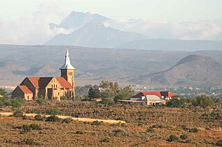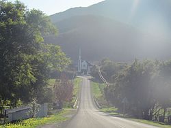
The Karoo is a semi-desert natural region of South Africa. No exact definition of what constitutes the Karoo is available, so its extent is also not precisely defined. The Karoo is partly defined by its topography, geology and climate, and above all, its low rainfall, arid air, cloudless skies, and extremes of heat and cold. The Karoo also hosted a well-preserved ecosystem hundreds of million years ago which is now represented by many fossils.

George Municipality is a local municipality within the Garden Route District Municipality, in the Western Cape province of South Africa. As of 2011, the population is 193,672. Its municipality code is WC044.

Mossel Bay Municipality is a local municipality within the Garden Route District Municipality, in the Western Cape province of South Africa. As of 2011, the population was 89,430.

Oudtshoorn Municipality is a local municipality within the Garden Route District Municipality, in the Western Cape province of South Africa. As of 2022, the population was 138,257.

Oudtshoorn is a town in the Western Cape province of South Africa, located between the Swartberg mountains to the north and the Outeniqua Mountains to the south. Dubbed the "ostrich capital of the world", Oudtshoorn is known for its ostrich-feather booms, during 1865–1870 and 1900–1914. With approximately 60,000 inhabitants, it is the largest town in the Klein Karoo region. The town's economy is primarily reliant on the ostrich farming and tourism industries. Oudtshoorn is home to the world's largest ostrich population, with a number of specialised ostrich breeding farms, such as the Safari Show Farm and the Highgate Ostrich Show Farm, as stated by Pierre D. Toit.

George is the second largest city in the Western Cape province of South Africa. The city is a popular holiday and conference centre, as well as the administrative and commercial hub and the seat of the Garden Route District Municipality. It is named after the British Monarch George III.

Ostrich leather is the result of tanning skins taken from African ostriches farmed for their feathers, skin and meat. The leather is distinctive for its pattern of vacant quill follicles, forming bumps ranged across a smooth field in varying densities. It requires an intricate, specialised, and expensive production process making its aesthetic value costly.

De Rust is a small village at the gateway to the Klein Karoo, South Africa. The name is Dutch and literally translates to "The Rest", referring to the town's original purpose of being a resting place for settlers en route through the challenging terrain of a nearby Swartberg gorge.

The Archdiocese of Cape Town is a Latin Church ecclesiastical jurisdiction or archdiocese of the Catholic Church located in Cape Town, in the south-western region of South Africa. The principal church of the archdiocese and the location of the archbishop's cathedra is the Cathedral of St. Mary of the Flight into Egypt, which also serves as the patron saint for the archdiocese.

The Roman Catholic Diocese of Oudtshoorn is a diocese located in the city of Oudtshoorn in the ecclesiastical province of Cape Town in South Africa.

De Hoop is a town in Oudtshoorn Local Municipality in the Western Cape province of South Africa.
Dysselsdorp is a small town that lies between Oudtshoorn and De Rust in the Little Karoo. It was founded as missionary station in 1838 for the emancipated slaves and dispossessed Khoekhoen who lived in the area. Since 1996 Dysselsdorp has been used as a case study for multiple agricultural reform programmes. 12 544 People live in Dysselsdorp and it is a predominantly Afrikaans-speaking coloured community. Majority of Dysselsdorp’s workers are employed in the agricultural industry or work in the nearby town of Oudtshoorn. Dysselsdorp is located in two wards of the Oudtshoorn Local Municipality.
Prince Albert Road is a village located in Laingsburg Local Municipality, Western Cape.

Baron Pieter van Reedevan Oudtshoorn was a senior official and Governor designate of the Dutch Cape Colony. He was appointed Governor of the Cape Colony in 1772 to succeed the deceased Governor Ryk Tulbagh but died at sea on his way to the Cape Colony to take up his post. The Western Cape town of Oudtshoorn is named after him. He is the progenitor of the van R(h)eede van Oudtshoorn family in South Africa.

Belmond Mount Nelson Hotel is a luxury hotel situated in the Gardens neighbourhood in inner-city Cape Town in a garden estate overlooked by Table Mountain.

The South African Infantry School is within the Army Base in Oudtshoorn, Western Cape. The Infantry School, now at Oudtshoorn, was established in November 1953, after a history dating back to the South African Military School in Bloemfontein, established in 1912. It is the Infantry’s “centre of excellence” and offers a number of infantry-specific courses to regulars and Reservists.
Ockert Stefanus "Okkie" Terblanche is a South African retired politician and retired police general who served as the Shadow Deputy Minister of Police and as a Member of the National Assembly from 2019 until retiring from politics in 2024. He represented the Western Cape in the National Council of Provinces (NCOP) from October 2015 to May 2019. Terblanche is a member of the Democratic Alliance (DA).
The Oudtshoorn Local Municipality council consists of twenty-five members elected by mixed-member proportional representation. Thirteen councillors are elected by first-past-the-post voting in thirteen wards, while the remaining twelve are chosen from party lists so that the total number of party representatives is proportional to the number of votes received. In the election of 1 November 2021, the African National Congress won a plurality of eight seats on the council.
The Moses Kotane Local Municipality is a Local Municipality in the North West Province in South Africa. The council consists of sixty-nine members elected by mixed-member proportional representation. Thirty-five councillors are elected by first-past-the-post voting in thirty-five wards, while the remaining thirty-four are chosen from party lists so that the total number of party representatives is proportional to the number of votes received. In the election of 1 November 2021 the African National Congress (ANC) won a majority of forty-six seats.

Ruiterbos is a village in the Mossel Bay Local Municipality in the Western Cape province of South Africa. As of 2011, the village had a population of 937 living in 310 households. The village is situaded at the foot of the Robinson Pass between Mossel Bay and Oudtshoorn. The settlement is about 22 km north of Mossel Bay, 12 km north of Brandwag and 10 km west of Friemersheim. The R328 passes through the town. The village is home to the Drie Magrietjies Padstal. Next to the village is the Ruitersbos Nature Reserve.


