
Cape Town is the legislative capital of South Africa. It is the country's oldest city and the seat of the Parliament of South Africa. It is the country's second-largest city, after Johannesburg, and the largest in the Western Cape. The city is part of the City of Cape Town metropolitan municipality.

Durban is the third-most populous city in South Africa, after Johannesburg and Cape Town, and the largest city in the province of KwaZulu-Natal. Situated on the east coast of South Africa, on the Natal Bay of the Indian Ocean, Durban is South Africa's busiest port and was formerly named Port Natal. North of the harbour and city centre lies the mouth of the Umgeni River; the flat city centre rises to the hills of the Berea on the west; and to the south, running along the coast, is the Bluff. Durban is the seat of the larger eThekwini Metropolitan Municipality, which spans an area of 2,556 km2 (987 sq mi) and had a population of 4.2 million in 2022, making the metropolitan population one of Africa's largest on the Indian Ocean. Within the city limits, Durban's population was 595,061 in 2011. The city has a humid subtropical climate, with hot, wet summers and mild, dry winters.
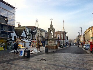
The Borough of Maidstone is a local government district with borough status in Kent, England. Its administrative centre is Maidstone, the county town of Kent.

Midrand is a town in central Gauteng, South Africa. It is situated in-between Centurion and Sandton. Formerly an independent municipality, Midrand now forms part of the City of Johannesburg Metropolitan Municipality.

Namaqualand is an arid region of Namibia and South Africa, extending along the west coast over 1,000 km (600 mi) and covering a total area of 440,000 km2 (170,000 sq mi). It is divided by the lower course of the Orange River into two portions – Little Namaqualand to the south and Great Namaqualand to the north.

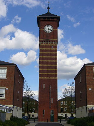
Rondebosch is one of the Southern Suburbs of Cape Town, South Africa. It is primarily a residential suburb, with shopping and business districts as well as the main campus of the University of Cape Town.
Reitz is a small maize, wheat and cattle farming town located in the east of the Free State province of South Africa.

East Farleigh railway station is on the Medway Valley Line in Kent, England, located to the south-west of Maidstone and close to the village of East Farleigh, on the opposite (south) bank of the River Medway, though the station is actually located in Barming parish. It is 42 miles 75 chains (69.1 km) down the line from London Charing Cross via Paddock Wood. The station and all trains that serve the station are operated by Southeastern.
Longtown is a market town in Cumbria, England, just south of the Scottish Border. It has a sheep market which was at the centre of the 2001 United Kingdom foot-and-mouth crisis. Just south-west of Longtown is Arthuret Church, dedicated to Saint Michael and All Angels.

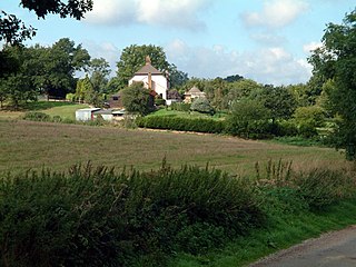
Cliddesden is a village and a parish in Hampshire, England located 3 miles south of Basingstoke, close to the M3 motorway. In the 2001 census it had a population of 489, increasing to 497 at the 2011 Census. The land and housing are currently protected as it is within a Conservation Zone and has many areas of beauty and rolling countryside.

Monkton Farleigh is a village and civil parish in west Wiltshire, England, on high ground 3 miles (5 km) northwest of Bradford-on-Avon, and a similar distance east of the city of Bath. The parish includes the hamlets of Farleigh Wick and Pinckney Green. In the west and northwest the parish is bounded by Somerset.

The Cape Town Cycle Tour, formerly known as the Cape Argus Cycle Tour, is an annual cycle race hosted in Cape Town, South Africa, usually 109 km (68 mi) long. It is the first event outside Europe to be included in the Union Cycliste Internationale's Golden Bike Series. South Africa hosts some of the largest, by the number of entrants, sporting events in the world with three being the largest of their type. The Cape Town Cycle Tour, with as many as 35 000 cyclists taking part, is the world's largest individually timed cycle race. The other two are the world's largest ultra-marathon running event, the Comrades Marathon, and the world's largest open water swim, the Midmar Mile.

Farleigh is a village and former civil parish, now in the parish of Chelsham and Farleigh in the Tandridge district of Surrey, England. It is located in the North Downs AONB and the Metropolitan Green Belt, 4.5 miles (7.2 km) south east of Croydon, 13.4 miles (21.6 km) south of London and 25 miles (40 km) WNE of Surrey's county town, Guildford. In 1961 the parish had a population of 1285.

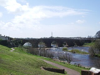
East Farleigh is a village and civil parish in the local government district of Maidstone, Kent, England. The village is located on the south side of the River Medway about two miles (3.2 km) upstream from the town of Maidstone.
Chelsham and Farleigh is a civil parish in the Tandridge District of Surrey, England. The parish is high on the North Downs and centred 14 miles (23 km) south-southeast of central London and it adjoins the Greater London boundary; it is a predominantly rural/wooded parish aside from minority of land used for homes and gardens. Other than the villages of Chelsham and Farleigh, the parish also includes the hamlet of Fickleshole. The parish was created on 1 April 1969 as an amalgamation of its two named small villages.
Ashton is a small town in the Western Cape in South Africa. The town is at the foot of the Langeberg mountain range, 10 km southwest of Montagu and 19 km east-southeast of Robertson. It is situated in a valley known for production of wines and fruit.
Chelsham is a village and former civil parish, now in the parish of Chelsham and Farleigh and the Tandridge district of Surrey, England. It is located in the Metropolitan Green Belt, 15.3 miles (24.6 km) from London, 3 miles (4.8 km) from Oxted and 23.8 miles (38.3 km) from Guildford. In 1961 the parish had a population of 1285.
Farleigh Wallop is a small village and civil parish in Hampshire, England, approximately 4.7 miles (7.6 km) south of Basingstoke on the slopes of Farleigh Hill. The parish includes about 1,725 acres (6.98 km2).
Farleigh is a rural town and locality in the Mackay Region, Queensland, Australia. In the 2021 census, the locality of Farleigh had a population of 814 people.

Woodville is a small hamlet in the Western Cape, South Africa. The settlement is located about 15 km west of Karatara and about 17 km east of George, with the closest town being Touwsranten located 5 km east. Woodville lies at the foot of the Outeniqua Mountains and is about 2 km east of the Woodville Big Tree, the third largest in South Africa.


