Silva | |
---|---|
Coordinates: 37°10′34″N90°27′49″W / 37.17611°N 90.46361°W Coordinates: 37°10′34″N90°27′49″W / 37.17611°N 90.46361°W | |
Country | United States |
State | Missouri |
County | Wayne |
Elevation | 404 ft (123 m) |
Time zone | UTC-6 (Central (CST)) |
• Summer (DST) | UTC-5 (CDT) |
ZIP code | 63964 [2] |
Area code | 573 |
GNIS feature ID | 752158 [1] |
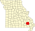
Silva is an unincorporated community in Wayne County, Missouri, United States. It is located on U.S. Route 67 just south of Missouri Route 34, approximately thirteen miles east of Piedmont and three miles north of Greenville. The community is at the north end of Lake Wappapello and the St. Francis River flows past one mile to the west. [3]
A post office called Silva has been in operation since 1902. [4] An early postmaster gave the community the name of one of her acquaintances. [5]
Silva is home to Camp Lewallen, a Boy Scout Camp serving the Scouts of the Greater Saint Louis Area Council. [6]
Eureka is a city located in St. Louis County, Missouri, United States, adjacent to the cities of Wildwood and Pacific, along Interstate 44. It is in the extreme southwest of the Greater St. Louis metro area. As of the 2020 census, the city had a population of 11,646. Since 1971, Eureka has been known as the home of the amusement park Six Flags St. Louis.
St. Louis is the second-largest city in Missouri. It sits near the confluence of the Mississippi and the Missouri Rivers. In 2020, the city proper had a population of 301,578, while the bi-state metropolitan area, which extends into Illinois, had an estimated population of over 2.8 million, making it the largest metropolitan area in Missouri, the second-largest in Illinois.
Wayne County is a county located in the Ozark foothills in the U.S. state of Missouri. As of the 2020 census, the population was 10,974. The county seat is Greenville. The county was officially organized on December 11, 1818, and is named after General "Mad" Anthony Wayne, who served in the American Revolution.
St. Louis County is located in the eastern-central portion of Missouri. It is bounded by the City of St. Louis and the Mississippi River to the east, the Missouri River to the north, and the Meramec River to the south. As of the 2020 census, the total population was 1,004,125, making it the most populous county in Missouri. Its county seat is Clayton. The county is included in the St. Louis, MO–IL metropolitan statistical area.
Scouting in Missouri has a long history, from the 1910s to the present day.
Scouting in Illinois has served youth since 1909. The state was the home of the Boy Scouts of America (BSA) founder, William D. Boyce.
Scouting in Ohio has a long history, from the 1908 to the present day, serving thousands of youth in programs that suit the environment in which they live.
Scouting in New York has a long history, from the 1910s to the present day, serving thousands of youth in programs that suit the environment in which they live. The first National Boy Scouts of America (BSA) Headquarters was in New York City, and the Girl Scouts of the USA National Headquarters is currently located at 420 5th Avenue, New York, New York.
High Ridge is an unincorporated community and census-designated place (CDP) in Jefferson County, Missouri, United States. The population was 4,305 at the 2010 census. At 927 feet (283 m) above sea level, High Ridge is the second-highest point in Jefferson County, second only to Sun Ridge, north of Hillsboro, according to data from the House Springs/Hillsboro 7.5 minute topographic quadrangles. The Beaumont Scout Reservation, a property of the Greater St. Louis Area Council, Boy Scouts of America, is 4 miles (6 km) north of High Ridge.
Creve Coeur is a city located in mid St. Louis County, Missouri, United States, a part of Greater St. Louis. Its population was 18,834 at the 2020 census. Creve Coeur borders and shares a ZIP code (63141) with the neighboring city of Town and Country. It is home to the headquarters of Drury Hotels, and Monsanto until its acquisition by Bayer in 2018.
Chesterfield is a city in St. Louis County, Missouri, United States. It is a western suburb of St. Louis. As of the 2020 census, the population was 49,999, making it the state's fourteenth-largest city. The broader valley of Chesterfield was originally referred to as "Gumbo Flats", derived from its soil, which though very rich and silty, resembled gumbo when wet.
Silicon Valley Monterey Bay Council (#055), the result of a council merger between the Santa Clara County Council and the Monterey Bay Area Council, is a Boy Scouts of America council headquartered in San Jose, California. In 2004, the previous two councils served over 11,000 youth in over 400 Boy Scout troops, Cub Scout packs, Venturing crews, and Explorer posts. In 2012, the Monterey Bay Area Council announced that after 89 years as a separate council, it had agreed to merge back into the Santa Clara County Council. As of 2013, the council served 13,000 youth in four different counties.
The Greater Saint Louis Area Council of the Boy Scouts of America was formed in 1911 and is based in St. Louis, Missouri. The council serves Scouts in the St. Louis Metro area, southeast Missouri, and southern and central Illinois.
Devils Elbow is an unincorporated community in Pulaski County, Missouri, United States on historic U.S. Highway 66. It is situated on the Big Piney River and is named for a tight incised meander in the river known as a "devil of an elbow". The community is approximately five miles (8 km) east of St. Robert.
Coldwater is an unincorporated community in northern Wayne County, Missouri, United States. It is located just east of U.S. Route 67, approximately seventeen miles south of Fredericktown and one mile south of the Madison-Wayne county line. The community is on Cedar Creek about three miles west of the St. Francis River.
Lodi is an unincorporated community in Wayne County, Missouri, United States. It is located on Bennett Creek, just east of the St. Francis River. U.S. Route 67 passes through the community, approximately thirteen miles northeast of Piedmont. The Coldwater Conservation Area lies to the northeast of Lodi and Sam A. Baker State Park lies to the west across the St. Francis River.
Transportation in Greater St. Louis, Missouri includes road, rail, ship, and air transportation modes connecting the bi-state St. Louis metropolitan area with surrounding communities throughout the Midwest, national transportation networks, and international locations. The Greater St. Louis region also supports a multi-modal transportation network that includes bus, paratransit, and light rail service in addition to shared-use paths, bike lanes and greenways.
Fort Leonard Wood is a U.S. Army training installation located in the Missouri Ozarks. The main gate is located on the southern boundary of The City of St. Robert. The post was created in December 1940 and named in honor of General Leonard Wood in January 1941. Originally intended to train infantry troops, in 1941 it became an engineer training post with the creation of the Engineer Replacement Training Center. During World War II Italian and German POWs were interned at the fort. In 1984, as part of the Base Realignment and Closure process, most of the U.S. Army Engineer School's operations were consolidated at Fort Leonard Wood. Before that, officer training was conducted at Fort Belvoir, Virginia.
Greater Tampa Bay Area Council serves Scouts in West-Central Florida with the council headquarters in Tampa, Florida. Youth are served in the following nine counties: Citrus, Hardee, Hernando, Highlands, Hillsborough, Pasco, Pinellas, Polk and Sumter. Greater Tampa Bay Area Council was formed on May 1, 2016 by the merger of Gulf Ridge Council with West Central Florida Council.
Ojibway is an extinct town in southern Wayne County, in the U.S. state of Missouri. The community location lies adjacent to the Otter Creek arm of Lake Wappapello approximately one mile from the end of Missouri Route PP. Previous to the formation of the lake the community was along Otter Creek and the St. Louis and San Francisco Railroad line just west of Chaonia.