Snicker's Gap Turnpike

Last updated

Snickersville Turnpike
Route information
Length15.00 mi [1]  (24.14 km)
(the old turnpike continued about 3 mi (5 km) from the north end)
Tourist
routes
Virginia D6-V1.svg Virginia Byway
Major junctions
South end US 50.svg US 50 at Aldie
North end Virginia 7.svg SR 7 at Bluemont
Location
Country United States
State Virginia
Highway system

The Snicker's Gap Turnpike was a turnpike road in the northern part of the U.S. state of Virginia. Part of it is now maintained as State Route 7, a primary state highway, but the road between Aldie and Bluemont (formerly Snickerville) in Loudoun County, via Mountville, Philomont, and Airmont, is a rural Virginia Byway known as Snickersville Turnpike (State Route 734), and includes the about 180-year-old Hibbs Bridge over Beaverdam Creek (a tributary of Goose Creek). This turnpike replaced, in part, the first toll road in the United States, which consisted of two roads from Alexandria northwest into the Shenandoah Valley.

Contents

History

1775 map showing the area northwest of Alexandria Alexandria Winchester 1776.jpg
1775 map showing the area northwest of Alexandria

In the late 18th century, there were two roads over the Blue Ridge Mountains between Alexandria and Winchester, crossing at Snickers Gap (now along State Route 7) and Keyes Gap (State Route 9). [2] The Virginia General Assembly, in 1785, passed a law appointing nine commissioners (a non-profit turnpike trust) and instructing them "to erect, or cause to be set up and erected, one or more gates or turnpikes across the roads, or any of them, leading into the town of Alexandria from Snigger's [Snickers] and Vesta's [Keyes] Gaps". This was not the first law authorizing a toll road in the United States,[ citation needed ] but was the first recorded turnpike in operation, opening by the end of 1786. Thomas Jefferson, who was at least a moral backer of the enterprise, pronounced it a success. A 1793 for sale advertisement referred to one of the two roads as "the Turnpike Road, down which all the wheat, from an extensive and fertile Country, intended for the Alexandria Market, is conveyed". [3] [4] [5]

However, the lack of maintenance caused by low tolls led to the wearing out of the southern route. The Little River Turnpike, a private corporation chartered in 1802, realigned and improved the portion between Alexandria and Aldie. [5] A similar charter for the northern route east of Leesburg was assigned to the Leesburg Turnpike in 1809, and in 1810 the Snicker's Gap Turnpike Company obtained a charter for the road from Aldie northwest over Snickers Gap and beyond to the Shenandoah River at Snicker's Ferry. [6] (The Berryville Turnpike later improved the road beyond the Shenandoah to Winchester.) When completed, the turnpike had three toll gates over a distance of about 17.5 miles (28 km). [7]

The turnpike company continued to operate - at least over the gap - as late as 1915, [8] and the road later became part of the state highway system - State Route 7 over the Blue Ridge Mountains west of Bluemont, and secondary State Route 734 between Bluemont and Aldie. The state had plans to transfer SR 734 to the primary system as part of State Route 234, renumbering the short State Route 245 spurring off SR 7 at Bluemont as a portion of SR 234 in the 1940 renumbering, [9] but instead transferred this short stub (Clayton Hall Road) to the secondary system in 1943 due to low traffic. [10]

Current status

Hibbs Bridge
HibbsBridge LoudounCounty.jpg
USA Virginia location map.svg
Red pog.svg
LocationSR 734 6 mi NW of Aldie between Hibbs Bridge Rd (SR 731 W) to the S and Watermill Rd (SR 731 E) to the N, Mountville vicinity, Virginia
NRHP reference No. 11000067
Added to NRHPMarch 1, 2011 [11]

The road between Aldie and Bluemont, now known as Snickersville Turnpike (after the former name of Bluemont) remains a rural road, designated as a Virginia Byway by the General Assembly in 1988. [8] It was listed on the National Register of Historic Places in 2022. [12]

Hibbs Bridge

The 124-foot (38 m) long by 22-foot (6.7 m) wide (38 m by 7 m) stone double-arch Hibbs Bridge ( 39°02′14″N77°43′23″W / 39.037332°N 77.72303°W / 39.037332; -77.72303 ) over Beaverdam Creek between Mountville and Philomont, built ca. 1829, is in poor condition, but has not been bypassed due to local opposition. The bridge, which was listed on the National Register of Historic Places in 2011, is named after the Hibbs Family that operated mills nearby, and has a posted — but often ignored — weight limit of 6 tons (5 metric tons). [6] [13]

The Snickersville Turnpike Association, organized to prevent the replacing of the bridge, has more recently opposed other developments such as cellular towers, [14] in addition to continuing to participate in matters related to the bridge.

The Virginia Department of Transportation temporarily closed the bridge on May 24, 2007 for a more than nine month rebuilding. The deteriorated mortar, and some of the stones, were replaced, and the approaches were rebuilt, however the bridge remains in its original state. [15]

See also

Other early U.S. turnpikes

Related Research Articles

<span class="mw-page-title-main">Purcellville, Virginia</span> Town in Virginia

Purcellville is a town in Loudoun County, Virginia. The population was 8,929 according to the 2020 Census. Purcellville is the major population center for Western Loudoun and the Loudoun Valley. Many of the older structures remaining in Purcellville reflect the Victorian architecture popular during the early-20th century.

<span class="mw-page-title-main">Battle of Aldie</span> 1863 battle of the American Civil War

The Battle of Aldie took place on June 17, 1863, in Loudoun County, Virginia, as part of the Gettysburg Campaign of the American Civil War.

<span class="mw-page-title-main">Virginia State Route 7</span>

Virginia State Route 7 (VA 7) is a major primary state highway and busy commuter route in northern Virginia, United States. It travels southeast from downtown Winchester to SR 400 in downtown Alexandria. Its route largely parallels those of the Washington & Old Dominion Trail and the Potomac River. Between its western terminus and Interstate 395 (I-395), SR 7 is part of the National Highway System. In 1968, the Virginia State Highway Commission designated the road as the "Harry Flood Byrd Highway" between Alexandria and Winchester to commemorate Harry F. Byrd Sr. (1887–1966).

<span class="mw-page-title-main">Virginia State Route 236</span>

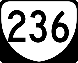
State Route 236 is a primary state highway in the U.S. state of Virginia. The state highway runs 15.63 miles (25.15 km) from U.S. Route 29 and US 50 in Fairfax east to SR 400 in Alexandria. SR 236 is a major suburban arterial highway that connects the independent cities of Fairfax and Alexandria via Annandale in Fairfax County. The state highway is known as Main Street in City of Fairfax, Little River Turnpike in Fairfax County, where the highway meets Interstate 495 (I-495), and Duke Street in Alexandria, where the road has junctions with I-395 and US 1.

<span class="mw-page-title-main">Washington and Old Dominion Railroad</span> Defunct railroad in Virginia, United States

The Washington and Old Dominion Railroad was an intrastate short-line railroad located in Northern Virginia, United States. The railroad was a successor to the bankrupt Washington and Old Dominion Railway and to several earlier railroads, the first of which began operating in 1859. The railroad closed in 1968.

<span class="mw-page-title-main">Bluemont, Virginia</span> Unincorporated community in Virginia, United States

Bluemont is an unincorporated village in Loudoun County, Virginia located at the eastern base of Snickers Gap in the Blue Ridge Mountains. The village's center is located along Snickersville Turnpike, 4 miles (6.4 km) west of the incorporated town of Round Hill. The village borders Virginia's fox hunting country and is within 1 mile (1.6 km) of the Appalachian Trail and the Bears Den and Raven Rocks formations in the Blue Ridge.

Philomont is an unincorporated community in western Loudoun County, Virginia. The name is derived from the Greek word philo meaning "beloved" and the French word mont or "mountain"; Philomont means "beloved mountain."

<span class="mw-page-title-main">Aldie, Virginia</span> Census-designated place in Virginia

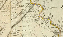
Aldie is an unincorporated community and census-designated place (CDP) located between Chantilly and Middleburg in Loudoun County, Virginia, United States. The historic village of Aldie is located on the John Mosby Highway in a gap between the Catoctin Mountains and Bull Run Mountains, through which the Little River flows. Aldie traditionally serves as the gateway to the Loudoun Valley and beyond.

Airmont is an unincorporated community in the Loudoun Valley of Loudoun County, Virginia, United States. It is located at the crossroads of Snickersville Pike and Airmont Road approximately 7 miles (11 km) south of the town of Round Hill and 3 miles (4.8 km) east of the village of Bluemont.

<span class="mw-page-title-main">Loudoun Valley</span> Valley in northern Virginia

The Loudoun Valley is a small, but historically significant valley in the Blue Ridge Mountains located in Loudoun County in Northern Virginia in the United States.

<span class="mw-page-title-main">Goose Creek (Potomac River tributary)</span> River in Virginia, United States

Goose Creek is a 53.9-mile-long (86.7 km) tributary of the Potomac River in Fauquier and Loudoun counties in northern Virginia. It comprises the principal drainage system for the Loudoun Valley.

<span class="mw-page-title-main">U.S. Route 50 in Virginia</span>

U.S. Route 50 is a transcontinental highway which stretches from Ocean City, Maryland to West Sacramento, California. In the U.S. state of Virginia, US 50 extends 86 miles (138 km) from the border with Washington, D.C. at a Potomac River crossing at Rosslyn in Arlington County to the West Virginia state line near Gore in Frederick County.

Loudoun County, Virginia, was destined to be an area of significant military activity during the American Civil War. Located on Virginia's northern frontier, the Potomac River, Loudoun County became a borderland after Virginia's secession from the Union in early 1861. Loudoun County's numerous Potomac bridges, ferries and fords made it an ideal location for the Union and Confederate armies to cross into and out of Virginia. Likewise, the county's several gaps in the Blue Ridge Mountains that connected the Piedmont to the Shenandoah Valley and Winchester were of considerable strategic importance. The opposing armies would traverse the county several times throughout the war leading to several small battles, most notably the Battle of Balls Bluff.

Battle of Unison Battle of the American Civil War

The Battle of Unison or Battle of Union refers to a series of American Civil War cavalry skirmishes in Loudoun County, Virginia, between October 31 – November 2, 1862, between the Confederate forces of J.E.B. Stuart and various units of the Union Army of the Potomac. Although driven from the field in individual engagements, Stuart accomplished his mission to delay the enemy and screen the movements of the retreating Army of Northern Virginia.

<span class="mw-page-title-main">Snickers Gap</span>

Snickers Gap, originally William's Gap, is a wind gap in the Blue Ridge Mountain on the border of Loudoun County and Clarke County in Virginia. The gap is traversed by Virginia State Route 7. The Appalachian Trail also passes across the gap. Bear's Den and Raven Rocks are adjacent to the gap.

Mountville, Virginia Unincorporated community in Virginia

Mountville is an unincorporated community in the Loudoun Valley of Loudoun County, Virginia. The village is situated on Snickersville Turnpike halfway between Aldie and Philomont at the intersection of Mountville Road.

<span class="mw-page-title-main">Burning Raid</span>

The Burning Raid was a Union raid conducted in the Loudoun Valley of Loudoun and Fauquier counties in Virginia in 1864 during the American Civil War. It was aimed at destroying the forage on which Confederate partisans operating in the area, specifically Mosby's Rangers, subsisted as well as at breaking the will of the citizens of the area for supporting the partisans.

<span class="mw-page-title-main">Bluemont Historic District</span> Historic district in Virginia, United States

The Bluemont Historic District comprises the historic core of Bluemont, Virginia. The town is located on the eastern side of Snickers Gap, with the majority of the district fronting on the Snickersville Turnpike, also designated Virginia State Route 734. The district includes 43 buildings, of which 36 are houses, five are commercial structure, a church and a community center. The oldest structure in Bluemont is Clayton Hall (1797), a large stone house. The Amos Clayton farm was located at the junction of Routes 734 and 760, now in the center of town. Relatively few pre-Civil War structures remain in Bluemont. Apart from Clayton Hall, the most significant is the Bluemont Methodist Church.

The Carolina Road or the "Old Carolina Road" are names for various sections of the Great Wagon Road and other routes in colonial America. "The 'Old Carolina Road', extending from Lancaster, Pennsylvania to the Yadkin Valley, was one of the most heavily traveled roads in eighteenth century America." Parts of the 180-mile-long (290 km) Journey Through Hallowed Ground National Heritage Area scenic byway follow the Old Carolina Road through Pennsylvania, Maryland and Virginia.

References

  1. "2005 Virginia Department of Transportation Jurisdiction Report - Daily Traffic Volume Estimates - Loudoun County" (PDF). (634  KiB)
  2. Thomas Jefferys, 1776, A Map of the most Inhabited part of Virginia, drawn by Joshua Fry and Peter Jefferson in 1775, London: Sayer and Bennett
  3. Alice Morse Earle, Stage-coach and Tavern Days, 1900, p. 232
  4. J. R. Dolan, The Yankee Peddlers of Early America, 1964, p. 41
  5. 1 2 Frederic James Wood, The Turnpikes of New England and Evolution of the Same Through England, Virginia, and Maryland, 1919, pp. 7-8
  6. 1 2 Steve Twomey, A Bridge to the Past, for the Asking, The Washington Post, September 24, 1992, p. B1
  7. Thirty-Sixth Annual Report of the Board of Public Works to the General Assembly of Virginia, 1851, p. 95
  8. 1 2 Snickersville Turnpike Association, The Byway, accessed July 6, 2007
  9. State Highway Commission of Virginia (October 10, 1940). Minutes of Meeting (PDF) (Report). Richmond, VA: Commonwealth of Virginia., p. 15
  10. State Highway Commission of Virginia (May 12, 1943). Minutes of Meeting (PDF) (Report). Richmond, VA: Commonwealth of Virginia., p. 23
  11. "Weekly List of Actions Taken on Properties: 2/28/11 through 3/4/11". National Register of Historic Places. National Park Service . Retrieved 4 March 2014.
  12. "Weekly listing". National Park Service.
  13. Virginia Department of Transportation, "Final Report: A Management Plan for Historic Bridges in Virginia" (PDF). (1.27  MiB), January 2001
  14. Michael Laris, Board Rejects Cellular Tower, The Washington Post , March 8, 2001, p T1
  15. MJ McAteer, Bridge Rebirth Takes More Than 9 Months, The Washington Post , June 28, 2007, p. LZ1

Route map:

Template:Attached KML/Snicker's Gap Turnpike
KML is from Wikidata