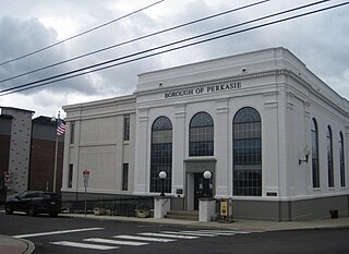
Perkasie is a borough in Bucks County, Pennsylvania, United States. Perkasie is 21.5 miles (34.6 km) southeast of Allentown and 39.2 miles (63.1 km) north of Philadelphia.

The Van Sant Covered Bridge, also known as the Beaver Dam Bridge, is a historic covered bridge located in Solebury Township, near New Hope in Bucks County, Pennsylvania. Built in 1875, the 86 foot, town truss span crosses the Pidcock Creek near Washington Crossing State Park.

The Pine Valley Covered Bridge, also known as the Iron Hill Bridge, is an historic, American, wooden covered bridge that is located in New Britain Borough, near Doylestown in Bucks County, Pennsylvania.
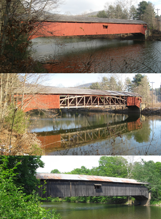
The Hillsgrove Covered Bridge is a Burr arch truss covered bridge over Loyalsock Creek in Hillsgrove Township, Sullivan County, in the U.S. state of Pennsylvania. It was built c. 1850 and is 186 feet (56.7 m) long. In 1973, it became the first covered bridge in the county to be placed on the National Register of Historic Places (NRHP). The bridge is named for the township and nearby unincorporated village of Hillsgrove, and is also known as Rinkers Covered Bridge for an adjoining farm.

The Cabin Run Covered Bridge is a historic covered bridge located in Point Pleasant, Plumstead Township, Bucks County, Pennsylvania. The bridge was built in 1871, and is 15 feet (4.6 m) wide and has a length of 82 feet (25 m). The Town truss bridge crosses Cabin Run (creek) downstream from the Loux Covered Bridge.

The Quakertown Passenger and Freight Station is a historic train station and freight depot located at Quakertown, Bucks County, Pennsylvania. The two buildings were designed by Wilson Bros. & Company in 1889 and built by Cramp and Co. for the Philadelphia and Reading Railroad in 1902. The passenger station is constructed of dark Rockhill granite and Indiana limestone and is in a Late Victorian style. It is 1+1⁄2 stories tall and measures 25 feet wide by 97 feet 6 inches, long. It has a hipped roof with an eight-foot overhang. The freight station is a 1+1⁄2-story, rectangular stone block building measuring 128 by 30 feet. Also on the property is a large crane that was used for freight movement. The Quakertown station had passenger rail service along the Bethlehem Line to Bethlehem and Philadelphia until July 27, 1981, when SEPTA ended service on all its intercity diesel-powered lines. SEPTA still owns the line and leases it to the East Penn Railroad. Other towns, stations, and landmarks on the Bethlehem Line are Perkasie, Pennsylvania, Perkasie Tunnel, and Perkasie station.
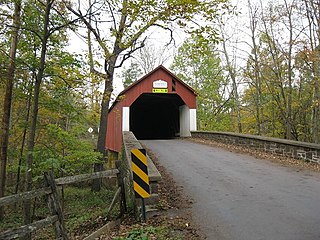
The Frankenfield Covered Bridge is a wooden covered bridge that spans Tinicum Creek in Point Pleasant, Pennsylvania, United States. The bridge is located in Bucks County on Cafferty Road about 0.6 miles (1.0 km) southeast of Headquarters Road, near Vansant Airport, and a similar distance northwest of East Dark Hollow Road, near Palisades School District. Hollow Horn Road branches off from Cafferty Road a short distance from the south end of the span and goes south.

Coplay Cement Company Kilns, also known as the Saylor Park Industrial Museum, is an open-air historic site located at Coplay, Pennsylvania in Lehigh County, Pennsylvania. The nine kilns were built between 1892 and 1893 and used for the production of Portland cement.

Bogert Covered Bridge is a historic wooden covered bridge located at Allentown, Pennsylvania. It is a 145-foot-long (44 m), Burr Truss bridge, constructed in 1841. It has vertical plank siding and a gable roof. It was restored by the Allentown Parks Department.
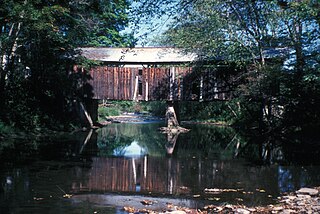
Bittenbender Covered Bridge was a historic wooden covered bridge in Huntington Township, Luzerne County, Pennsylvania. It was a 68.6-foot-long (20.9 m), Queenpost Truss bridge, constructed in 1888. It had rough vertical plank siding, crossed Huntington Creek, and was the last covered bridge in Luzerne County.
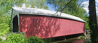
The Hassenplug Bridge is an historic wooden covered bridge which is located in Mifflinburg, Union County, Pennsylvania.

Loux Covered Bridge is a historic wooden covered bridge located on Wismer Road crossing Cabin Run (creek) upstream from the Cabin Run Covered Bridge in Bedminster Township and Plumstead Township, Bucks County, Pennsylvania. It was built in 1874 by David Sutton out of hemlock in the Town Truss style. This is one of the shorter covered bridges in Bucks County at only 60 feet (18 m) long.

Knecht's Covered Bridge is a historic covered bridge in Springfield Township, Bucks County, Pennsylvania. It crosses Cooks Creek on Knecht Bridge Road south of Springtown. Built in 1873 in the town truss style, the bridge is 110 feet long and 15 feet wide.

The Sheard's Mill Covered Bridge is located in East Rockhill Township and Haycock Township, Bucks County, Pennsylvania next to the Levi Sheard Mill. The bridge was built in 1873, and is 15-foot-wide (4.6 m) and 130-foot-long (40 m), making it one of Bucks County's longest bridges. The bridge crosses the Tohickon Creek on Covered Bridge Road.

The Haupt's Mill Covered Bridge was an historic covered bridge that was located in Springfield Township, Bucks County, Pennsylvania. It crossed Durham Creek.

Mood's Covered Bridge was an historic, American covered bridge that was located in East Rockhill Township, Bucks County, Pennsylvania. It crossed the East Branch Perkiomen Creek.

Speakman No. 1 is a historic wooden covered bridge located at East Fallowfield Township near Modena in Chester County, Pennsylvania. It is a 75-foot-long (23 m) Burr Truss bridge, constructed in 1881. It is a twin of Speakman No. 2, Mary Ann Pyle Bridge, located a 1/4 mile away. It crosses Buck Run.

Speakman No. 2, Mary Ann Pyle Bridge is a historic wooden covered bridge located at East Fallowfield Township near Modena in Chester County, Pennsylvania. It is a 75-foot-long (23 m) Burr Truss bridge, constructed in 1881. It is a twin of Speakman No. 1, located a 1/4 mile away. It crosses Buck Run.

Cabin Run is a tributary of the Tohickon Creek in Bucks County, Pennsylvania, rising in the southwestern portion of Bedminster Township to its confluence with the Tohickon Creek in northeastern Plumstead Township. Its course is approximately 4.5 miles (7.2 km)


