
Ghazipur is a city in the state of Uttar Pradesh, India. Ghazipur city is the administrative headquarters of the Ghazipur district, one of the four districts that form the Varanasi division of Uttar Pradesh. The city of Ghazipur also constitutes one of the seven distinct tehsils, or subdivisions, of the Ghazipur district.

Etah district is one of the districts of Uttar Pradesh, India, since 1854. Etah town is the district headquarters. Etah district is a part of Aligarh Division. Etah district is a part of Aligarh Division.

Yusufpur Mohammadabad is a town and a Township in Ghazipur district in the Indian state of Uttar Pradesh. Haydaria village near Mohammadabad is the starting point of Purvanchal Expressway.
Arangi is a small village of Kamsaar located in Seorai tehsil of Ghazipur district, Uttar Pradesh, India. The village is located in the eastern parts Varanasi division, situated almost at the border of Uttar Pradesh and Bihar, on the left bank of the river Karmnasha. Arangi contains an old monument to Lord Buddha.
Tajpur Manjha is a village in Indian state of Uttar Pradesh, situated on the bank of the River Ganges. It is located in Zamania taluk of Ghazipur district.
Sherpur is a region or a pargana of 'Sakarwar Vansh' in the Mohammadabad tehsil of Ghazipur district in Uttar Pradesh. It consists of Sherpur Kalan, Sherpur Khurd, Narainpur, Semra, Surtapur, Jamalpur, Nizampur, Firozpur, villages which were established by the descendants of Dullah Rai. It has population of 31322 as per 2011 Census.
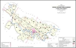
Kasmandi Kalan is a village in Malihabad block of Lucknow district, Uttar Pradesh, India. It is located 27 km away from central Lucknow, a short distance to the north of the Behta River. The village lands include two settlements, Kasmandi Kalan proper in the north and the hamlet of Hafiznagar to the south. Historically known as a Muslim centre, Kasmandi Kalan is renowned for its mango orchards and is surrounded by mango trees all around. Some mango groves here are very old, dating back to the time of the Nawabs of Awadh.
Usia is a village in Kamsaar, Uttar Pradesh, India. It lies southeast of Ghazipur and east of Dildarnagar, close to the Bihar State border.
Bhimapar is a village and a Gram panchayat in Ghazipur district of Uttar Pradesh, India. Bhimapar is a developing and new face town. It is 57 km from Varanasi and 57 km from Ghazipur.
Beerpur is a large village located in Mohammadabad tehsil in Ghazipur district of Uttar Pradesh. It is located on the bank of river Ganges. It has total 1348 families residing. The Beerpur village has population of 9377 as per Population Census 2011.
Amarupur is a village located in Mohammadabad tehsil of Ghazipur district, Uttar Pradesh. It has total 146 families residing. Amarupur has population of 1216 as per Population Census 2011. This village is one of the old establishments of Karail area of Mohammadabad tehsil of Ghazipur.
Parsa is a village located in Mohammadabad tehsil of Ghazipur district, Uttar Pradesh. It has total 1,148 families residing. Parsa has population of 6,330 as per Population Census 2011.
Kanuan is a village located in Mohammadabad tehsil of Ghazipur district, Uttar Pradesh. It has total 440 families residing. Kanuan has population of 3,112 as per Population Census 2011.
Sonwani is a village located in Mohammadabad tehsil of Ghazipur district, Uttar Pradesh. It has total 303 families residing. Sonwani has population of 2168 as per Population Census 2011.
Firozpur Kalan is a village located in Mohammadabad tehsil of Ghazipur district, Uttar Pradesh. It has total 316 families residing. Firozpur has population of 2167 as per Population Census 2011. This village belongs to Varanasi Division. It is located at distance of 13 km towards East from District headquarters Ghazipur, 6 km towards west from Mohammadabad tehsil and at a distance of 357 km towards east from State capital Lucknow.
Narahi is a village located in Ballia Sadar tehsil of Ballia district, Uttar Pradesh, India. It has a total of 1,274 families residing at present. Narahi had a population of 8,960 as per 2011 census.
Lathudih is a village located in Mohammadabad tehsil of Ghazipur district of Uttar Pradesh in India. It has total 646 families residing. Lathudih has population of 4,080 as per government records. It is located at a distance of 18 km towards east from tehsil headquarter Mohammadabad and 41 km from district headquarter Ghazipur.The total geographical area of village is approximately 440 hectares.
Asawar is a village located in Mohammadabad tehsil of Ghazipur district, Uttar Pradesh. It has total 1061 families residing. Asawar has population of 6,300 as per government records.

Bisauri is a village of the Jaunpur district, Uttar Pradesh, Northern India. Bisauri's Postal Index Number is 222129 and its post office is at Patrahi. The village is also a Gram Panchayat, comprising itself and the village of Tiwaripur.

Mirri Kalan is a village in Asoha block of Unnao district, Uttar Pradesh, India. It has nine primary schools and four medical practitioners as well as one veterinary hospital. As of 2011, its population is 5,622, in 1,066 households.

