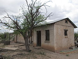
Summit, Arizona | |
---|---|
Coordinates: 32°3′48″N110°56′37″W / 32.06333°N 110.94361°W | |
Country | United States |
State | Arizona |
County | Pima |
Area | |
• Total | 3.66 sq mi (9.48 km2) |
• Land | 3.66 sq mi (9.48 km2) |
• Water | 0.00 sq mi (0.00 km2) |
Elevation | 2,621 ft (799 m) |
Population (2020) | |
• Total | 4,724 |
• Density | 1,291.06/sq mi (498.47/km2) |
Time zone | UTC-7 (MST (no DST)) |
FIPS code | 04-70240 |
GNIS feature ID | 1853167 |
Summit is a census-designated place (CDP) in Pima County, Arizona, United States. The population was 3,702 at the 2000 census.
According to the United States Census Bureau, the CDP has a total area of 10.1 square miles (26 km2), all land.
Census | Pop. | Note | %± |
---|---|---|---|
2020 | 4,724 | — | |
U.S. Decennial Census [2] |
At the 2000 census there were 3,702 people, 1,144 households, and 871 families living in the CDP. The population density was 365.8 inhabitants per square mile (141.2/km2). There were 1,259 housing units at an average density of 124.4 per square mile (48.0/km2). The racial makeup of the CDP was 65.9% White, 0.5% Black or African American, 2.2% Native American, 0.1% Asian, <0.1% Pacific Islander, 26.0% from other races, and 5.3% from two or more races. 63.5% of the population were Hispanic or Latino of any race. [3] Of the 1,144 households 46.7% had children under the age of 18 living with them, 55.6% were married couples living together, 13.4% had a female householder with no husband present, and 23.8% were non-families. 18.4% of households were one person and 5.9% were one person aged 65 or older. The average household size was 3.24 and the average family size was 3.68.
The age distribution was 34.8% under the age of 18, 10.0% from 18 to 24, 29.8% from 25 to 44, 18.4% from 45 to 64, and 6.9% 65 or older. The median age was 29 years. For every 100 females, there were 107.3 males. For every 100 females age 18 and over, there were 103.7 males.
The median household income was $28,485 and the median family income was $31,806. Males had a median income of $21,316 versus $21,333 for females. The per capita income for the CDP was $11,274. About 22.0% of families and 26.2% of the population were below the poverty line, including 42.9% of those under age 18 and 9.0% of those age 65 or over.
West Crossett is a census-designated place (CDP) in Ashley County, Arkansas, United States. Per the 2020 census, the population was 1,144.
Vine Hill is a census-designated place (CDP) in Contra Costa County, California, United States. The population was 3,761 at the 2010 census. It is located 2.25 miles (3.6 km) east of downtown Martinez.
Edgemere is an unincorporated community and census-designated place in Baltimore County, Maryland, United States. The population was 8,669 at the 2010 census. Founded in 1899 as Edgemere being renamed from previous name "Fitzell". Meeting held at the Fitzell Farm which was situated where the old Rheem plant was located.
Wilson-Conococheague is a census-designated place (CDP) in Washington County, Maryland, United States. The population was 2,262 at the 2020 census.
Wye is an unincorporated community in Missoula County, Montana, United States. It is part of the Missoula, Montana Metropolitan Statistical Area. The population was 511 at the 2010 census, an increase from its population of 381 in 2000. For statistical purposes, the United States Census Bureau has defined Wye as a census-designated place (CDP). Wye is named for the "y"-shaped DeSmet Junction where US 93 and MT 200 met former US 10.
Ashland is an unincorporated community and census-designated place (CDP) located within Cherry Hill, in Camden County, in the U.S. state of New Jersey. As of the 2010 United States Census, the CDP's population was 8,302.
Crestwood Village is an unincorporated community and census-designated place (CDP) located within Manchester Township, in Ocean County, in the U.S. state of New Jersey. As of the 2010 United States Census, the CDP's population was 7,907.
Groesbeck is a census-designated place (CDP) in Hamilton County, Ohio, United States. The population was 7,365 at the 2020 census. It is a suburb of Cincinnati.
Pleasant Run is a census-designated place (CDP) in Colerain Township, Hamilton County, Ohio, United States. The population was 4,861 at the 2020 census.
Marble City Community is a census-designated place (CDP) in Sequoyah County, Oklahoma, United States. It is part of the Fort Smith, Arkansas-Oklahoma Metropolitan Statistical Area. The population was 420 at the 2000 census.
Glide is a census-designated place (CDP) in Douglas County, Oregon, United States. The population was 1,795 at the 2010 census.
Lenape Heights is a census-designated place (CDP) in Armstrong County, Pennsylvania, United States. The population was 1,144 at the 2020 census.
Sandy is a census-designated place (CDP) in Clearfield County, Pennsylvania, United States. The population was 1,362 at the 2020 census.
Berea is a census-designated place (CDP) in Greenville County, South Carolina, United States. The population was 14,295 at the 2010 census. It is part of the Greenville–Mauldin–Easley Metropolitan Statistical Area.
Rosebud also Sicanġu is a census-designated place (CDP) in Todd County, South Dakota, United States. The population was 1,455 at the 2020 census.
Murillo, previously recorded as Nurillo, is a census-designated place (CDP) in Hidalgo County, Texas, United States. The population was 7,344 at the 2010 census, up from 5,056 at the 2000 census. It is part of the McAllen–Edinburg–Mission Metropolitan Statistical Area.
Hooverson Heights is a census-designated place (CDP) in Brooke County, West Virginia, United States. It is part of the Weirton–Steubenville metropolitan area. The population was 2,590 at the 2010 census.
Bradley is a census-designated place (CDP) in Raleigh County, West Virginia, United States, named in honor of General Omar Bradley, a field commander in North Africa and Europe during World War II and a General of the Army. The population was 1,928 at the 2020 census.
Millinocket is a census-designated place (CDP) comprising most of the developed land within the town of Millinocket in Penobscot County, Maine, United States. The population of the CDP was 4,466 at the 2010 census.
Anson is a census-designated place (CDP) in the town of Anson in Somerset County, Maine, United States. The population was 818 at the 2000 census.