Related Research Articles

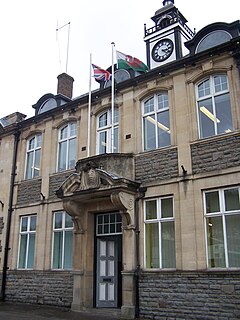
Pontypridd is a town and community in Rhondda Cynon Taf, Wales. Colloquially known as "Ponty", it is 12 miles (19 km) north of Cardiff.

Toronto is a lakeside suburb within the city of Lake Macquarie, Greater Newcastle in New South Wales, Australia, approximately 28 kilometres (17 mi) from Newcastle's central business district and is a commercial hub for the sprawling suburbs on the western shore of the lake. It is one of the major centres in the City of Lake Macquarie LGA.

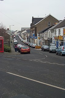
Porth is a town and a community in the county borough of Rhondda Cynon Taf, within the historic county boundaries of Glamorgan, Wales. Lying in the Rhondda Valley, it is regarded as the gateway connecting the Rhondda Fawr and Rhondda Fach valleys because both valleys meet at Porth. The Welsh word "porth" means "gate". Porth is a predominantly English-speaking community.

Treorchy is a town and community in Wales. Once a mining town, it retains the characteristics of one. Situated in the county borough of Rhondda Cynon Taf in the Rhondda Fawr valley. Treorchy is also one of the 16 communities of the Rhondda. It includes the villages of Cwmparc and Ynyswen.
Mountain Ash is a town and former community in the Cynon Valley, within the County Borough of Rhondda Cynon Taf, Wales, with a population of 11,230 at the 2011 Census, estimated in 2019 at 11,339. It includes the districts and villages of Cefnpennar, Cwmpennar, Caegarw, Darranlas, Fernhill, Glenboi and Newtown, all within the historic county boundaries of Glamorgan. Aberdare lies about 4.5 miles (7.2 km) north-west, Cardiff 19 miles (31 km) south-east, and Penrhiwceiber a mile to the south-east. It divides into two electoral wards: West covers the town centre and the districts of Miskin, Darranlas, Fernhill and Glenboi, and East the districts of Cefnpennar, Cwmpennar, Caegarw and Newtown.

Cardiff is a small town in the Lake Macquarie LGA of New South Wales, Australia.
Aberaman is a village near Aberdare in the county borough of Rhondda Cynon Taf, south Wales. It was heavily dependent on the coal industry and the population, as a result, grew rapidly in the late nineteenth century. Most of the industry has now disappeared and a substantial proportion of the working population travel to work in Cardiff and the M4 corridor. Many residents also work in the nearby towns of Aberdare and Pontypridd.

Boolaroo is a suburb of Greater Newcastle, city of Lake Macquarie, New South Wales, Australia, located 19 kilometres (12 mi) west of Newcastle's central business district in Lake Macquarie's West Ward.
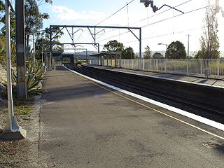
Cockle Creek railway station is located on the Main Northern line in New South Wales, Australia. It serves the City of Lake Macquarie suburb of Boolaroo. The station is on the eastern side of Cockle Creek and a balloon loop exists west of the creek for the Teralba Colliery.
Edgeworth is a suburb of Greater Newcastle, City of Lake Macquarie local government area in New South Wales, Australia, located 18 kilometres (11 mi) west of Newcastle's central business district.
Speers Point is a suburb of Greater Newcastle, and the location of the council seat of the City of Lake Macquarie local government area in New South Wales, Australia. It is 17 kilometres (10.6 mi) west-southwest of the city of Newcastle on the northern shore of Lake Macquarie, in Cockle and Warners Bays, between the suburbs of Cardiff and Warners Bay.
James Brunton Simpson was a Scottish-Australian trade unionist, coal miner and politician, elected as a member of the New South Wales Legislative Assembly for Lake Macquarie for the NSW Branch of the Labor Party.

Wallsend is a western suburb of Newcastle, New South Wales, Australia 11 kilometres (6.8 mi) from Newcastle's central business district. It is part of the City of Newcastle local government area.
Fassifern is a suburb of the City of Lake Macquarie, Greater Newcastle in New South Wales, Australia, located west of Lake Macquarie. The Sydney-Newcastle railway line runs through Fassifern railway station, which is a major station along the line. There used to be a branch line between Fassifern Station and nearby Toronto, but this has been replaced by a bus service, aptly named "The Train".
Killingworth is a small town located south of West Wallsend, New South Wales and east of the Sydney-Newcastle Freeway. It is part of the West Ward of the City of Lake Macquarie local government area in Greater Newcastle.
West Wallsend is a suburb and small town in the City of Lake Macquarie, Greater Newcastle in New South Wales, Australia. It is near the Sydney-Newcastle Freeway and the western suburbs of Newcastle.

Seahampton is a hamlet situated north of West Wallsend, New South Wales, Australia, located 21 kilometres (13 mi) west of the city of Newcastle's central business district and west of the Sydney-Newcastle Freeway. It is a suburb of the City of Lake Macquarie local government area.
Cockle Creek Power Station was located in Teralba, New South Wales, Australia on the banks of Cockle Creek. The power stationed operated from 11 March 1927 until March 1976.
The Maerdy Branch was a railway branch line in South Wales. Financed and operated by the Taff Vale Railway, on amalgamation it became part of the Great Western Railway in 1923. Designed and mainly operated as a coal mining freight railway, its creation and demise was wholly defined by the South Wales Coalfield.
References
- ↑ Australian Bureau of Statistics (27 June 2017). "State Suburbs: Teralba". 2016 Census QuickStats. Retrieved 29 May 2019.

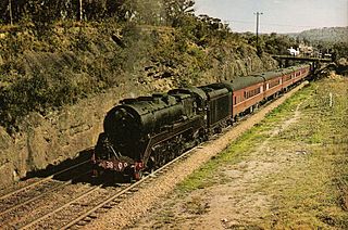
- 1 2 The Branch Railway Serving Pacific Colliery at Teralba Williams, K Australian Railway Historical Society Bulletin, April 1998 pp133-138
- ↑ "Aboriginal and Torres Strait Islander people". Lake Macquarie City Council. Retrieved 8 September 2020.