Swansea is a town at the entrance to Lake Macquarie from the Pacific Ocean in New South Wales, Australia. It is part of the City of Lake Macquarie local government area. The Aboriginal people, in this area, the Awabakal, were the first people of this land.

Warners Bay is a suburb of the City of Lake Macquarie in New South Wales, Australia, and is located 15 kilometres (9 mi) from Newcastle's central business district on the eastern side of Lake Macquarie. It was named after Jonathan Warner, who settled the area.

Boolaroo is a suburb of the city of Lake Macquarie, New South Wales, Australia, located 19 kilometres (12 mi) west of Newcastle's central business district in Lake Macquarie's West Ward.
Glendale is a suburb of Lake Macquarie, New South Wales, Australia, located 15 kilometres (9 mi) west of Newcastle's central business district at the northern tip of Lake Macquarie. It is part of the City of Lake Macquarie local government area.
Windale is a suburb of the city of Lake Macquarie, in the Newcastle metropolitan area. It is located west of the junction of the Pacific Highway and Newcastle Inner City Bypass, covering an area of 1.7 km2 (0.7 sq mi). Windale is a lower socio-economic area consisting largely of public housing homes, and has historically been known for its high rates of alcoholism, crime and unemployment, however recent local government efforts to regenerate the area have been somewhat successful. The suburb was listed as one of the most socially disadvantaged areas in the State according to the 2015 Dropping Off The Edge report.
Wyee is a small town in the Lake Macquarie region of New South Wales, Australia, in the City of Lake Macquarie. It is near the Sydney-Newcastle Freeway and has a railway station on NSW TrainLink's Central Coast & Newcastle Line. It had a population of 1,487 in 2001, which significantly increased to 2,588 in 2011, and decreased to 2,406 in 2016.
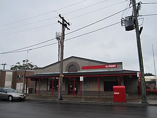
Fassifern is a suburb of the City of Lake Macquarie, in New South Wales, Australia, located west of Lake Macquarie. The Sydney-Newcastle railway line runs through Fassifern railway station, which is a major station along the line. There used to be a branch line between Fassifern Station and nearby Toronto, but this has been replaced by a bus service, aptly named "The Train".
Barnsley is a township in New South Wales, Australia, 21 kilometres (13 mi) west of Newcastle's central business district. It is a suburb of the City of Lake Macquarie local government area.
Kotara South is a suburb of the City of Lake Macquarie, New South Wales, Australia 11 kilometres (7 mi) from Newcastle's central business district.

Redhead is a coastal suburb of the City of Lake Macquarie in New South Wales, Australia 16 kilometres (10 mi) south of Newcastle's central business district on the Pacific Ocean. It was named for the appearance of its headland, Redhead Bluff, when viewed from the sea.

Dudley is a southern coastal suburb of Newcastle, New South Wales, Australia, 13 kilometres (8 mi) southwest of Newcastle's central business district on the eastern side of Lake Macquarie. It is part of the City of Lake Macquarie local government area.
Whitebridge is a suburb of Newcastle, New South Wales, Australia, 11 kilometres (7 mi) from Newcastle's central business district on the eastern side of Lake Macquarie. It is part of the City of Lake Macquarie local government area.
Holmesville is a suburb of Newcastle, New South Wales, Australia, 21 kilometres (13 mi) from Newcastle's central business district and close to the Sydney-Newcastle Freeway. It is part of the City of Lake Macquarie local government area.
New Lambton Heights is a suburb of Newcastle, New South Wales, Australia, located 9 kilometres (6 mi) west of Newcastle's central business district. It is split between the City of Lake Macquarie and City of Newcastle local government areas.
Swansea Heads is a locality on the Swansea peninsula between Lake Macquarie and the Pacific Ocean in New South Wales, Australia. It is part of the City of Lake Macquarie local government area. The Aboriginal people, in this area, the Awabakal, were the first people of this land.
Pelican is a suburb of the City of Lake Macquarie in New South Wales, Australia, located 25 kilometres (16 mi) from Newcastle's central business district across the entrance to Lake Macquarie from the town of Swansea. It was known as Pelican Flat until 1991.
Rankin Park is a suburb of Newcastle, New South Wales, Australia, located 11 kilometres (7 mi) west of Newcastle's central business district. It is split between the City of Lake Macquarie and City of Newcastle local government areas.
Highfields is a residential suburb of Newcastle, New South Wales, Australia, located 8 kilometres (5 mi) west-southwest of Newcastle's central business district near the Charlestown town centre. It is part of the City of Lake Macquarie local government area.
Ryhope is a small rural locality in the City of Lake Macquarie in New South Wales, Australia, located approximately eight kilometres west of the town of Toronto and west of Lake Macquarie.
Pinny Beach was made a suburb of the City of Lake Macquarie on 5 May 2006 following amendments to the boundaries of surrounding suburbs. It is located on the Swansea Peninsula and is to the east of Lake Macquarie, south of the Pacific Ocean entrance channel at Swansea in New South Wales, Australia. It is part of the City of Lake Macquarie local government area.
