
Alappuzha district, is one of the 14 districts in the Indian state of Kerala. It was formed as Alleppey district on 17 August 1957, the name of the district being changed to Alappuzha in 1990. Alappuzha is the smallest district of Kerala. Alleppey town, the district headquarters, was renamed Alappuzha in 2012.

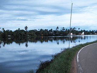
The Kerala backwaters are a network of brackish lagoons and canals lying parallel to the Arabian Sea of the Malabar coast of Kerala state in south-western India. It also includes interconnected lakes, rivers, and inlets, a labyrinthine system formed by more than 900 km (560 mi) of waterways, and sometimes compared to bayous. The network includes five large lakes linked by canals, both man made and natural, fed by 38 rivers, and extending virtually half the length of Kerala state. The backwaters were formed by the action of waves and shore currents creating low barrier islands across the mouths of the many rivers flowing down from the Western Ghats range. In the midst of this landscape there are a number of towns and cities, which serve as the starting and end points of backwater cruises. There are 34 backwaters in Kerala. Out of it, 27 are located either closer to Arabian Sea or parallel to the sea. The remaining 7 are inland navigation routes.

Kuttanad is a river delta landscape region in the state of Kerala, India, known for its vast paddy fields and geographical peculiarities. It is in the Districts of Alappuzha, Kottayam and Pathanamthitta. The region has the lowest altitude in India, and is one of the few places in the world where farming is carried on around 1.2 to 3.0 metres below sea level. Kuttanad is historically important in the ancient history of South India and is the major rice producer in the state. Farmers of Kuttanad are famous for Biosaline Farming. The United Nations Food and Agriculture Organization (FAO) has declared the Kuttanad Farming System as a Globally Important Agricultural Heritage System (GIAHS) in 2013.

Kavalam is a village in Kuttanadu, Kerala state, Alappuzha District. India.

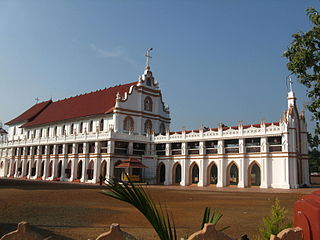
Aranmula is a temple town in the state of Kerala, India. It is known as the cultural capital of Pathanamthitta district, located at a distance of around 116 km from Trivandrum, the capital of Kerala, it is situated on the banks of the river Pampa. A centre of pilgrimage from time immemorial and a trade post of eminence, when the river was the chief means of transport, it is near Kozhencherry in Pathanamthitta District. It is easily accessible from Chengannur railway station (10km). It is one of the Fastest Growing Village. Aranmula, along with the majority of Pathanamthitta district, was part of the Quilon division or Central Travancore division of Travancore. On November 1, 1982, Pathanamthitta district was established.

The Pamba River is the longest river in the Indian state of Kerala after Periyar and Bharathappuzha, and the longest river in the erstwhile former princely state of Travancore. The Sabarimala Temple, dedicated to Lord Ayyappa, is located on the banks of the river Pamba.
Alappuzha, formerly known as Alleppey, is a city and municipality in the Alappuzha district of Kerala, India. It is the district headquarters of the district, and is located about 130 km (80.8 mi) north of the state capital Thiruvananthapuram. As per the 2011 Indian census, Alappuzha has a population of 240,991 people, and a population density of 3,675/km2 (9,520/sq mi).
Edathua is a small village in Kuttanad, Alappuzha district, Kerala, India. It is located 12 km from Thiruvalla city center, National Highway 183 and the Thiruvalla railway station.
Vengad is a gram panchayat situated in Thalassery taluk, Kannur district, Kerala, India, on the banks of the Anjarakandi River. Vengad is famous for its black pepper and handloom. One state seed farm is located in Vengad. Vengad gram panchayat consists of 21 wards; viz Pattathari (1), Kallayi (2), Vengad Angadi (3), Vengad Metta (4), Vengad Theru (5), Oorppalli (6), Kaitheripoyil (7), Valankichal (8), Pathiriyad (9), Pachapoika (10), Parambayi (11), Kelalur (12), Mambaram (13), Poyanad (14), Keezhathur Balavadi (15), Keezhathur Vayanasala (16), Kuzhiyil Peedika (17), Mailulli (18), Kunnirikka (19), Paduvilayi (20) and Thattari (21).
Ramankary is a village in the Kuttanad region of India. It is 9 km away from Changanacherry town and 17 km from Alappuzha city. It is one of the villages in Alapuzha on the bank of the Manimala River with picturesque vast paddy fields.
Neerattupuram is a place in Kuttanad, Alappuzha district, Kerala, India. It is a part of Thalavady Grama Panchayat, situated near the junction of Alappuzha, Pathanamthitta and Kottayam districts, at the confluence of Pamba and Manimala rivers.
Trikkayil is a village near Neerattupuram. It is situated on the Neerattupuram-Takazhi-Alappuzha road. The place is home to the Thalavady Panchayat office and the famous Sree Krishna Temple. It is an Upper Kuttanad area and the bank of Pampa River.
Vellakkinar or Vellakinar is the fourth ward of the village panchayat of Thalavady in Alappuzha district, Kuttanad taluk, in the State of Kerala, India. Its name is derived from water well (vellakkinar) that was located at Vellakkinar Junction.
Muttar is a village in upper Kuttanad, Alappuzha district of Kerala, India. It is located 10 km west of Thiruvalla on the Kidangara Neerattupuram road, surrounded by Thalavady, Neerettupuram, Kunnamkary, Chathamkary & Mithrakary.
Poothakkulam, also known as Bhoothakkulam, is a village in Kollam district in the state of Kerala, India. The village is located 3.9 km away from Paravur, 11.4 km from Varkala and 23 km from Kollam. In 2011, it had a population of 628,451 residents. The village covers an area of 16.56 km2.
Melukavu (Melukavumattom) is a village in the eastern part of Meenachil Taluk in Kottayam District of Kerala state, India.

Kadapra is a village in the Thiruvalla subdistrict of Pathanamthitta district, Kerala state, India. It shares an intradistrict river border with Nedumpuram village separated along the Manimala river towards its north and an interpenetrating intradistrict land border with Niranam village towards its west.
Velur or Veloor is a village and panchayat in Kunnamkulam Taluk, Thrissur district, Kerala, India with a population of 22,155. Other places close to Velur are Kechery, Wadakkanchery etc.
Puthukkary is a small village in Kuttanadu Taluk. It is located in Ramankary Panchayat. It is 2 km far from Mampuzhakkary, at AC Road and, 5 km far from Edathua at Thiruvalla-Ambalappuzha Road. It is believed that this region was a very big forest in ancient years but later destroyed by a forest fire. Still we can see "kari" if we dig deep into the soil. So this place's name ended up with Kari. Mampuzhakkary-Edathua Road Passing through Puthukkary, 2 kilometers to Mampuzhakary and 5.5 kilometers to Edathua. Major Christian church is St Xaviers Church, now under the Archdiocese of Changanassery. Nearby villages are Kalangara Mithrakary, Oorukkary, Thekke Puthukkary, Kalangara, Koduppunna, Mampuzhakary, Edathua etc. Most of the villagers here are farmers and mainly depend on Alappuzha and Changanacherry for their day-to-day life.
Alappuzha District has four types of administrative hierarchies:

