Thompsonville, Michigan | |
---|---|
Coordinates: 44°31′13″N85°56′30″W / 44.52028°N 85.94167°W | |
Country | United States |
State | Michigan |
County | Benzie |
Townships | Colfax and Weldon |
Area | |
• Total | 1.00 sq mi (2.58 km2) |
• Land | 1.00 sq mi (2.58 km2) |
• Water | 0.00 sq mi (0.00 km2) |
Elevation | 794 ft (242 m) |
Population (2020) | |
• Total | 451 |
• Density | 452.81/sq mi (174.88/km2) |
Time zone | UTC-5 (Eastern (EST)) |
• Summer (DST) | UTC-4 (EDT) |
ZIP code(s) | 49683 |
Area code | 231 |
FIPS code | 26-79600 [2] |
GNIS feature ID | 1614783 [3] |
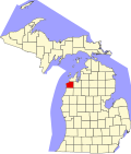
Thompsonville is a village in Benzie County in the U.S. state of Michigan. The village had a population of 451 at the 2020 census, up from 441 at the 2010 census. The village lies immediately north of the Manistee County line, and is divided between Colfax and Weldon townships.
Crystal Mountain, one of Michigan's largest ski resorts, is located just west of Thompsonville.
According to the United States Census Bureau, the village has a total area of 1.00 square mile (2.59 km2), all land. [4]
Thompsonville was established when construction of the lines of two railroads, the Chicago & West Michigan and the Frankfort & South Eastern, crossed here in 1889. The village, originally called Lyndonville, was platted on July 23, 1890, and was named for Sumner S. Thompson,(4/12/1823-10/24/1889), who was the President of the Frankfort and South Eastern Railroad at the time of his death. Of the two railroads serving the village, the Chicago & West Michigan was merged into the Pere Marquette Railway in 1900 and the Chesapeake & Ohio Railway in 1947, while the Frankfort & South Eastern was acquired in 1892 by the Toledo, Ann Arbor & North Michigan, which in turn was reorganized in 1895 as the Ann Arbor Railroad. [5] [6] [7]
Census | Pop. | Note | %± |
---|---|---|---|
1900 | 893 | — | |
1910 | 815 | −8.7% | |
1920 | 410 | −49.7% | |
1930 | 295 | −28.0% | |
1940 | 324 | 9.8% | |
1950 | 313 | −3.4% | |
1960 | 243 | −22.4% | |
1970 | 312 | 28.4% | |
1980 | 331 | 6.1% | |
1990 | 416 | 25.7% | |
2000 | 457 | 9.9% | |
2010 | 441 | −3.5% | |
2020 | 451 | 2.3% | |
U.S. Decennial Census [8] |
As of the census [9] of 2010, there were 441 people, 183 households, and 112 families living in the village. The population density was 441.0 inhabitants per square mile (170.3/km2). There were 245 housing units at an average density of 245.0 per square mile (94.6/km2). The racial makeup of the village was 94.8% White, 0.2% African American, 2.5% Native American, 0.2% Asian, 0.2% from other races, and 2.0% from two or more races. Hispanic or Latino of any race were 1.4% of the population.
There were 183 households, of which 28.4% had children under the age of 18 living with them, 37.2% were married couples living together, 16.4% had a female householder with no husband present, 7.7% had a male householder with no wife present, and 38.8% were non-families. 30.6% of all households were made up of individuals, and 12.6% had someone living alone who was 65 years of age or older. The average household size was 2.41 and the average family size was 2.99.
The median age in the village was 38.5 years. 23.1% of residents were under the age of 18; 9.1% were between the ages of 18 and 24; 28.1% were from 25 to 44; 24% were from 45 to 64; and 15.6% were 65 years of age or older. The gender makeup of the village was 49.9% male and 50.1% female.
As of the census [2] of 2000, there were 457 people, 180 households, and 120 families living in the village. The population density was 454.5 inhabitants per square mile (175.5/km2). There were 221 housing units at an average density of 219.8 per square mile (84.9/km2). The racial makeup of the village was 96.06% White, 2.41% Native American, 0.22% Asian, 1.09% from other races, and 0.22% from two or more races. Hispanic or Latino of any race were 0.22% of the population.
There were 180 households, out of which 34.4% had children under the age of 18 living with them, 47.2% were married couples living together, 13.9% had a female householder with no husband present, and 33.3% were non-families. 28.9% of all households were made up of individuals, and 15.0% had someone living alone who was 65 years of age or older. The average household size was 2.54 and the average family size was 3.12.
In the village, the population was spread out, with 28.4% under the age of 18, 8.3% from 18 to 24, 27.6% from 25 to 44, 21.4% from 45 to 64, and 14.2% who were 65 years of age or older. The median age was 35 years. For every 100 females, there were 101.3 males. For every 100 females age 18 and over, there were 99.4 males.
The median income for a household in the village was $29,125, and the median income for a family was $31,103. Males had a median income of $22,500 versus $18,250 for females. The per capita income for the village was $12,104. About 12.8% of families and 13.3% of the population were below the poverty line, including 24.3% of those under age 18 and 7.1% of those age 65 or over.
This climatic region has large seasonal temperature differences, with warm to hot (and often humid) summers and cold (sometimes severely cold) winters. According to the Köppen Climate Classification system, Thompsonville has a humid continental climate, abbreviated "Dfb" on climate maps. [10]
Climate data for Thompsonville, Michigan | |||||||||||||
---|---|---|---|---|---|---|---|---|---|---|---|---|---|
Month | Jan | Feb | Mar | Apr | May | Jun | Jul | Aug | Sep | Oct | Nov | Dec | Year |
Mean daily maximum °C (°F) | −6 (22) | −4 (24) | 1 (34) | 9 (48) | 17 (62) | 22 (71) | 25 (77) | 24 (75) | 19 (66) | 12 (54) | 4 (39) | −2 (28) | 10 (50) |
Mean daily minimum °C (°F) | −15 (5) | −16 (4) | −11 (12) | −4 (25) | 3 (37) | 7 (44) | 10 (50) | 9 (49) | 6 (42) | 1 (33) | −5 (23) | −11 (12) | −2 (28) |
Average precipitation mm (inches) | 89 (3.5) | 46 (1.8) | 56 (2.2) | 56 (2.2) | 71 (2.8) | 81 (3.2) | 81 (3.2) | 91 (3.6) | 97 (3.8) | 89 (3.5) | 76 (3.0) | 76 (3.0) | 909 (35.8) |
Source: Weatherbase [11] |
Thompsonville is a village in Cave Township, Franklin County, Illinois, United States. The population was 486 at the 2020 census.
Michigantown is a town in Michigan Township, Clinton County, Indiana, United States. The population was 467 at the 2010 census. The town was named for the Michigan Road, an early thoroughfare through the area.
Benzonia Township is a civil township of Benzie County in the U.S. state of Michigan. As of the 2020 census, the township population was 1,870.
Colfax Township is a civil township of Benzie County in the U.S. state of Michigan. The population was 504 at the 2020 census. Colfax Township contains half of the village of Thompsonville, and the entire community of Nessen City
Elberta is a village in Benzie County in the U.S. state of Michigan. The population was 329 at the 2020 census. Located in Gilmore Township, Elberta overlooks Lake Michigan and lies across Betsie Lake from Frankfort. Elberta is part of Northern Michigan.
Bear Lake is a village in Manistee County in the U.S. state of Michigan. The population was 342 at the 2020 census. The village is located within Bear Lake Township.
Cleon Township is a civil township of Manistee County located in the U.S. state of Michigan. The population was 1,063 at the 2020 census, up from 957 in 2010.
Copemish is a village in Manistee County of the U.S. state of Michigan. The population was 195 at the 2020 census. The village is within Cleon Township.
Dickson Township is a civil township of Manistee County in the U.S. state of Michigan. The population was 980 at the 2020 census.
Eastlake is a village in the U.S. state of Michigan. The population was 415 at the 2020 census. Located within Manistee County, the village sits across Manistee Lake from the city of Manistee.
Kaleva is a village in Manistee County in the U.S. state of Michigan. The population was 507 at the 2020 census.
Manistee Township is a civil township of Manistee County in the U.S. state of Michigan. The population was 4,022 at the 2020 census.
Maple Grove Township is a civil township of Manistee County in the U.S. state of Michigan. The population was 1,342 at the 2020 census. The township is home to the village of Kaleva.
Marilla Township is a civil township of Manistee County in the U.S. state of Michigan. The population was 398 at the 2020 census.
Onekama is a village in Manistee County in the U.S. state of Michigan. The population was 399 at the 2020 census. The village is located on the northeast shore of Portage Lake and is surrounded by Onekama Township. The town's name is derived from Ona-ga-maa, an Anishinaabe word which means "singing water".
Buckley is a village in Wexford County in the U.S. state of Michigan. The population was 775 at the 2020 census, an increase from 697 at the 2010 census. The village is located within Hanover Township, and lies immediately south of the Grand Traverse County line. The village lies about 6.5 miles (10.5 km) north of Mesick, about 20 miles (32 km) northwest of Cadillac, and about 15 miles (24 km) south of Traverse City.
Mesick is a village in Wexford County in the U.S. state of Michigan. The population was 397 at the 2020 census. The majority of the village is located within Springville Township with a very small portion extending east into Antioch Township.
Wexford Township is a civil township of Wexford County in the U.S. state of Michigan. The population was 1,161 at the 2020 census.
Roy is a village in Harding County, New Mexico, United States. The population was 234 at the 2010 census.
Cave Township is one of twelve townships in Franklin County, Illinois, USA. As of the 2020 census, its population was 1,683 and it contained 828 housing units.