Timeline of Homs

Last updated

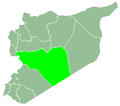
The following is a timeline of the history of the city of Homs, Syria.

Contents

Prior to 7th century

7th–19th centuries

20th century

21st century

See also

Related Research Articles

<span class="mw-page-title-main">Homs</span> City in Homs Governorate, Syria

Homs, known in pre-Islamic Syria as Emesa, is a city in western Syria and the capital of the Homs Governorate. It is 501 metres (1,644 ft) above sea level and is located 162 kilometres (101 mi) north of Damascus. Located on the Orontes River, Homs is also the central link between the interior cities and the Mediterranean coast.

<span class="mw-page-title-main">Latakia</span> City in Latakia Governorate, Syria

Latakia or Lattakia is the principal port city of Syria and capital city of the Latakia Governorate located on the Mediterranean coast. Historically, it has also been known as Laodicea in Syria or Laodicea ad Mare. In addition to serving as a port, the city is a significant manufacturing center for surrounding agricultural towns and villages. According to the 2004 official census, the population of the city is 383,786, however its population greatly increased as a result of the ongoing Syrian Civil War, which led to an influx of refugees from rebel held areas. It is the 4th-largest city in Syria after Aleppo, Damascus, and Homs. It borders Tartus to the south, Hama to the east, and Idlib to the north, and Cape Apostolos Andreas, the north-eastern tip of Cyprus, is about 109 kilometres (68 mi) away.

<span class="mw-page-title-main">Hama</span> City in Hama Governorate, Syria

Hama is a city on the banks of the Orontes River in west-central Syria. It is located 213 km (132 mi) north of Damascus and 46 kilometres (29 mi) north of Homs. It is the provincial capital of the Hama Governorate. With a population of 854,000, Hama is the fourth-largest city in Syria after Damascus, Aleppo and Homs.

<span class="mw-page-title-main">Al-Nabek</span> Place in Rif Dimashq, Syria

An-Nabek or Al-Nabek is a Syrian city administratively belonging to Rif Dimashq and the capital of the Qalamoun. Located 81 kilometers (50 mi) north of Damascus and south of Homs. It has an altitude of 1255 meters. According to the Syria Central Bureau of Statistics (CBS), An-Nabek had a population of 32,548 in the 2004 census. The Monastery of Saint Moses the Abyssinian is located along the Anti-Lebanon Mountains near Nabek and dates back to at least the 6th century.

Syrian Turkmen, also referred to as Syrian Turkomans, Turkish Syrians, or simply Syrian Turks or Turks of Syria or Turkmens of Syria, are Syrian citizens of Turkish origin who mainly trace their roots to Anatolia. Turkish-speaking Syrian Turkmen make up the third largest ethnic group in the country, after the Arabs and Kurds respectively.

<span class="mw-page-title-main">Ottoman Syria</span> The region of Syria under Ottoman rule (1516–1918)

Ottoman Syria refers to divisions of the Ottoman Empire within the region of Syria, usually defined as being east of the Mediterranean Sea, west of the Euphrates River, north of the Arabian Desert and south of the Taurus Mountains.

<span class="mw-page-title-main">Al-Kiswah</span> Place in Rif Dimashq, Syria

Al-Kiswah is a city in the Rif Dimashq Governorate, Syria. It is located approximately 13 kilometres south of Damascus. It was the location of the 1303 Battle of Marj al-Saffar, and the childhood home of Adnan Awad.

Al-Sukhnah is a town in eastern Syria under the administration of the Homs Governorate, located east of Homs in the Syrian Desert. Nearby localities include Mayadin and al-Asharah to the east, al-Taybah and Raqqa to the north, Salamiyah to the west, Arak and Tadmur (Palmyra) to the southwest.

Qara or Kara is a Syrian city in the An-Nabek District of the Rif Dimashq Governorate. It is located between the Qalamoun Mountains and the Eastern Lebanon mountains range, 95 kilometres (59 mi) north of the capital Damascus on the road to the city of Homs. According to the Syria Central Bureau of Statistics (CBS), Qara had a population of 12,508 in the 2004 census. Its inhabitants are mostly Sunni Muslims and Greek Orthodox and Catholic Christians.

Jasim is a small city in the Izra' District of the Daraa Governorate in southern Syria. It is located 41 kilometers north of Daraa and is near the towns of Nawa to the south, Kafr Shams to the north, Inkhil to the northeast and al-Harra to the northwest. In the 2004 census by the Central Bureau of Statistics (CBS), Jasim had a population of 31,683.

Busra al-Harir is a town in southern Syria, part of the Daraa Governorate situated in the Hauran plain. It is located northeast of Daraa and northwest of as-Suwayda. Nearby localities include Maliha al-Atash to the southeast, al-Shaykh Maskin to the east, Izra to the northeast, Harran to the northwest, Najran to the west, al-Mazraa to the southwest and Nahitah to the south. In the 2004 census by the Central Bureau of Statistics (CBS) Busra al-Harir had a population of 13,315.

The following is a timeline of the history of the city of Damascus, Syria.

Al-Tayba is a village in eastern Syria, administratively part of the Homs Governorate. It is located in the Syrian Desert, near the Euphrates River to the east and al-Sukhnah and the village of al-Kawm to the west. Like many of the other desert towns in Syria, it is situated in a spring-fed oasis. According to the Central Bureau of Statistics (CBS), al-Taybah had a population of 2,413 in the 2004 census.

<span class="mw-page-title-main">Furqlus</span> Town in Homs, Syria

Furqlus is a town in central Syria, administratively part of the Homs Governorate, east of the city of Homs. Situated at the eastern approaches of the Syrian Desert, the town is located between al-Qaryatayn to the south, Sadad to the southwest, Shinshar to the west, Fatim al-Amuq and al-Sayyid to the northwest, al-Mukharram to the north and Palmyra to the east. According to the Central Bureau of Statistics (CBS), Furqlus had a population of 5,096 in the 2004 census.

Hisyah is a town in central Syria, administratively part of the Homs Governorate, located about 35 kilometers south of Homs. Situated on the M5 Highway between Homs and Damascus, nearby localities include al-Qusayr and Rableh to the northwest, Shamsin and Jandar to the north, Dardaghan to the northeast, Sadad to the southeast and Bureij to the south. According to the Central Bureau of Statistics (CBS), Hisyah had a population of 5,425 in the 2004 census. Its inhabitants are mostly Sunni Muslims and Catholics.

Al-Qastal is a village in southern Syria, administratively part of the Rif Dimashq Governorate, located on the northeast of Damascus, on the ancient caravan route to Homs and Aleppo, in the Qalamoun Mountains. Nearby localities include Yabroud, an-Nabek, al-Sahel and Deir Atiyah to the north, ar-Ruhaybah, Jayroud, al-Dumayr and al-Qutayfah to the south, and Ma'loula, Assal al-Ward and Hosh Arab to the southwest. According to the Syria Central Bureau of Statistics, al-Qastal had a population of 3,486 in the 2004 census. Its inhabitants are predominantly Sunni Muslims.

The following is a timeline of the history of the city of Aleppo, Syria.

The following is a timeline of the history of the city of Hama, Syria.

<span class="mw-page-title-main">History of Syria</span>

The history of Syria covers events which occurred on the territory of the present Syrian Arab Republic and events which occurred in the region of Syria. Throughout ancient times the territory of present Syrian Arab Republic was occupied and ruled by several empires, including the Sumerians, Mitanni, Assyrians, Babylonians, Egyptians, Hittites, Canaanites, Phoenicians, Arameans, Amorites, Persians, Greeks and Romans. Syria is considered to have emerged as an independent country for the first time on 24 October 1945, upon the signing of the United Nations Charter by the Syrian government, effectively ending France's mandate by the League of Nations to "render administrative advice and assistance to the population" of Syria, which came in effect in April 1946.

The following is a timeline of the history of the city of Latakia, Syria.

References

  1. Dumper, 2007, p. 171.
  2. 1 2 Cook, 1907, p. 362.
  3. Gil, 1997, pp. 296–97.
  4. le Strange, 1890, p. 353.
  5. Dumper, 2007, p. 172.
  6. 1 2 3 4 5 Dumper, 2007, p. 173.
  7. le Strange, 1890, p. 354.
  8. Yaqut al-Hamawi quoted in le Strange, 1890, p. 356.
  9. Mohammad Amin Sheikho (2011). حقيقة تيمورلنك العظيم تظهر في القرن الواحد والعشرين- الجزء الثاني (in Arabic). دار نور البشير. p. 43.
  10. Collelo, Thomas (1987). "Syria – Ottoman Empire". Syria: A Country Study. GPO for the Library of Congress. Retrieved 28 February 2009.
  11. Shaw, 1977, p. 33
  12. "Rev. H.H. Jessup Dead" (PDF). The New York Times . 29 April 1910.
  13. معالم حمص ومشيداتها الأثرية: المدرسة الغسانية.. منارة للعلم والثقافة خلال قرن من الزمن. Zaman Alwsl (in Arabic). 1 February 2014.
  14. متحف حمص. Directorate-General of Antiquities and Museums (in Arabic). 13 December 2012. Retrieved 3 December 2017.
  15. Cleveland, 2000, p. 215.
  16. "Military Training". All Refer. Retrieved 3 December 2017.
  17. Commins, 2004, p. 130.
  18. Seale, 2007, p. 210.
  19. Winckler, 1998, p. 72.
  20. افتتاح مسرح دار الثقافة بحمص.. مشوح: نجهد للارتقاء بالفكر الثقافي. Discover-Syria (in Arabic). 27 June 2014. Retrieved 2 November 2017.
  21. Population Census Report (1981), Central Bureau of Statistics
  22. PUN Demographic Yearbook (1999)
  23. Bassel al-Assad Stadium in Homs
  24. General Census of Population and Housing 2004. Syria Central Bureau of Statistics (CBS). Homs Governorate. (in Arabic)
  25. "Table 8 - Population of capital cities and cities of 100,000 or more inhabitants", Demographic Yearbook – 2018, United Nations
  26. Nicholas Blanford (8 May 2014). "Retreat from Homs: Assad conquers cradle of revolution". The Times. United Kingdom.

Bibliography

Coordinates: 34°43′51″N36°42′34″E / 34.73083°N 36.70944°E / 34.73083; 36.70944