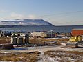
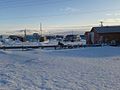
Tununak, Alaska

Last updated

Tununak
Tununeq
CDP
Tununak1 (9726470242).jpg
Aerial view of Tununak
USA Alaska location map.svg
Red pog.svg
Tununak
Location within the state of Alaska
Coordinates: 60°34′50″N165°15′34″W / 60.58056°N 165.25944°W / 60.58056; -165.25944
CountryUnited States
State Alaska
Census Area Bethel
Government
   State senator Lyman Hoffman (D)
   State rep. Conrad McCormick (D)
Area
[1]
  Total60.95 sq mi (157.85 km2)
  Land60.71 sq mi (157.23 km2)
  Water0.24 sq mi (0.62 km2)
Population
 (2020)
  Total411
  Density6.77/sq mi (2.61/km2)
Time zone UTC-9 (Alaska (AKST))
  Summer (DST) UTC-8 (AKDT)
ZIP code
99681
Area code 907
FIPS code 02-79230

Tununak(Too-new-nak) (Central Yupik : Tununeq) is a census-designated place (CDP) in Bethel Census Area, Alaska, United States. At the 2020 census, the population was 411.

Contents

Geography

Tununak is located at 60°34′50″N165°15′34″W / 60.58056°N 165.25944°W / 60.58056; -165.25944 (60.580477, -165.259486). [2]

It is located on the northwest side of Nelson Island in the Bering Sea. It is approximately 5 miles (8.0 km) from the closest village Toksook Bay and a year-round trail exists between the two villages.

According to the United States Census Bureau, the CDP has a total area of 60.7 square miles (157 km2), of which, 60.5 square miles (157 km2) of it is land and 0.2 square miles (0.52 km2) of it (0.33%) is water.

Demographics

Historical population
CensusPop.Note
1880 8
1890 48500.0%
1940 65
1950 11272.3%
1960 18363.4%
1970 27449.7%
1980 2988.8%
1990 3166.0%
2000 3252.8%
2010 3270.6%
2020 41125.7%
U.S. Decennial Census [3]

Tununak first appeared on the 1880 U.S. Census as "Tanunak", an unincorporated village of 8 residents, all Inuit. It appeared on the 1890 census as the village of "Dununuk." In 1940, it appeared again as "Tanunak" until it was incorporated as Tununak in 1975. It was disincorporated in 1997 and made a census-designated place (CDP) effective with the 2000 census.

As of the census [4] of 2000, there were 325 people, 82 households, and 59 families residing in the CDP. The population density was 5.4 people per square mile (2.1 people/km2). There were 93 housing units at an average density of 1.5 per square mile (0.58/km2). The racial makeup of the CDP was 94.77% Central Yupik, 3.08% White, and 2.15% from two or more races.

There were 82 households, out of which 47.6% had children under the age of 18 living with them, 50.0% were married couples living together, 7.3% had a female householder with no husband present, and 28.0% were non-families. 23.2% of all households were made up of individuals, and 1.2% had someone living alone who was 65 years of age or older. The average household size was 3.96 and the average family size was 5.00.

In the CDP, the population was spread out, with 42.5% under the age of 18, 10.8% from 18 to 24, 26.8% from 25 to 44, 12.9% from 45 to 64, and 7.1% who were 65 years of age or older. The median age was 23 years. For every 100 females, there were 139.0 males. For every 100 females age 18 and over, there were 159.7 males.

The median income for a household in the CDP was $25,000, and the median income for a family was $26,500. Males had a median income of $18,125 versus $0 for females. The per capita income for the CDP was $7,653. About 29.6% of families and 30.8% of the population were below the poverty line, including 37.9% of those under age 18 and 50.0% of those age 65 or over.

The naturalist Edward Nelson, who visited the island in 1878, noted 6 people living on Nelson Island: 5 Yupik and one non-Yupik trader.

Composition

In 2003 there were seventy houses. There were also two shops and a video/DVD rental business. [5]

Government and infrastructure

In 2003 the community had a post office. [5]

In 2003 "honey buckets" for human waste and wells for drinking water were used due to a lack of sewage and water systems. [5]

Education

Lower Kuskokwim School District operates Paul T. Albert Memorial School, K-12. It is a bilingual English-Yugtun school. As of 2018 there are about 108 students at the school, all Alaska Natives. [6] In 2003 it was the building of the largest size in Tununak. Kimberly C. Price, who formerly taught at the school, stated that students are in mainly Yupik speaking houses and generally retain fluency of the language. [5]

The Bureau of Indian Affairs (BIA) formerly operated a school in Tununak. It was converted into school district employee housing. [5]

Transportation

There was a single main road. [5]

Related Research Articles

<span class="mw-page-title-main">Atmautluak, Alaska</span> CDP in Alaska, United States

Atmautluak is a census-designated place (CDP) in Bethel Census Area, Alaska, United States. The population was 277 at the 2010 census, down from 294 in 2000.

<span class="mw-page-title-main">Kasigluk, Alaska</span> Census-designated place in Alaska, United States

Kasigluk is a census-designated place (CDP) in the Bethel Census Area in the U.S. state of Alaska. At the 2010 census the population was 569, up from 543 in 2000. Kasigluk consists of two smaller villages, called Akiuk and Akula.

<span class="mw-page-title-main">Kipnuk, Alaska</span> CDP in Alaska, United States

Kipnuk is a census-designated place (CDP) in Bethel Census Area, Alaska, United States. At the 2010 census the population was 639, down from 644 in 2000.

<span class="mw-page-title-main">Kongiganak, Alaska</span> CDP in Alaska, United States

Kongiganak is a census-designated place (CDP) in Bethel Census Area, Alaska, United States, and primarily sits on the eastern shore of the Kongiganak River. As of the 2010 census, the population was 439, up from 359 in 2000.

<span class="mw-page-title-main">Kwigillingok, Alaska</span> CDP in Alaska, United States

Kwigillingok is a census-designated place (CDP) in Bethel Census Area, Alaska, United States. The population was 321 at the 2010 census, down from 338 in 2000.

<span class="mw-page-title-main">Oscarville, Alaska</span> CDP in Alaska, United States

Oscarville is a census-designated place (CDP) in Bethel Census Area, Alaska, United States. The population was 70 at the 2010 census, up from 61 in 2000.

<span class="mw-page-title-main">Tuntutuliak, Alaska</span> CDP in Alaska, United States

Tuntutuliak is a census-designated place (CDP) in Bethel Census Area, Alaska, United States. At the 2010 census the population was 408, up from 370 in 2000.

<span class="mw-page-title-main">Igiugig, Alaska</span> Census-designated place in Alaska, United States

Igiugig is a census-designated place (CDP) in Lake and Peninsula Borough, Alaska, United States. The population was 68 at the 2020 census, up from 54 in 2010. The village is at the source of the Kvichak River, at the outlet of Lake Iliamna.

<span class="mw-page-title-main">Green Valley, Solano County, California</span> Census-designated place in California, United States

Green Valley is a census-designated place (CDP) located in Solano County, California, United States. It sits in the northeast corner of the San Francisco Bay Area and is located approximately 45 miles (72 km) from Sacramento, approximately 38 miles (61 km) from San Francisco, approximately 32 miles (51 km) from Oakland, less than 15 miles (24 km) from Napa Valley, and less than 15 miles (24 km) from both the Carquinez Bridge and the Benicia Bridge.

<span class="mw-page-title-main">Gulf Gate Estates, Florida</span> Census-designated place in Florida, United States

Gulf Gate Estates is a census-designated place (CDP) in Sarasota County, Florida, United States. The population was 10,911 at the 2010 census. It is part of the North Port–Sarasota–Bradenton Metropolitan Statistical Area.

<span class="mw-page-title-main">Hollister, Idaho</span> City in Idaho, United States


Hollister is a city in Twin Falls County, Idaho, United States. The population was 272 at the 2020 census. It is part of the Twin Falls, Idaho Micropolitan Statistical Area.

<span class="mw-page-title-main">Windsor, Maine</span> Town in the state of Maine, United States

Windsor is a town in Kennebec County, Maine, United States. The population was 2,632 at the 2020 census. Windsor is included in the Augusta, Maine micropolitan New England City and Town Area.

<span class="mw-page-title-main">Melvin, Texas</span> Town in Texas, United States

Melvin is a town in McCulloch County, Texas, United States. Its population was 179 at the 2010 census.

Medina is a census-designated place (CDP) in Zapata County, Texas, United States. The population was 3,935 at the 2010 census.

<span class="mw-page-title-main">Monterey, Virginia</span> Town in Virginia, United States

Monterey is a town in Highland County, Virginia, United States. The population was 165 at the 2020 census. It is the county seat of Highland County.

<span class="mw-page-title-main">Linton Hall, Virginia</span> Census-designated place in Virginia, United States

Linton Hall is a census-designated place (CDP) in Prince William County, Virginia, United States, which includes unincorporated Bristow. The population was 35,725 at the 2010 census, an increase of over 300% from the 2000 census.

<span class="mw-page-title-main">Lewiston, Wisconsin</span> Town in Wisconsin, United States

Lewiston is a town in Columbia County, Wisconsin, United States. The population was 1,187 at the 2000 census.

<span class="mw-page-title-main">Millington, Maryland</span> Town in Maryland, United States

Millington is a town in Kent and Queen Anne's counties in the U.S. state of Maryland. The population was 642 at the 2010 census. Millington is the head of navigation for the Chester River.

Nunda is a village in the town of Nunda, Livingston County, New York, United States. The population of the village was 1,377 at the 2010 census, out of 3,064 in the entire town.

<span class="mw-page-title-main">Dallas, Wisconsin</span> Village in Wisconsin, United States

Dallas is a village in Barron County in the U.S. state of Wisconsin. The population was 409 at the 2010 census. The village is located within the Town of Dallas.

References

  1. "2020 U.S. Gazetteer Files". United States Census Bureau. Retrieved October 29, 2021.
  2. "US Gazetteer files: 2010, 2000, and 1990". United States Census Bureau. February 12, 2011. Retrieved April 23, 2011.
  3. "U.S. Decennial Census". Census.gov. Retrieved June 6, 2013.
  4. "U.S. Census website". United States Census Bureau . Retrieved January 31, 2008.
  5. 1 2 3 4 5 6 Price, p. 43.
  6. "Paul T. Albert Memorial School." Paul T. Albert Memorial School. Retrieved on July 13, 2018.

Further reading

Made by a former school district employee:

60°34′50″N165°15′34″W / 60.580477°N 165.259486°W / 60.580477; -165.259486