
The Oregon Trail was a 2,170-mile (3,490 km) east–west, large-wheeled wagon route and emigrant trail in the United States that connected the Missouri River to valleys in Oregon Territory. The eastern part of the Oregon Trail spanned part of what is now the state of Kansas and nearly all of what are now the states of Nebraska and Wyoming. The western half of the trail spanned most of the current states of Idaho and Oregon.

Scotts Bluff National Monument is located west of the City of Gering in western Nebraska, United States. This National Park Service site protects over 3,000 acres of historic overland trail remnants, mixed-grass prairie, rugged badlands, towering bluffs and riparian area along the North Platte River. The park boasts over 100,000 annual visitors.

The Mormon Trail is the 1,300-mile (2,100 km) long route from Illinois to Utah on which Mormon pioneers traveled from 1846–47. Today, the Mormon Trail is a part of the United States National Trails System, known as the Mormon Pioneer National Historic Trail.

The North Platte River is a major tributary of the Platte River and is approximately 716 miles (1,152 km) long, counting its many curves. In a straight line, it travels about 550 miles (890 km), along its course through the U.S. states of Colorado, Wyoming, and Nebraska.

The California Trail was an emigrant trail of about 1,600 mi (2,600 km) across the western half of the North American continent from Missouri River towns to what is now the state of California. After it was established, the first half of the California Trail followed the same corridor of networked river valley trails as the Oregon Trail and the Mormon Trail, namely the valleys of the Platte, North Platte, and Sweetwater rivers to Wyoming. The trail has several splits and cutoffs for alternative routes around major landforms and to different destinations, with a combined length of over 5,000 mi (8,000 km).

Fort Laramie was a significant 19th-century trading post, diplomatic site, and military installation located at the confluence of the Laramie and the North Platte Rivers. They joined in the upper Platte River Valley in the eastern part of the present-day U.S. state of Wyoming. The fort was founded as a private trading-post in the 1830s to service the overland fur trade; in 1849, it was purchased by the United States Army. The site was located east of the long climb leading to the best and lowest crossing-point over the Rocky Mountains at South Pass and became a popular stopping-point for migrants on the Oregon Trail. Along with Bent's Fort on the Arkansas River, the trading post and its supporting industries and businesses were the most significant economic hub of commerce in the region.

Fort Kearny was a historic outpost of the United States Army founded in 1848 in the western U.S. during the middle and late 19th century. The fort was named after Col. and later General Stephen Watts Kearny. The outpost was located along the Oregon Trail near Kearney, Nebraska. The town of Kearney took its name from the fort. The "e" was added to Kearny by postmen who consistently misspelled the town name. A portion of the original site is preserved as Fort Kearny State Historical Park by the Nebraska Game and Parks Commission.

Courthouse and Jail Rocks are two rock formations located near Bridgeport in the Nebraska Panhandle.

The Hastings Cutoff was an alternative route for westward emigrants to travel to California, as proposed by Lansford Hastings in The Emigrant's Guide to Oregon and California. The ill-fated Donner Party infamously took the route in 1846.
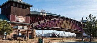
The Great Platte River Road Archway Monument is a monument on Interstate 80 located three miles east of Kearney, Nebraska, United States. Opened in July 2000, it houses a historical experience that tells the story of Nebraska and the Platte River Valley in the development of America. The monument spans more than 300 feet above Interstate 80 and is accessible via two numbered exits.

The Elliott Cutoff was a covered wagon road that branched off the Oregon Trail at the Malheur River where present-day Vale, Oregon, United States is today. The first portion of the road was originally known as the Meek Cutoff after Stephen Meek, a former trapper who led over 1,000 emigrants into the Harney Basin in 1845. There were considerable difficulties for the 1845 train, and after reaching a hill known as Wagontire, the people left Meek and split into groups. They turned north at the Deschutes River and finally returned to the traditional Oregon Trail near The Dalles.

The Nebraska State Highway System consists of all the state highways in Nebraska maintained by the Nebraska Department of Roads. This includes federally designated Interstates and US Highways as well as state highways, links and spurs. The system comprises 9,942 miles (16,000 km) of state highways in all 93 counties. Highways within the system range in scale and quality from 10-lane urban freeways, such as I-80 around Omaha, to standard two-lane rural undivided highways as well as 39 miles (63 km) of state highways that remain unpaved such as N-67 north of Dunbar. Surrounding landscapes along the highway system range from the urban areas in Omaha and Lincoln to scenic journeys through uninhabited grasslands in the Nebraska Sandhills.

The Emigrant Trail in Wyoming, which is the path followed by Western pioneers using the Oregon, California, and Mormon Trails, spans 400 miles (640 km) through the U.S. state of Wyoming. The trail entered from Nebraska on the eastern border of the state near the present day town of Torrington and exited on the western border near the towns of Cokeville and Afton. An estimated 350,000 to 400,000 settlers traveled on the trail through Wyoming between 1841 and 1868. All three trails follow the same path through most of the state. The Mormon Trail splits at Fort Bridger and enters Utah, while the Oregon and California Trails continue to Idaho.

The Great Platte River Road was a major overland travel corridor approximately following the course of the Platte River in present-day Nebraska and Wyoming that was shared by several popular emigrant trails during the 19th century, including the Trapper's Trail, the Oregon Trail, the Mormon Trail, the California Trail, the Pony Express route, and the military road connecting Fort Leavenworth and Fort Laramie. The road, which extended nearly 370 miles (600 km) from the Second Fort Kearny to Fort Laramie, was utilized primarily from 1841 to 1866. In modern times it is often regarded as a sort of superhighway of its era, and has been referred to as "the grand corridor of America's westward expansion".
The Salt Lake Cutoff is one of the many shortcuts that branched from the California, Mormon and Oregon Trails in the United States. It led northwest out of Salt Lake City, Utah and north of the Great Salt Lake for about 180 miles (290 km) before rejoining the California trail near the City of Rocks, Idaho. From there Oregon Trail travelers could easily travel down the Raft River valley portion of the California Trail to return to the Oregon Trail. It provided a way to stop in Salt Lake City for repairs, fresh supplies, fresh livestock, etc. In later years it was used by tens of thousands of pioneers and miners going east and west on their way to or from the future states of California, Oregon, Utah, Idaho, Montana, Nevada or Washington.
In the history of the American frontier, pioneers built overland trails throughout the 19th century, especially between 1829 and 1870, as an alternative to sea and railroad transport. These immigrants began to settle much of North America west of the Great Plains as part of the mass overland migrations of the mid-19th century. Settlers emigrating from the eastern United States did so with various motives, among them religious persecution and economic incentives, to move from their homes to destinations further west via routes such as the Oregon, California, and Mormon Trails. After the end of the Mexican–American War in 1849, vast new American conquests again encouraged mass immigration. Legislation like the Donation Land Claim Act and significant events like the California Gold Rush further encouraged settlers to travel overland to the west.

The historic 2,170-mile (3,490 km) Oregon Trail connected various towns along the Missouri River to Oregon's Willamette Valley. It was used during the 19th century by Great Plains pioneers who were seeking fertile land in the West and North.

Deadwood Draw is part of the Sidney-Black Hills Trail near Sidney, Nebraska, which provided supplies for gold mining operations in the Black Hills from 1874 to 1881. The draw served as a staging area for freight wagons carrying supplies to the Black Hills and contains ruts caused by the wheels of the freight wagons and the animals that pulled them. The draw is listed on the National Register of Historic Places.

O'Fallons Bluff is a section of bluffs about 20 miles (32 km) long that run along the south side of the Platte River near Sutherland in Lincoln County, Nebraska. The Oregon and California trails ran up and over these bluffs. They were characterized by American pioneers heading west to Oregon and California as sparse in vegetation with a number of violent incidents involving Native Americans. In the early 1860s, a Pony Express station was located about 5 miles (8 km) west of where the wagon trails went up the bluff. During construction of Interstate 80, the steep part of the bluffs were cut away but wagon ruts remained, which are marked by iron hoops signifying wagon wheels. It was listed in the National Register of Historic Places in 1974.
Mormon Road, also known to the 49ers as the Southern Route, of the California Trail in the Western United States, was a seasonal wagon road pioneered by a Mormon party from Salt Lake City, Utah led by Jefferson Hunt, that followed the route of Spanish explorers and the Old Spanish Trail across southwestern Utah, northwestern Arizona, southern Nevada and the Mojave Desert of California to Los Angeles in 1847. From 1855, it became a military and commercial wagon route between California and Utah, called the Los Angeles – Salt Lake Road. In later decades this route was variously called the "Old Mormon Road", the "Old Southern Road", or the "Immigrant Road" in California. In Utah, Arizona and Nevada it was known as the "California Road".


