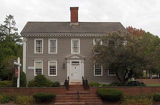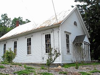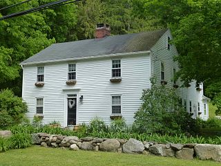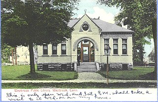
The Main Street Historic District in Cromwell, Connecticut is roughly bounded by Nooks Hill Rd., Prospect Hill Rd., Wall and West Sts. and New Ln., and Stevens Ln. and Main St.

The Worthington Ridge Historic District encompasses the historic town center of Berlin, Connecticut. It runs mostly along Worthington Ridge Road from the intersection of Mill Street to Sunset Lane. This section of road was historically part of the Boston Post Road laid out in 1673, and is now lined by a diversity of residential architecture and several of the town's civic buildings. In 1974, the Berlin Historic District was formed in order to preserve the integrity of the architecture of the village. The district was listed on the National Register of Historic Places in 1989.

The Colchester Village Historic District encompasses most of the historic village center of Colchester, Connecticut. It is located at the junction of Route 16, Route 85, and Norwich Avenue. Roughly, the district extends to the northwest along Broadway Street as far as Jaffe Terrace; east along Norwich Avenue to just short of Pleasant Street; south along South Main Street to just north of Hall Hill Road; west along Linwood Avenue to just east of Kmick Lane. The historic district was listed on the National Register of Historic Places (NRHP) in 1994.

The Main Street Historic District encompasses the historic portion of the central business district of Willimantic, in Windham, Connecticut. The district encompasses the commercial business district of Willimantic and is roughly linear along Main Street and Riverside Drive between Church Street and Bridge Street. It was first listed on the National Register of Historic Places in 1982. Its area was increased in 1992 to include the Hall and Bill building on North Street, built in 1889 by one of Willimantic's leading printers.

Plainfield Street Historic District is a historic district in Plainfield, Connecticut that encompasses the historic area of Plainfield Village, the town center of Plainfield. The district is linear, being located along Route 12 between Railroad Avenue and Route 14A. It has been the center of the town's civic life since its settlement in the early 18th century, and includes two centuries of architectural styles. The district was listed on the National Register of Historic Places in 1991.

The Clinton Village Historic District encompasses the historic portion of the town center of Clinton, Connecticut. It is roughly linear and extends along East Main Street from the Indian River in the west to Old Post Road in the east. The area represents a well-preserved mid-19th century town center, with architecture dating from the late 17th to mid-20th centuries. The district was listed on the National Register of Historic Places in 1994.

The Simsbury Center Historic District is a 75-acre (30 ha) historic district located in the town center area of Simsbury, Connecticut. It encompasses seven blocks of Hopmeadow Street, as well as the cluster of commercial, civic, and residential buildings along Railroad, Station, and Wilcox Streets, and Phelps Lane. Although its oldest element is the cemetery, most of its buildings were built in the late 19th and early 20th century. It was listed on the National Register of Historic Places in 1996.

The Flanders Historic District is a historic district that encompasses a small cluster of late-18th to early-19th century residential structures north of the center of Kent, Connecticut, which was the original heart of the community when it was first settled. It is centered at the junction of United States Route 7 with Cobble Road and Studio Hill Road. The area was supplanted by the current town center in the 1840s. The district was listed on the National Register of Historic Places in 1979.

The Sheffield Plain Historic District encompassing the original 18th-century village center of Sheffield, Massachusetts. The linear district extends southward about 0.5 miles (0.80 km) from the junction of United States Route 7 and Cook Road, where the original town common is located. The district was primarily developed in the mid-18th and early 19th centuries. It was listed on the National Register of Historic Places in 1988.

The Peabody Civic Center Historic District encompasses a well-preserved portion of the historic center of Peabody, Massachusetts. Extending along Chestnut and Franklin Streets south of Peabody City Hall, the district includes a small residential area built in the mid-19th century, as well as the city hall and St. JOhn the Baptist Roman Catholic Church, two monumental structures defining the town's civic heart. The district was added to the National Register of Historic Places in 1980.

The Wayland Center Historic District encompasses the predominantly 19th-century village center of Wayland, Massachusetts. Located at the junction of United States Route 20 and Cochituate Road, it includes fifteen well-preserved 19th-century buildings that form one of the best-preserved village centers of that period near Boston. It was added to the National Register of Historic Places in 1974.

The Granby Center Historic District is a predominantly residential historic district encompassing a portion of the village of Granby Center in Granby, Connecticut. The village developed in the 18th century as a farming center, and a now includes a variety of architectural styles from the late 18th to early 20th centuries. The district was listed on the National Register of Historic Places (NRHP) in 1985.

The Andover Center Historic District encompasses the historic town center of Andover, Connecticut. Centered on the junction of Hebron Road with Center Street and Cider Mill Road, the district includes houses dating to the town's early history, civic buildings including a library and former town hall, and the town's first cemetery. The district was listed on the National Register of Historic Places in 2003.

The Canton Center Historic District encompasses the historic rural town center of Canton, Connecticut. Extending mainly along Connecticut Route 179, near the geographic town center, is a well-preserved example of rural agricultural center in Connecticut, a role served until about 1920. The district includes many examples of Late Victorian and Greek Revival architecture. It was listed on the National Register of Historic Places in 1997.

The Old Saybrook South Green is a 20-acre (8.1 ha) historic district that encompasses the historic town green and nearby streets in Old Saybrook, Connecticut. Established in the 1630s, most of the buildings arrayed around the green were built between 1760 and 1900, and reflect the prosperity of the town, which was a major port and shipbuilding center. The district was listed on the National Register of Historic Places in 1976.

The Guildhall Village Historic District encompasses the central common and surrounding buildings in the village center of Guildhall, Vermont. The town, the first to be settled in Vermont's Northeast Kingdom, has a history from the late 18th century as a commercial, civic, and industrial center, and is the shire town of Essex County. The district was listed on the National Register of Historic Places in 1980.

The Watertown Center Historic District encompasses the historic village center of Watertown, Connecticut. It exhibits architectural and historic changes from the early 1700s into the 20th century. It is roughly bounded by Main, Warren, North, Woodbury, Woodruff, and Academy Hill Roads, and was listed on the National Register of Historic Places in 2001.

The Woodbury Historic District No. 2 encompasses a linear rural-residential area of southern Woodbury, Connecticut. It extends along the town's Main Street, from the town line with Southbury in the south to the South Pomperaug Avenue junction in the north. It contains some of the town's finest examples of 18th and early 19th-century residential architecture. It was listed on the National Register of Historic Places in 1972.

The Enfield Historic District encompasses a two-mile stretch of Enfield Street, the main north-south road of Enfield, Connecticut. Centered on the town common with its church and old town hall, it includes a diversity of residential architecture from the 18th to early 20th centuries. The district was listed on the National Register of Historic Places in 1979.

The South Willington Historic District is a historic district encompassing the historic village of South Willington in the town of Willington, Connecticut. The village, mostly stretched along Connecticut Route 32, developed as a 19th-century industrial mill village associated with the Gardiner Hall Jr. Company. The district was listed on the National Register of Historic Places in 2017.


