
A barn is an agricultural building usually on farms and used for various purposes. In the North American area, a barn refers to structures that house livestock, including cattle and horses, as well as equipment and fodder, and often grain. As a result, the term barn is often qualified e.g. tobacco barn, dairy barn, sheep barn, potato barn. In the British Isles, the term barn is restricted mainly to storage structures for unthreshed cereals and fodder, the terms byre or shippon being applied to cow shelters, whereas horses are kept in buildings known as stables. In mainland Europe, however, barns were often part of integrated structures known as byre-dwellings. In addition, barns may be used for equipment storage, as a covered workplace, and for activities such as threshing.

Westphalia is a small unincorporated community in Falls County, Texas, United States located 35 mi (56 km) south of Waco on State Highway 320. Westphalia has a strong German and Catholic background. The Church of the Visitation was, until recently, the largest wooden church west of the Mississippi River. Westphalia is mainly noted for its historic church and convents, but also for its meat market and for its annual church picnic, which is one of the largest in the area. Westphalia is also known for the Westphalia Waltz.

The John Scott Farm is a historic farmstead near the community of Shandon, Ohio, United States. Established in the nineteenth century and still in operation in the twenty-first, the farmstead has been named a historic site because of its traditionally built agricultural structures.
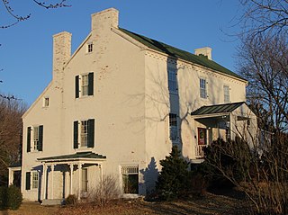
Rock Spring is a historic farmstead property near Shepherdstown, West Virginia.

The Terwilliger–Smith Farm is located on Cherrytown Road near the hamlet of Kerhonkson in the Town of Rochester in Ulster County, New York, United States. It was established in the mid-19th century.

Log buildings and structures can be categorized as historic and modern. A diverse selection of their forms and styles with examples of architectural elements is discussed in the following articles:

The James Elliott Farm is a historic farmstead located on the edge of the town of New Harmony in Posey County, in the U.S. state of Indiana. The farm is composed of the farmhouse and seven outbuildings, including corn cribs, a barn, a shed, a silo, and a milkhouse. The farm centers around the farmhouse, which was built in the Greek Revival style in 1826 by English immigrant James Elliott; even before Elliott joined the commune, the property had been associated with the followers of Robert Owen; the land had previously supported an offshoot of the main community, which its residents called "Feiba Peveli." Elliott had settled in the vicinity as part of the Owenist commune that lived at New Harmony at that time; besides farming, Elliott established himself as the community's brewer.

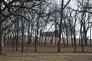
The Nelson Farm is a historic farmstead in rural Merrick County, in the east central part of the state of Nebraska in the Midwestern United States. Originally settled by Swedish immigrants in 1879, it was expanded and improved over the subsequent eighty years and more, remaining in the founder's family into the fourth and fifth generations.

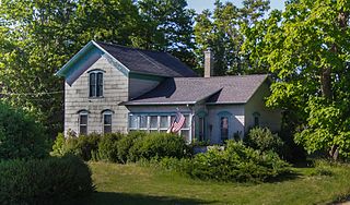
The John and Katharine Tunkun Podjun Farm is a farm located at 9581 East 1 Mile Road in Ellsworth, Michigan. It was listed on the National Register of Historic Places in 2002.

The Saxon Lutheran Memorial in Frohna, Missouri, commemorates the German Lutheran migration of 1838/1839, and features a number of log cabins and artifacts from that era. The memorial opened in 1962 and was placed on the National Register of Historic Places in 1980.

The Stahly–Nissley–Kuhns Farm is a historic farm located at Nappanee, Elkhart County, Indiana. Nappanee was established in 1874. The Farm is part of Amish Acres, which includes the old farmstead and additional structures brought in to show Amish life.

The Helvig–Olson Farm Historic District is an agricultural historic district located in rural Clinton County, Iowa, United States, 3 miles (4.8 km) southwest of the town of Grand Mound. It was listed on the National Register of Historic Places in 2000.

The David Hanaford Farmstead is a historic farm in Monticello Township, Minnesota, United States. It was first settled in 1855 and features a farmhouse built in 1870 and a barn from around the same time. The farmstead was listed on the National Register of Historic Places in 1979 for having local significance in the themes of agriculture and exploration/settlement. It was nominated for being "an excellent example of an early Wright County farmstead developed by a pioneer family from New England."

Dr. John Arnold Farm is a historic home and farm and national historic district located in Union Township, Rush County, Indiana. The farmhouse was built in 1853, and is two-story, Gothic Revival style frame dwelling. It is sheathed in clapboard and has a five-gabled roof forming a double crossed "T"-plan. It features a wraparound front porch added about 1900, and a decorative vergeboard. Also on the property are the contributing remains of an early settlement established in the 1820s, including the remains of the original John Arnold cabin, tomb, and cemetery. Other contributing buildings and structures include a smokehouse, milk house, privy, tool shed, buggy shed / garage, chicken house, granary, corn crib / shed, cattle barn, calf shed, and two additional corn cribs.
Nelson–Pettis Farmsteads Historic District, also known as Poverty Hill, is a national historic district located at St. Joseph, Missouri. The district encompasses four contributing buildings, three contributing sites, and one contributing structure on two adjoining farmsteads - the Nelson farmstead and the Pettis farmstead. The contributing resources are the Nelson I-house farmhouse, root cellar, the Nelson family cemetery, the Pettis farmhouse, the barn, the corn crib / shed, and the agricultural fields.

The Carstens Farmstead is a collection of historic buildings located south of Shelby, Iowa, United States. Johan Carstens was a German immigrant who spent eight years living and working in Milwaukee, Chicago, and Davenport, Iowa before settling in Pottawattamie County in 1871, where he established this farm. He bought 160 acres (65 ha) of land from the Chicago, Rock Island and Pacific Railroad, and continued to farm it until he and his wife retired in 1905. The farm remained in the Carstens family until 1977, when the last of the 80 acres (32 ha) was donated to the Pottawattamie County Historical Society. The farm buildings include: the original farmhouse (1872), the 1888 farmhouse with the summer kitchen, an outhouse, garage (1917), granary (1898), horse and dairy barn (1886), beef cattle barn (1903), beef cattle barn (1917), forge and workshop, windmill (1916), feed shed (1919), hog house (1919), poultry house, machine shed (1920), the cob house (1926), and a corn crib (1930). The buildings were listed together on the National Register of Historic Places in 1979.
The Rock S. Edwards Farmstead is a collection of farm buildings located at 3503 Edwards Road in Sodus Township, Michigan. It was listed on the National Register of Historic Places in 1995.

The Corn Barn, Stable and Cider House at Great Tre-Rhew Farm, Llantilio Crossenny, Monmouthshire form part of "one of the most completely surviving farmsteads in the county". Constructed in the late 17th century, the corn barn is an eight-bay structure with the stable and cider house forming two, gabled, linked additions. The whole is a Grade II* listed structure. The other buildings that comprise the farmstead include the farmhouse, a granary and brewhouse, and a shelter shed, all of which have their own Grade II listings.

The Langford and Lydia McMichael Sutherland Farmstead is a farm located at 797 Textile Road in Pittsfield Charter Township, Michigan. It was listed on the National Register of Historic Places in 2006. It is now the Sutherland-Wilson Farm Historic Site.

The Gordon Hitt Farmstead is a former farm located at 4561 North Lake Road near Clark Lake, Michigan. It was listed on the National Register of Historic Places in 1994. It now serves as a vacation rental.


