Williamsville, Delaware | |
---|---|
Unincorporated community | |
Coordinates: 38°27′36″N75°08′00″W / 38.46000°N 75.13333°W Coordinates: 38°27′36″N75°08′00″W / 38.46000°N 75.13333°W | |
Country | United States |
State | Delaware |
County | Sussex |
Elevation | 30 ft (9 m) |
Time zone | Eastern (EST) (UTC-5) |
• Summer (DST) | EDT (UTC-4) |
Area code(s) | 302 |
GNIS feature ID | 216251 [1] |
Williamsville is an unincorporated community in Sussex County, Delaware, United States. Williamsville is located on Delaware Route 54 between Selbyville and Fenwick Island.
In law, an unincorporated area is a region of land that is not governed by a local municipal corporation; similarly an unincorporated community is a settlement that is not governed by its own local municipal corporation, but rather is administered as part of larger administrative divisions, such as a township, parish, borough, county, city, canton, state, province or country. Occasionally, municipalities dissolve or disincorporate, which may happen if they become fiscally insolvent, and services become the responsibility of a higher administration. Widespread unincorporated communities and areas are a distinguishing feature of the United States and Canada. In most other countries of the world, there are either no unincorporated areas at all, or these are very rare; typically remote, outlying, sparsely populated or uninhabited areas.
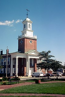
Sussex County is a county located in the southern part of the U.S. state of Delaware, on the Delmarva Peninsula. As of the 2010 census, the population was 197,145. The county seat is Georgetown.
Delaware is one of the 50 states of the United States, in the South-Atlantic or Southern region. It is bordered to the south and west by Maryland, north by Pennsylvania, and east by New Jersey and the Atlantic Ocean. The state takes its name from Thomas West, 3rd Baron De La Warr, an English nobleman and Virginia's first colonial governor.
Griffith's Chapel was listed on the National Register of Historic Places in 1983. [2]
Griffith's Chapel, also known as Williamsville Methodist Church, is a historic Methodist chapel located at the junction of Williamsville Road and Abbotts Pond Road in Williamsville, Kent County, Delaware. It was built in 1850, and is a one-story, rectangular frame building measuring 24 feet wide by 30 feet deep. It has a gable roof and is sheathed in clapboard. The property also includes a 19th-century graveyard in which early members of the congregation are buried.
The National Register of Historic Places (NRHP) is the United States federal government's official list of districts, sites, buildings, structures, and objects deemed worthy of preservation for their historical significance. A property listed in the National Register, or located within a National Register Historic District, may qualify for tax incentives derived from the total value of expenses incurred preserving the property.
The Delmarva Peninsula, or simply Delmarva, is a large peninsula on the East Coast of the United States, occupied by Delaware and parts of the Eastern Shores of Maryland and Virginia. The peninsula is 170 miles (274 km) long. In width, it ranges from 70 miles (113 km) near its center, to 12 miles (19 km) at the isthmus on its northern edge, to less near its southern tip of Cape Charles. It is bordered by the Chesapeake Bay on the west, the Delaware River, Delaware Bay, and the Atlantic Ocean on the east, and the Elk River and its isthmus on the north.
Porter Township is a civil township of Cass County in the U.S. state of Michigan. The population was 3,798 at the 2010 census.
Unadilla Township is a civil township of the southwest corner of Livingston County, Michigan, United States. The population was 3,190 at the 2000 census.
Williamsville is a village in Erie County, New York, in the United States. The population was 5,300 at the 2010 census. The village is named after Jonas Williams, an early settler. It is part of the Buffalo–Niagara Falls Metropolitan Statistical Area.
Oak Grove may refer to:
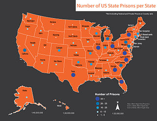
This is a list of U.S. state prisons (2010) :
Kent County may refer to:
The Dean of the United States Senate is an informal term for the Senator with the longest continuous service, regardless of party affiliation. This is not an official position within the Senate, although customarily the longest-serving member of the majority party serves as President pro tempore.
Indigenous peoples of the Northeastern Woodlands include Native American tribes and First Nation bands residing in or originating from a cultural area encompassing the northeastern and Midwest United States and southeastern Canada. It is part of a broader grouping known as the Eastern Woodlands. The Northeastern Woodlands is divided into three major areas: the Coastal, Saint Lawrence Lowlands, and Great Lakes-Riverine zones.
Williamsville may refer to either of two small unincorporated communities in the U.S. state of Michigan:
Georgetown or George Town may refer to:
Williamsville is an unincorporated community in Sussex County, Delaware, United States. Williamsville is located on Delaware Route 54 between Selbyville and Fenwick Island.
Williamsville is an unincorporated community in Bath County, Virginia, in the United States.
Williamsville is a historic home located at Studley, Hanover County, Virginia. The main house was built between 1794 and 1803, and is a two-story, five bay, brick I-house in the Federal style. It has a rear ell. The house features a one-story wood porch surmounted by a balustrade and sophisticated trim, including the fully developed modillioned cornice and the elaborate Adamesque mantels.
Orange is an unincorporated community in Delaware County, in the U.S. state of Ohio.
Williamsville is an unincorporated community in Kent County, Delaware, United States. Williamsville is located at the intersection of Williamsville Road and Deep Grass Lane south of Houston.
This Delaware state location article is a stub. You can help Wikipedia by expanding it. |