
The Wilson River, about 33 miles (53 km) long, flows from the Northern Oregon Coast Range to Tillamook Bay in the U.S. state of Oregon. Formed by the confluence of its Devil's Lake Fork and its South Fork, it runs generally west through the Tillamook State Forest to its mouth near the city of Tillamook. It is one of five rivers—the Tillamook, the Trask, the Wilson, the Kilchis, and the Miami—that flow into the bay.

The Kilchis River is a stream, about 14 miles (23 km) long, near the coast of northwest Oregon in the United States. It drains a mountainous timbered region of about 65 square miles (170 km2) in the Northern Oregon Coast Range west of Portland.
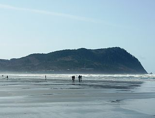
Tillamook Head is a high promontory on the Pacific coast of northwest Oregon in the United States. It is located in west-central Clatsop County, approximately 5 mi (8 km) southwest of Seaside. The promontory forms a steep rocky bluff on the ocean, approximately 1,200 ft high, forested with Sitka Spruce. It is located in Ecola State Park.

Idiotville is a ghost town in Tillamook County, Oregon, United States, near the mouth of Idiot Creek on the Wilson River, on the route of Oregon Route 6. Idiotville's elevation is 1,200 feet.

Prospect State Scenic Viewpoint, is a state park south of the community of Prospect on Oregon Route 62 in Jackson County, in the U.S. state of Oregon. It was formerly known as Mill Creek Falls Scenic Area, a private hiking area that was developed by Willamette Industries along the Rogue River. Both Mill Creek Falls and Pearsony Falls are contained within the area, with Barr Creek Falls close by.

The Tillamook State Forest is a 364,000-acre (1,470 km2) publicly owned forest in the U.S. state of Oregon. Managed by the Oregon Department of Forestry, it is located 40 miles (64 km) west of Portland in the Northern Oregon Coast Range, and spans Washington, Tillamook, Yamhill, and Clatsop counties. The forest receives large amounts of precipitation and is dominated by Douglas-fir trees. Activities include commercial logging, recreation, and other commercial resource extraction activities such as mushroom hunting.

The Siuslaw National Forest is a national forest in western Oregon in the United States. Established in 1908, the Siuslaw is made up of a wide variety of ecosystems, ranging from coastal forests to sand dunes.

Castle Rock is an unincorporated community in Tillamook County, Oregon, United States. It is located in the Northern Oregon Coast Range within the Siuslaw National Forest on Oregon Route 22 near Three Rivers. The nearest major community is Hebo. Castle Rock has an elevation of 272 feet (83 m).
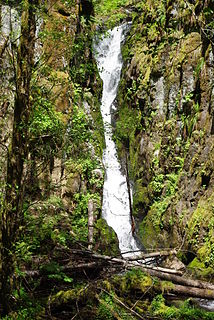
Ki-a-Kuts Falls is a 40-foot (12 m) tall waterfall on the Tualatin River in Washington County, Oregon, United States. Discovered in 1993 in the more remote upper stretch of the river, the falls were named after the last chief of the local band of Native Americans, Chief Ki-a-Kuts of the Atfalati. The water descends in a single fall down a narrow channel in the basalt cliffs overhanging the river at that spot.

Jordan Creek is an unincorporated community in Tillamook County, Oregon, United States. The community is along Oregon Route 6 northeast of Tillamook in the Northern Oregon Coast Range. It lies in the Tillamook State Forest at the confluence of Jordan Creek with the Wilson River.

Lees Camp is an unincorporated community in Tillamook County, Oregon, United States. It is along Oregon Route 6 about 25 miles (40 km) northeast of Tillamook at the confluence of the Wilson River and North Fork Wilson River, surrounded by the Tillamook State Forest. It is near the summit of the Northern Oregon Coast Range.

Willamina Creek is a tributary, about 20 miles (32 km) long, of the South Yamhill River in the U.S. state of Oregon. Beginning in the Northern Oregon Coast Range in Yamhill County, it briefly enters and exits a small part of eastern Tillamook County, then flows generally south to meet the larger stream at Willamina, near the border with Polk County.
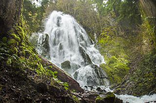
Moon Falls, also spelled Moonfalls, is a waterfall located on the west edge of the Umpqua National Forest in Lane County, in the U.S. state of Oregon. It totals 100 feet fall in one wide veiling cascade and is 1.5 miles from Spirit Falls trailhead.
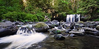
Upper Butte Creek Falls, is a waterfall located in the south edge of the Table Rock Wilderness at the east end of the city of Salem, in Marion County, in the U.S. state of Oregon. It is located in a privileged area on the east foothills of Drake Crossing. Several prominent rivers and waterfalls are located in the Butte Creek Falls trail system.
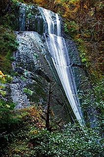
Wolf Creek Falls, is a two tier waterfall located on the west skirt of the Umpqua National Forest, in Douglas County, in the U.S. state of Oregon. It is located in a privileged area where rivers of the forest create several waterfalls: Cavitt Creek Falls, and Shadow Falls are within five miles of Wolf Creek Falls. Grotto Falls is further to the east off Little River Road and National Forest Road 2703.

Wizard Falls, was a waterfall located in Jefferson County, in the U.S. state of Oregon. It was located in a privileged area on the northwest foothills of Deschutes National Forest, just north of Black Butte and the city of Sisters, Oregon. To the west sits volcano Three Fingered Jack, between Mount Washington to the South and Mount Jefferson to the North.
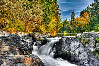
Wildwood Falls, also known as Row River Falls, is a waterfall located on the west skirt of the Umpqua National Forest, in Lane County, in the U.S. state of Oregon. It is located in a privileged area on the west foothills where Willamette National Forest meets with the Umpqua National Forest.
Yocum Falls, is a waterfall located in the heart of the Mount Hood National Forest, in Clackamas County, in the U.S. state of Oregon. It is located in a privileged area in Zigzag canyon with several waterfalls including Little Zigzag Falls and Ramona Falls. The name, as well as Yocum Ridge, the south ridge of the Sandy Glacier on the west slope of Mount Hood, comes from businessman Oliver C. Yocum.
Chitwood Falls is a waterfall from the Chitwood Creek, just before it empties into the Cascade Head North Marine Protected Area, in Tillamook County, Oregon. Access to Chitwood Falls is from Forest Road 1861.


