List of incorporated places in New York's Capital District

Last updated

Albany City Hall. AlbanyNYCityHall.jpg
Albany City Hall.

There are three types of incorporated municipalities in the Capital District of the U.S. state of New York : Cities, towns, and villages. In the State of New York, all the land located in a county is either in a city, in a town, or in an Indian Reservation. [1] New York villages are located within one or more towns and may cross town or county lines. There are 11 counties in the Capital District comprising 13 cities, 143 towns, and 62 villages.[ citation needed ] The counties are Albany, Columbia, Greene, Fulton, Montgomery, Rensselaer, Saratoga, Schenectady, Schoharie, Warren, and Washington. [2] The village of Green Island is coterminous with the town of the same name. [3] Ballston Spa, Broadalbin, Cambridge, Chatham, Fort Plain, Greenwich, Nassau, and Valley Falls are villages that cross into two towns.[ citation needed ] The village of Dolgeville is partly in Fulton County, but is mostly in Herkimer County, which is part of the Utica-Rome Metropolitan Statistical Area. [4]

Contents

Ten of the eleven counties of the Capital District make up two Metropolitan Statistical Areas (MSA) and three Micropolitan Statistical Areas (μSA); together, those five statistical areas make up the Albany-Schenectady-Amsterdam Combined Statistical Area. Albany, Rensselaer, Saratoga, Schenectady, and Schoharie Counties make up the Albany-Schenectady-Troy MSA; while Warren and Washington counties are the constituent counties of the Glens Falls MSA. Fulton County is the sole county in the Gloversville μSA, Montgomery County is the Amsterdam μSA, and Columbia County is the Hudson μSA. Greene County is not in any CSA, MSA, or μSA.[ citation needed ]

Incorporated cities, towns, and villages

  * -Central city of a metro or micro statistical area

Place Name County Population
(2000 Census) [5]
Area
(as of 2000)
[5]
Type of municipalityMetro or micro
statistical area
Incorp.
date
Image
* Albany Albany 95,65821.8 sq mi (56.6 km2)CityAlb.-Sch.-Troy MSA1686 AlbanyNYPano.jpg
Altamont Albany 1,7371.2 sq mi (3.1 km2)VillageAlb.-Sch.-Troy MSA1860
Ames Montgomery 1730.1 sq mi (0.3 km2)VillageAmsterdam μSA1924
* Amsterdam Montgomery 18,3556.3 sq mi (16.3 km2)CityAmsterdam μSA1885 Historic Amsterdam NY.jpg
Amsterdam Montgomery 5,82030.3 sq mi (78.6 km2)TownAmsterdam μSA1793
Ancram Columbia 1,51342.8 sq mi (110.7 km2)TownHudson μSA1803 Ancramdale.jpg
Argyle Washington 3,68857.8 sq mi (57.8 km2)TownGlens Falls MSA1786
Argyle Washington 2890.4 sq mi (0.9 km2)VillageGlens Falls MSA1838
Ashland Greene 75226.0 sq mi (67.3 km2)TownNone1848
Athens Greene 3,99128.8 sq mi (74.7 km2)TownNone1815
Athens Greene 1,6954.6 sq mi (11.9 km2)VillageNone1805
Austerlitz Columbia 1,45348.8 sq mi (126.5 km2)TownHudson μSA1818
Ballston Saratoga 8,72930.0 sq mi (77.7 km2)TownAlb.-Sch.-Troy MSA1788
* Ballston Spa Saratoga 5,5561.6 sq mi (4.2 km2)VillageAlb.-Sch.-Troy MSA1807 Ballston Spa 1.jpg
Berlin Rensselaer 1,90159.9 sq mi (155.2 km2)TownAlb.-Sch.-Troy MSA1806
Berne Albany 2,84664.8 sq mi (167.7 km2)TownAlb.-Sch.-Troy MSA1795
Bethlehem Albany 31,30449.6 sq mi (128.4 km2)TownAlb.-Sch.-Troy MSA1793
Bleecker Fulton 57359.5 sq mi (154.0 km2)TownGloversville μSA1831
Blenheim Schoharie 33034.4 sq mi (89.0 km2)TownAlb.-Sch.-Troy MSA1797
Bolton Warren 2,11790.1 sq mi (233.3 km2)TownGlens Falls MSA1799 Church in Bolton Landing NY.JPG
Broadalbin Fulton 5,06639.8 sq mi (103.0 km2)TownGloversville μSA1793
Broadalbin Fulton 1,4111.0 sq mi (2.6 km2)VillageGloversville μSA1815
Broome Schoharie 94748.1 sq mi (124.5 km2)TownAlb.-Sch.-Troy MSA1797
Brunswick Rensselaer 11,64444.6 sq mi (115.6 km2)TownAlb.-Sch.-Troy MSA1807 BrunswickPanorama.jpg
Cairo Greene 6,35560.1 sq mi (155.8 km2)TownNone1802
Cambridge Washington 2,15836.5 sq mi (94.5 km2)TownGlens Falls MSA1788
Cambridge Washington 1,9251.7 sq mi (4.3 km2)VillageGlens Falls MSA1866 Hubbard Hall, Cambridge, NY.jpg
Canaan Columbia 1,82037.0 sq mi (95.7 km2)TownHudson μSA1788
Canajoharie Montgomery 3,79743.1 sq mi (111.6 km2)TownAmsterdam μSA1788
Canajoharie Montgomery 2,2571.3 sq mi (3.5 km2)VillageAmsterdam μSA1829 Church Street Canajoharie.JPG
Carlisle Schoharie 1,75834.2 sq mi (88.7 km2)TownAlb.-Sch.-Troy MSA1807
Caroga Fulton 1,40754.2 sq mi (140.5 km2)TownGloversville μSA1842
Castleton-on-Hudson Rensselaer 1,6190.8 sq mi (2.1 km2)VillageAlb.-Sch.-Troy MSA1827
Catskill Greene 11,84964.2 sq mi (166.2 km2)TownNone1788
Catskill Greene 4,3922.8 sq mi (7.3 km2)VillageNone1806
Charleston Montgomery 1,29242.8 sq mi (111.0 km2)TownAmsterdam μSA1793
Charlton Saratoga 3,95432.8 sq mi (85.0 km2)TownAlb.-Sch.-Troy MSA1792
Chatham Columbia 4,24953.5 sq mi (138.7 km2)TownHudson μSA1795
Chatham Columbia 1,7581.2 sq mi (3.1 km2)VillageHudson μSA1869
Chester Warren 3,61487.1 sq mi (225.6 km2)TownGlens Falls MSA1799 Chester Four Corners, Chestertown, NY.JPG
Claverack Columbia 6,40148.0 sq mi (124.2 km2)TownHudson μSA1788
Clermont Columbia 1,72619.2 sq mi (49.7 km2)TownHudson μSA1788
Clifton Park Saratoga 32,99550.2 sq mi (130.1 km2)TownAlb.-Sch.-Troy MSA1828
Cobleskill Schoharie 6,40730.8 sq mi (79.7 km2)TownAlb.-Sch.-Troy MSA1795
Cobleskill Schoharie 4,5333.3 sq mi (8.5 km2)VillageAlb.-Sch.-Troy MSA1868
Coeymans Albany 8,15153.1 sq mi (137.5 km2)TownAlb.-Sch.-Troy MSA1791
Cohoes Albany 15,5214.2 sq mi (11.0 km2)CityAlb.-Sch.-Troy MSA1869 Cohoes, NY, skyline.jpg
Colonie Albany 79,25857.9 sq mi (149.9 km2)TownAlb.-Sch.-Troy MSA1895
Colonie Albany 7,9163.3 sq mi (8.6 km2)VillageAlb.-Sch.-Troy MSA1921
Conesville Schoharie 72639.9 sq mi (103.2 km2)TownAlb.-Sch.-Troy MSA1836
Copake Columbia 3,27842.1 sq mi (109.1 km2)TownAlb.-Sch.-Troy MSA1824 Downtown Copake NY.JPG
Corinth Saratoga 5,98558.1 sq mi (150.6 km2)TownAlb.-Sch.-Troy MSA1818
Corinth Saratoga 2,4741.1 sq mi (2.9 km2)VillageAlb.-Sch.-Troy MSA1888
Coxsackie Greene 8,88438.4 sq mi (99.4 km2)TownNone1788
Coxsackie Greene 2,8952.6 sq mi (6.7 km2)VillageNone1867
Day Saratoga 92069.6 sq mi (180.1 km2)TownAlb.-Sch.-Troy MSA1819
Delanson Schenectady 3850.6 sq mi (1.6 km2)VillageAlb.-Sch.-Troy MSA1921
Dolgeville Fulton
Herkimer
2,1661.9 sq mi (4.8 km2)VillageGloversville μSA
Utica-Rome MSA
1881
Dresden Washington 67755.0 sq mi (142.5 km2)TownGlens Falls MSA1822
Duanesburg Schenectady 5,80872.1 sq mi (186.8 km2)TownAlb.-Sch.-Troy MSA1788
Durham Greene 2,59249.3 sq mi (127.6 km2)TownNone1790
East Greenbush Rensselaer 15,56024.4 sq mi (63.1 km2)TownAlb.-Sch.-Troy MSA1855 US4WesternJunction.jpg
East Nassau Rensselaer 5714.9 sq mi (12.7 km2)VillageAlb.-Sch.-Troy MSA1998
Easton Washington 2,25963.2 sq mi (163.6 km2)TownGlens Falls MSA1789
Edinburg Saratoga 1,38467.1 sq mi (173.7 km2)TownAlb.-Sch.-Troy MSA1801
Ephratah Fulton 1,69339.4 sq mi (102.1 km2)TownGloversville μSA1827
Esperance Schoharie 2,04320.0 sq mi (51.9 km2)TownAlb.-Sch.-Troy MSA1846
Esperance Schoharie 3800.5 sq mi (1.4 km2)VillageAlb.-Sch.-Troy MSA1819
Florida Montgomery 2,73151.5 sq mi (133.4 km2)TownAmsterdam μSA1793
Fonda Montgomery 8100.6 sq mi (1.6 km2)VillageAmsterdam μSA1850
Fort Ann Washington 6,417110.8 sq mi (287.0 km2)TownGlens Falls MSA1808
Fort Ann Washington 4710.3 sq mi (0.8 km2)VillageGlens Falls MSA1820
Fort Edward Washington 5,89227.4 sq mi (71.0 km2)TownGlens Falls MSA1818
Fort Edward Washington 3,1411.9 sq mi (5.0 km2)VillageGlens Falls MSA1849
Fort Johnson Montgomery 4910.8 sq mi (2.2 km2)VillageAmsterdam μSA1909
Fort Plain Montgomery 2,2881.4 sq mi (3.7 km2)VillageAmsterdam μSA1832
Fulton Schoharie 1,49565.0 sq mi (168.2 km2)TownAlb.-Sch.-Troy MSA1828
Fultonville Montgomery 7100.5 sq mi (1.3 km2)VillageAmsterdam μSA1948
Gallatin Columbia 1,49939.6 sq mi (102.6 km2)TownHudson μSA1830
Galway Saratoga 3,58945.0 sq mi (116.6 km2)TownAlb.-Sch.-Troy MSA1792
Galway Saratoga 2140.3 sq mi (0.7 km2)VillageAlb.-Sch.-Troy MSA1838
Germantown Columbia 2,01813.9 sq mi (36.0 km2)TownHudson μSA1788
Ghent Columbia 5,27645.4 sq mi (117.6 km2)TownHudson μSA1818
Gilboa Schoharie 1,21559.3 sq mi (153.7 km2)TownAlb.-Sch.-Troy MSA1848
Glen Montgomery 2,22239.3 sq mi (101.8 km2)TownAmsterdam μSA1823
* Glens Falls Warren 14,3543.9 sq mi (10.2 km2)CityGlens Falls MSA1908 Downtown Glens Falls New York roundabout.jpg
Glenville Schenectady 28,18350.9 sq mi (131.8 km2)TownAlb.-Sch.-Troy MSA1821
* Gloversville Fulton 15,4135.1 sq mi (13.2 km2)CityGloversville μSA1890
Grafton Rensselaer 1,98746.0 sq mi (119.0 km2)TownAlb.-Sch.-Troy MSA1807
Granville Washington 6,45656.1 sq mi (145.4 km2)TownGlens Falls MSA1786
Granville Washington 2,6441.6 sq mi (4.1 km2)VillageGlens Falls MSA1849
Greenfield Saratoga 7,36267.7 sq mi (175.4  km2)TownAlb.-Sch.-Troy MSA1793
Green Island Albany 2,2780.9 sq mi (2.4 km2)TownAlb.-Sch.-Troy MSA1896
Green Island Albany 2,2780.9 sq mi (2.4 km2)VillageAlb.-Sch.-Troy MSA1853
Greenport Columbia 4,18020.5 sq mi (53.1 km2)TownHudson μSA1837
Greenville Greene 3,31639.1 sq mi (101.3 km2)TownNone1803
Greenwich Washington 4,89644.4 sq mi (114.9 km2)TownGlens Falls MSA1803
Greenwich Washington 1,9021.5 sq mi (3.9 km2)VillageGlens Falls MSA1809
Guilderland Albany 32,68858.7 sq mi (152 km2)TownAlb.-Sch.-Troy MSA1803
Hadley Saratoga 1,97141.1 sq mi (106.4 km2)TownAlb.-Sch.-Troy MSA1801
Hagaman Montgomery 1,3571.5 sq mi (4.0 km2)VillageAmsterdam μSA1892
Hague Warren 85479.6 sq mi (206.2 km2)TownGlens Falls MSA1807
Halcott Greene 19323.0 sq mi (59.7 km2)TownNone1851
Halfmoon Saratoga 18,47433.7 sq mi (87.2 km2)TownAlb.-Sch.-Troy MSA1788
Hampton Washington 87122.6 sq mi (58.6 km2)TownGlens Falls MSA1786
Hartford Washington 2,27943.5 sq mi (112.6 km2)TownGlens Falls MSA1793
Hebron Washington 1,77356.4 sq mi (146.1 km2)TownGlens Falls MSA1786
Hillsdale Columbia 1,74447.8 sq mi (123.7 km2)TownHudson μSA1788
Hoosick Rensselaer 6,75963.2 sq mi (163.6 km2)TownAlb.-Sch.-Troy MSA1788
Hoosick Falls Rensselaer 3,4361.7 sq mi (4.5 km2)VillageAlb.-Sch.-Troy MSA1827
Horicon Warren 1,47971.8 sq mi (186.0 km2)TownGlens Falls MSA1838
* Hudson Columbia 7,5242.3 sq mi (6.0 km2)CityHudson μSA1785 HudsonNYWarren.jpg
Hunter Greene 2,72190.7 sq mi (235.0 km2)TownNone1813 View from top of Kaaterskill Falls 2.jpg
Hunter Greene 4901.6 sq mi (4.3 km2)VillageNone1896
Jackson Washington 1,71837.5 sq mi (97.0 km2)TownGlens Falls MSA1815
Jefferson Schoharie 1,28543.4 sq mi (112.5 km2)TownAlb.-Sch.-Troy MSA1803
Jewitt Greene 97050.5 sq mi (130.8 km2)TownNone1849
Johnsburg Warren 2,450206.7 sq mi (535.5 km2)TownGlens Falls MSA1805
* Johnstown Fulton 8,5114.9 sq mi (12.6 km2)CityGloversville μSA1895
Johnstown Fulton 7,16671.4 sq mi (184.9 km2)TownGloversville μSA1793
Kinderhook Columbia 8,29632.4 sq mi (84.0 km2)TownHudson μSA1788
Kinderhook Columbia 1,2751.9 sq mi (4.9 km2)VillageHudson μSA1838
Kingsbury Washington 11,17140.0 sq mi (103.6 km2)TownGlens Falls MSA1786
Knox Albany 2,64741.9 sq mi (108.6 km2)TownAlb.-Sch.-Troy MSA1822
Lake George Warren 3,57832.7 sq mi (84.7 km2)TownGlens Falls MSA1810
Lake George Warren 9850.6 sq mi (1.6 km2)VillageGlens Falls MSA1903 Lake George Vil 1.JPG
Lake Luzerne Warren 3,21954.1 sq mi (140.0 km2)TownGlens Falls MSA1792
Lexington Greene 83079.7 sq mi (206.5 km2)TownNone1813
Livingston Columbia 3,42439.0 sq mi (100.9 km2)TownHudson μSA1788
Malta Saratoga 13,00531.4 sq mi (81.2 km2)TownAlb.-Sch.-Troy MSA1802
Mayfield Fulton 6,64064.7 sq mi (167.5 km2)TownGloversville μSA1793
Mayfield Fulton 8001.1 sq mi (2.8 km2)VillageGloversville μSA1896
Mechanicville Saratoga 5,0190.9 sq mi (2.4 km2)CityAlb.-Sch.-Troy MSA1915
Menands Albany 3,9103.4 sq mi (8.8 km2)VillageAlb.-Sch.-Troy MSA1924
Middleburgh Schoharie 3,51549.3 sq mi (127.6 km2)TownAlb.-Sch.-Troy MSA1797
Middleburgh Schoharie 1,3981.2 sq mi (3.1 km2)VillageAlb.-Sch.-Troy MSA1881 Vroman27s Nose.jpg
Milton Saratoga 17,10335.6 sq mi (92.3 km2)TownAlb.-Sch.-Troy MSA1792
Minden Montgomery 4,20251.5 sq mi (133.3 km2)TownAmsterdam μSA1798
Mohawk Montgomery 3,90235.4 sq mi (91.7 km2)TownAmsterdam μSA1837
Moreau Saratoga 13,82643.6 sq mi (112.96 km2)TownAlb.-Sch.-Troy MSA1805
Nassau Rensselaer 4,81845.2 sq mi (117.1 km2)TownAlb.-Sch.-Troy MSA1807
Nassau Rensselaer 1,1610.7 sq mi (1.8 km2)VillageAlb.-Sch.-Troy MSA1819
Nelliston Montgomery 6221.2 sq mi (3.1 km2)VillageAmsterdam μSA1878
New Baltimore Greene 3,41743.1 sq mi (111.7 km2)TownNone1811
New Lebanon Columbia 2,45436.0 sq mi (93.2 km2)TownHudson μSA1818
New Scotland Albany 8,62658.4 sq mi (151.3 km2)TownAlb.-Sch.-Troy MSA1832
Niskayuna Schenectady 20,29515.1 sq mi (39.0 km2)TownAlb.-Sch.-Troy MSA1809
North Greenbush Rensselaer 10,80519.0 sq mi (49.3 km2)TownAlb.-Sch.-Troy MSA1855
Northampton Fulton 2,76034.7 sq mi (89.9 km2)TownGloversville μSA1799
Northumberland Saratoga 4,60332.9 sq mi (85.2 km2)TownAlb.-Sch.-Troy MSA1798
Northville Fulton 1,1391.4 sq mi (3.7 km2)VillageGloversville μSA1873
Oppenheim Fulton 1,77456.5 sq mi (146.2 km2)TownGloversville μSA1808
Palatine Montgomery 3,07041.7 sq mi (108.1 km2)TownAmsterdam μSA1788
Palatine Bridge Montgomery 7060.9 sq mi (2.5 km2)VillageAmsterdam μSA1867
Perth Fulton 3,63826.1 sq mi (67.5 km2)TownGloversville μSA1838
Petersburgh Rensselaer 1,56341.6 sq mi (107.7 km2)TownAlb.-Sch.-Troy MSA1791
Philmont Columbia 1,4801.2 sq mi (3.1 km2)VillageHudson μSA1891
Pittstown Rensselaer 5,64464.8 sq mi (167.9 km2)TownAlb.-Sch.-Troy MSA1788
Poestenkill Rensselaer 4,05432.6 sq mi (84.4 km2)TownAlb.-Sch.-Troy MSA1848
Prattsville Greene 66519.7 sq mi (51.1 km2)TownNone1824
Princetown Schenectady 2,13224.1 sq mi (62.4 km2)TownAlb.-Sch.-Troy MSA1798
Providence Saratoga 1,84145.1 sq mi (116.8 km2)TownAlb.-Sch.-Troy MSA1796
Putnam Washington 64535.5 sq mi (91.8 km2)TownGlens Falls MSA1806
Queensbury Warren 25,41164.81 sq mi (167.9 km2)TownGlens Falls MSA1786
Ravena Albany 3,3691.3 sq mi (3.5 km2)VillageAlb.-Sch.-Troy MSA1914
Rensselaer Rensselaer 7,7613.3 sq mi (8.6 km2)CityAlb.-Sch.-Troy MSA1897
Rensselaerville Albany 1,91561.9 sq mi (160.2 km2)TownAlb.-Sch.-Troy MSA1790
Richmondville Schoharie 2,41230.2 sq mi (78.3 km2)TownAlb.-Sch.-Troy MSA1849
Richmondville Schoharie 7861.8 sq mi (4.7 km2)VillageAlb.-Sch.-Troy MSA1881
Root Montgomery 1,75251.0 sq mi (132.1 km2)TownAmsterdam μSA1823
Rotterdam Schenectady 28,31636.5 sq mi (94.5 km2)TownAlb.-Sch.-Troy MSA1820
Round Lake Saratoga 6041.2 sq mi (3.0 km2)VillageAlb.-Sch.-Troy MSA1869
St. Johnsville Montgomery 2,56517.4 sq mi (45.0 km2)TownAmsterdam μSA1838
St. Johnsville Montgomery 1,6850.9 sq mi (2.2 km2)VillageAmsterdam μSA1857
Salem Washington 2,70252.5 sq mi (136.0 km2)TownGlens Falls MSA1786
Salem Washington 9642.9 sq mi (7.6 km2)VillageGlens Falls MSA1803
Sand Lake Rensselaer 7,98736.2 sq mi (93.6 km2)TownAlb.-Sch.-Troy MSA1812
Saratoga Saratoga 5,14142.9 sq mi (111.1 km2)TownAlb.-Sch.-Troy MSA1788
* Saratoga Springs Saratoga 28,18629.1 sq mi (75.3 km2)CityAlb.-Sch.-Troy MSA1826 Downtown Saratoga Springs.jpg
Schaghticoke Rensselaer 7,45651.9 sq mi (134.3 km2)TownAlb.-Sch.-Troy MSA1788
Schaghticoke Rensselaer 6760.9 sq mi (2.3 km2)VillageAlb.-Sch.-Troy MSA1867
* Schenectady Schenectady 61,82111.0 sq mi (28.5 km2)CityAlb.-Sch.-Troy MSA1798 SchenectadyAerial.jpeg
Schodack Rensselaer 12,53663.7 sq mi (164.9 km2)TownAlb.-Sch.-Troy MSA1795
Schoharie Schoharie 3,29930.0 sq mi (77.6 km2)TownAlb.-Sch.-Troy MSA1788
Schoharie Schoharie 1,0301.6 sq mi (4.3 km2)VillageAlb.-Sch.-Troy MSA1867
Schuylerville Saratoga 1,1970.6 sq mi (1.5 km2)VillageAlb.-Sch.-Troy MSA1831
Scotia Schenectady 7,9571.8 sq mi (4.6 km2)VillageAlb.-Sch.-Troy MSA1904
Seward Schoharie 1,63736.5 sq mi (94.4 km2)TownAlb.-Sch.-Troy MSA1840
Sharon Schoharie 1,84339.2 sq mi (101.4 km2)TownAlb.-Sch.-Troy MSA1797
Sharon Springs Schoharie 5471.8 sq mi (4.7 km2)VillageAlb.-Sch.-Troy MSA1871
South Glens Falls Saratoga 3,3681.5 sq mi (3.9 km2)VillageAlb.-Sch.-Troy MSA1895
Stephentown Rensselaer 2,87358.1 sq mi (150.4 km2)TownAlb.-Sch.-Troy MSA1788
Stillwater Saratoga 7,52243.6 sq mi (112.8 km2)TownAlb.-Sch.-Troy MSA1788
Stillwater Saratoga 1,6441.4 sq mi (3.7 km2)VillageAlb.-Sch.-Troy MSA1816
Stockport Columbia 2,93313.1 sq mi (34.1 km2)TownHudson μSA1833
Stony Creek Warren 74383.2 sq mi (215.5 km2)TownGlens Falls MSA1852
Stratford Fulton 64076.7 sq mi (198.6 km2)TownGloversville μSA1805
Stuyvesant Columbia 2,18826.8 sq mi (69.3 km2)TownHudson μSA1823
Summit Schoharie 1,12337.5 sq mi (97.0 km2)TownAlb.-Sch.-Troy MSA1819
Taghkanic Columbia 1,11840.2 sq mi (104.0 km2)TownHudson μSA1803
Tannersville Greene 4481.1 sq mi (3.0 km2)VillageNone1895
Thurman Warren 1,19992.8 sq mi (240.3 km2)TownGlens Falls MSA1792
* Troy Rensselaer 49,17011.0 sq mi (28.5 km2)CityAlb.-Sch.-Troy MSA1816 TroyCentralHistoricDistrict.JPG
Valatie Columbia 1,7121.3 sq mi (3.3 km2)VillageHudson μSA1856
Valley Falls Rensselaer 4910.5 sq mi (1.2 km2)VillageAlb.-Sch.-Troy MSA1904
Victory Saratoga 5440.5 sq mi (1.4 km2)VillageAlb.-Sch.-Troy MSA1849
Voorheesville Albany 2,7052.1 sq mi (5.5 km2)VillageAlb.-Sch.-Troy MSA1899
Warrensburg Warren 4,25564.8 sq mi (168.0 km2)TownGlens Falls MSA1813
Waterford Saratoga 8,5157.4 sq mi (19.2 km2)TownAlb.-Sch.-Troy MSA1816
Waterford Saratoga 2,2040.4 sq mi (0.9 km2)VillageAlb.-Sch.-Troy MSA1794
Watervliet Albany 10,2071.5 sq mi (3.9 km2)CityAlb.-Sch.-Troy MSA1897 WatervlietNY.JPG
Westerlo Albany 3,46658.5 sq mi (151.6 km2)TownAlb.-Sch.-Troy MSA1815 NY 32 in Westerlo.jpg
White Creek Washington 3,41147.9 sq mi (124.1 km2)TownGlens Falls MSA1815
Whitehall Washington 4,03558.8 sq mi (149.2 km2)TownGlens Falls MSA1786
Whitehall Washington 2,6674.8 sq mi (12.5 km2)VillageGlens Falls MSA1806
Wilton Saratoga 12,51136.0 sq mi (93.2 km2)TownAlb.-Sch.-Troy MSA1818
Windham Greene 1,66045.4 sq mi (117.6 km2)TownNone1798
Wright Schoharie 1,54728.7 sq mi (74.3 km2)TownAlb.-Sch.-Troy MSA1846

See also

Related Research Articles

<span class="mw-page-title-main">Albany County, New York</span> County in New York, United States

Albany County is a county in the state of New York, United States. Its northern border is formed by the Mohawk River, at its confluence with the Hudson River, which is to the east. As of the 2020 United States Census, the population was 314,848. The county seat and largest city is Albany, which is also the state capital of New York. As originally established by the English government in the colonial era, Albany County had an indefinite amount of land, but has had an area of 530 square miles (1,400 km2) since March 3, 1888. The county is named for the Duke of York and of Albany, who became James II of England. The county is part of the Capital District region of the state.

<span class="mw-page-title-main">Schenectady County, New York</span> County in New York, United States

Schenectady County is a county in the U.S. state of New York. As of the 2020 census, the population was 158,061. The county seat is Schenectady. The name is from a Mohawk language word meaning "on the other side of the pine lands," a term that originally applied to Albany. The county is part of the Capital District region of the state.

<span class="mw-page-title-main">Mohawk Valley</span> Six-county region in New York, United States

The Mohawk Valley region of the U.S. state of New York is the area surrounding the Mohawk River, sandwiched between the Adirondack Mountains and Catskill Mountains, northwest of the Capital District. As of the 2010 United States Census, the region's counties have a combined population of 622,133 people. In addition to the Mohawk River valley, the region contains portions of other major watersheds such as the Susquehanna River.

<span class="mw-page-title-main">Capital District (New York)</span> Region in New York, United States

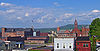
The Capital District, also known as the Capital Region, is the metropolitan area surrounding Albany, the capital of the U.S. state of New York. The Capital District was first settled by the Dutch in the early 17th century and came under English control in 1664. Albany has been the permanent capital of the state of New York since 1797. The Capital District is notable for many historical events that predate the independence of the United States, including the Albany Plan of Union and the Battles of Saratoga.

<span class="mw-page-title-main">New York's 29th congressional district</span> Former congressional district

New York's 29th congressional district is an obsolete congressional district for the United States House of Representatives which most recently included a portion of the Appalachian mountains in New York known as the "Southern Tier." It was most recently represented by Tom Reed. This district number became obsolete for the 113th Congress in 2013 as a result of the 2010 census. Most of the former 29th district remained intact and was to be renumbered as the 23rd district.

<span class="mw-page-title-main">Capital District Transportation Authority</span> Public transport operator in the New York Capital District

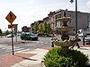
The Capital District Transportation Authority (CDTA) is a New York State public-benefit corporation overseeing a number of multi-modal parts of public transportation in the Capital District of New York State. CDTA runs local and express buses, including four lines of an express bus service called BusPlus, and day-to-day management of three Amtrak stations in the Capital region–the Albany-Rensselaer, Schenectady and Saratoga Springs Amtrak stations. In 2023, the system had a ridership of 15,779,000, or about 55,300 per weekday as of the fourth quarter of 2023.

<span class="mw-page-title-main">Area codes 518 and 838</span> Telephone area codes for Upstate New York, U.S.

Area codes 518 and 838 are telephone area codes in the North American Numbering Plan for eastern Upstate New York in the United States. 518 is one of the 86 original North American area codes created in 1947. Area code 838 was added to the 518 numbering plan area in 2017. The two area codes serve 24 counties and 1,200 ZIP Code areas in a numbering plan area (NPA) that extends from the eastern Mohawk Valley to the Vermont border, and from the Canada–US border to south of Albany. The bulk of the population is in the Capital District, the vicinity of the cities Albany, Schenectady, and Troy. Other cities in the NPA are Glens Falls, Plattsburgh, and Saratoga Springs. It includes the Upper Hudson Valley counties, Greene and Columbia counties, and some northern parts of Dutchess County.

The media in New York's Capital District is part of the Albany-Schenectady-Troy media market, which is the 59th largest in the United States, includes all of the 11 counties of the Capital District, along with Hamilton County, New York, as well as Berkshire County, Massachusetts, and Bennington County, Vermont. In total, there are 16 AM/MW stations, 30 full-power FM stations, 14 low-power FM translators, 8 full power analog TV stations, 5 low-power TV translators, and 8 full power digital TV (DTV) stations licensed to communities within 30 miles (48 km) of downtown Albany. In terms of broadcast media, Albany is part of Arbitron market #63 (radio), and Nielsen DMA #57 (television), and is a broadcast market with historical relevance. The pioneering influence of General Electric in Schenectady directly contributed to the area emerging as the birthplace of station-based television (WRGB) and one of the earliest FM broadcast stations, in addition to the first federally licensed radio station in upstate New York, WGY.

<span class="mw-page-title-main">New York's 20th congressional district</span> U.S. House district for New York

New York's 20th congressional district is a congressional district for the United States House of Representatives in New York's Capital District. It includes all of Albany, Saratoga, and Schenectady counties, and portions of Rensselaer county.

New York's 21st congressional district is a congressional district for the United States House of Representatives that is represented by Republican Elise Stefanik.

New York’s 30th congressional district was a congressional district for the United States House of Representatives in New York. It was eliminated as a result of the 2000 U.S. census. It was last represented by Jack Quinn who was redistricted into the 27th district.

<span class="mw-page-title-main">Timeline of town creation in New York's Capital District</span>

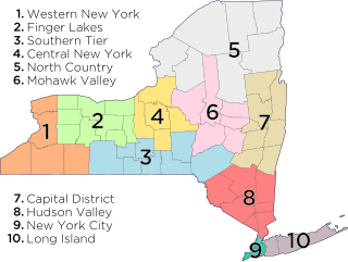
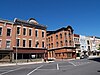
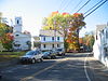
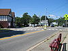
The towns and cities of New York's Capital District were created by the U.S. state of New York as municipalities in order to give residents more direct say over local government. The Capital District is an 11 county area, which consists of the counties of Albany, Schenectady, Rensselaer, Saratoga, Schoharie, Warren, Washington, Columbia, Montgomery, Fulton, and Greene. New York experimented with different types of municipalities before settling upon the current format of towns and cities occupying all the land in a county. Districts were created for Albany and Tryon counties in 1772; all were transformed into towns in 1788 when all of the state of New York was divided into towns. Two years before that, in 1786, all of what Washington County encompassed at that time was divided into townships with the same legal status, abilities, and responsibilities as districts with their status as towns confirmed in 1788. Some other forms of government in earlier years included land patents with some municipal rights and boroughs. The following timelines show the creation of the current towns from their predecessors stretching back to the earliest municipal entity over the area. The timelines only represent from which town(s) a particular town was created from and does not represent annexations of territory to and from towns that already existed. All municipalities are towns unless otherwise noted as patent, township, borough, district, or city. Unless otherwise sourced with a footnote all dates of incorporation represent those stated in the 1860 Gazetteer of the State of New York by John H. French.

<span class="mw-page-title-main">38th New York State Legislature</span> New York state legislative session

The 38th New York State Legislature, consisting of the New York State Senate and the New York State Assembly, met from September 26, 1814, to April 18, 1815, during the eighth year of Daniel D. Tompkins's governorship, in Albany.

<span class="mw-page-title-main">41st New York State Legislature</span> New York state legislative session

The 41st New York State Legislature, consisting of the New York State Senate and the New York State Assembly, met from January 27 to April 21, 1818, during the first year of DeWitt Clinton's governorship, in Albany.

<span class="mw-page-title-main">57th New York State Legislature</span> New York state legislative session

The 57th New York State Legislature, consisting of the New York State Senate and the New York State Assembly, met from January 7 to May 6, 1834, during the second year of William L. Marcy's governorship, in Albany.

<span class="mw-page-title-main">62nd New York State Legislature</span> New York state legislative session

The 62nd New York State Legislature, consisting of the New York State Senate and the New York State Assembly, met from January 1 to May 7, 1839, during the first year of William H. Seward's governorship, in Albany.

<span class="mw-page-title-main">64th New York State Legislature</span> New York state legislative session

The 64th New York State Legislature, consisting of the New York State Senate and the New York State Assembly, met from January 5 to May 25, 1841, during the third year of William H. Seward's governorship, in Albany.

<span class="mw-page-title-main">65th New York State Legislature</span> New York state legislative session

The 65th New York State Legislature, consisting of the New York State Senate and the New York State Assembly, met from January 4 to September 7, 1842, during the fourth year of William H. Seward's governorship, in Albany.

<span class="mw-page-title-main">66th New York State Legislature</span> New York state legislative session

The 66th New York State Legislature, consisting of the New York State Senate and the New York State Assembly, met from January 3 to April 18, 1843, during the first year of William C. Bouck's governorship, in Albany.

References

  1. "Governmental Units". John B. Deitz. Retrieved May 18, 2009.
  2. "Capital Region income growth fares well". Times Union. December 30, 2018.
  3. "Legal Memorandum LG06". New York State Office of General Counsel. Archived from the original on June 6, 2011. Retrieved May 18, 2009.
  4. "Metropolitan Statistical Areas in New York State" (PDF). New York Department of Labor. Archived from the original (PDF) on 2010-06-20. Retrieved 2010-08-28.
  5. 1 2 "U.S. Census Bureau". Archived from the original on 2020-02-16. Retrieved 2020-03-29.