| Adelaide | |
|---|---|
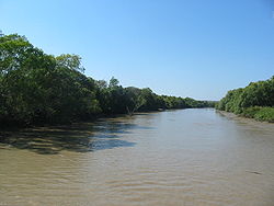 The Adelaide River | |
 | |
| Etymology | Queen Adelaide |
| Location | |
| Country | Australia |
| Territory | Northern Territory |
| LGA | Coomalie, Litchfield |
| Townships | Adelaide River |
| Physical characteristics | |
| Source | |
| • elevation | 149 m (489 ft) |
| Mouth | Adam Bay |
• location | Clarence Strait |
• coordinates | 12°13′S131°14′E / 12.217°S 131.233°E |
• elevation | 0 m (0 ft) |
| Length | 238 km (148 mi) |
| Basin size | 7,640 km2 (2,950 sq mi) |
| Discharge | |
| • average | 1,980 m3/s (70,000 cu ft/s) |
| Basin features | |
| National park | Litchfield National Park |
| [1] [2] | |
The Adelaide River is a river in the Northern Territory of Australia.

