
The Adelaide River is a river in the Northern Territory of Australia.
The Shoalhaven River is a perennial river that rises from the Southern Tablelands and flows into an open mature wave dominated barrier estuary near Nowra on the South Coast of New South Wales, Australia.

The Mitchell River is a river in Far North Queensland, Australia. The river rises on the Atherton Tableland about 50 kilometres (31 mi) northwest of Cairns and flows about 750 kilometres (470 mi) northwest across Cape York Peninsula from Mareeba to the Gulf of Carpentaria.
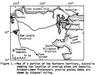
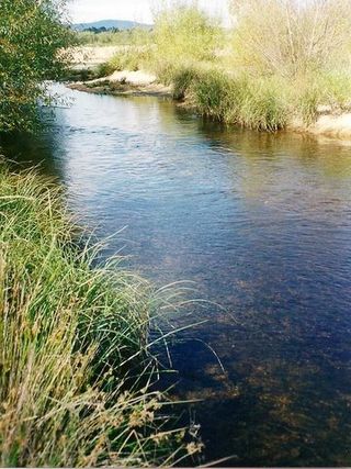
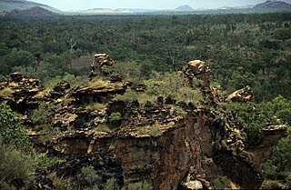
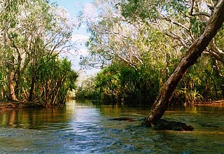
Alligator Rivers is the name of an area in an Arnhem Land region of the Northern Territory of Australia, containing three rivers, the East, West, and South Alligator Rivers. It is regarded as one of the richest biological regions in Australia, with part of the region in the Kakadu National Park. It is an Important Bird Area (IBA), lying to the east of the Adelaide and Mary River Floodplains IBA. It also contains mineral deposits, especially uranium, and the Ranger Uranium Mine is located there. The area is also rich in Australian Aboriginal art, with 1500 sites. The Kakadu National Park is one of the few World Heritage sites on the list because of both its natural and human heritage values. They were explored by Lieutenant Phillip Parker King in 1820, who named them in the mistaken belief that the crocodiles in the estuaries were alligators.
Gapuwiyak, also known as Lake Evella, is an Aboriginal Australian community located in north-eastern Arnhem Land, Northern Territory, 25 kilometres (16 mi) south of the head of Buckingham Bay and about the same distance south-west of Arnhem Bay. The settlement had a population of 871 people recorded at the 2016 census.

The Mary River flows in the Northern Territory of Australia and is a site of the Mary River National Park.
Blackmore River flows into Darwin Harbour close to Darwin in the Northern Territory of Australia.
The Wildman River is a river in the Darwin Coastal bioregion of the Northern Territory, Australia.
Liverpool River is a river in the Northern Territory of Australia. It is the largest of the tidal river systems of northern Arnhem Land, which includes two major tributaries, the Tomkinson and Mann Rivers.
The Goromuru River is a river, located in the Northern Territory in Australia.
The Keep River is a river located in the Victoria Bonaparte bioregion of Western Australia and the Northern Territory in Australia.
The Blyth River is a river in the Northern Territory, Australia.
The Koolatong River is a river in the Northern Territory, Australia.
The Moyle River is a river in the Northern Territory, Australia.
The Goomadeer River is a river in the Northern Territory, Australia.
The Goyder River is a river in the Northern Territory of Australia.
The Walker River is a river in the Northern Territory, Australia.

The Towns River is a river in the Northern Territory, Australia.
The Limmen Bight River is a river in the Northern Territory, Australia.
The Nicholson River is a river in the Northern Territory and the state of Queensland, Australia.
