Robinson River (Northern Territory)

Last updated

Robinson
Australia Northern Territory relief location map.png
Red pog.svg
Location of the Robinson River mouth in the Northern Territory
Etymology Joseph Phelps Robinson
Location
Country Australia
Territory Northern Territory
Physical characteristics
Source 
  location Barkly Tableland, Australia
  elevation343 m (1,125 ft)
Mouth  
  location
Gulf of Carpentaria, Australia
  coordinates
16°02′55″S137°14′41″E / 16.04861°S 137.24472°E / -16.04861; 137.24472
  elevation
0 m (0 ft)
Length215 km (134 mi)
Basin size11,369 km2 (4,390 sq mi)
Discharge 
  average31.7 m3/s (1,120 cu ft/s)
[1]

The Robinson River is a river in Australia's Northern Territory.

Contents

Description

The headwaters of the river rise on the Barkly Tableland and flow in a northerly direction across mostly uninhabited plains, crossing Highway 1 then past the Seven Emu homestead before eventually discharging into the Gulf of Carpentaria approximately 60 kilometres (37 mi) east of Borroloola.

The estuary at the river mouth occupies an area of 10.15 square kilometres (4 sq mi) and is in near pristine condition. It is river dominated in nature with a wave dominated delta and has an area of 142 hectares (351 acres) covered with mangroves. [2]

The drainage basin occupies an area of 11,369 square kilometres (4,390 sq mi) and is wedged between the catchment areas for McArthur River to the west and Calvert River to the east and the Barkly to the south. [3] The river has a mean annual outflow of 1,000 gigalitres (1.308×10⁹ cu yd). [4]

Flora and fauna

Stands of Cycas angulata are found along the lower reaches of the river. [5]

A total of 33 species of fish are found in the river including: sailfin glassfish, barred grunter, snub-nosed garfish, fly-specked hardyhead, mouth almighty, golden flathead goby, spangled perch, barramundi, mangrove jack, chequered rainbowfish, giant gudgeon, spotted scat, freshwater longtom, and seven-spot archerfish. [6]

The critically endangered largetooth sawfish has been caught in the river mouth. [7] The endangered gulf snapping turtle has been found in the upper reaches of the Robinson. [8]

History

The traditional owners of the area are the Garawa [9] and the Gunindiri peoples. [10]

The river was named by Ludwig Leichhardt during his expedition from Queensland to Port Essington in 1845. Leichhardt named the river after one of the supporters of the expedition, Joseph Phelps Robinson, a well known philanthropist, banker and Quaker. [11]

In 1992 the Robinson River pastoral lease and surrounding areas were handed back to the Garawa people who had started working on the land claim in 1980. [12]

See also

Related Research Articles

<span class="mw-page-title-main">Ludwig Leichhardt</span> German explorer of Australia (1813–1848)

Friedrich Wilhelm Ludwig Leichhardt, known as Ludwig Leichhardt, was a German explorer and naturalist, most famous for his exploration of northern and central Australia.

<span class="mw-page-title-main">Gilbert River (Queensland)</span> River in Queensland, Australia

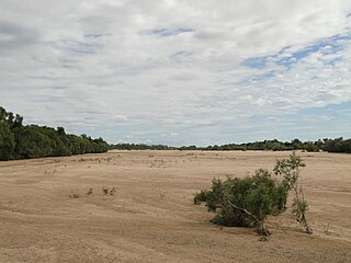
The Gilbert River is located in Far North Queensland, Australia. When combined with the Einasleigh River, the river system is the largest river system in northern Australia.

<span class="mw-page-title-main">McArthur River</span> River in Northern Territory, Australia

The McArthur River is a river in the Northern Territory of Australia which flows into the Gulf of Carpentaria at Port McArthur, opposite the Sir Edward Pellew Group of Islands. The river was named by Ludwig Leichhardt while he explored the area in 1845. He named the River after James MacArthur and the MacArthur family of Camden, who were enthusiastic supporters of his expedition. The McArthur River has significance for the local Aboriginal communities, who use it for fishing and other traditional activities.

<span class="mw-page-title-main">Mary River (Northern Territory)</span> River in Northern Territory, Australia

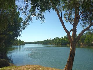
The Mary River flows in the Northern Territory of Australia and is a site of the Mary River National Park.

<span class="mw-page-title-main">Gulf Country</span> Queensland region

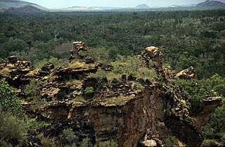
The Gulf Country or North West Queensland is the region of woodland and savanna grassland surrounding the Gulf of Carpentaria in north western Queensland and eastern Northern Territory on the north coast of Australia. The region is also called the Gulf Savannah. The Gulf Country is crossed by the Savannah Way highway.

Pungalina-Seven Emu Sanctuary is a 3060 km2 private protected area in the Northern Territory of Australia. It is managed by the Australian Wildlife Conservancy (AWC) which purchased Pungalina Station in 2009, with some assistance from the Wildlife Australia Fund. It adjoins the Gulf of Carpentaria near the border with Queensland, lying in the Gulf Coastal bioregion. The reserve is bordered by Calvert Hills and Wollogorang Stations to the south and east. The nearest town is Borroloola, 150 km to the west.

The Calvert River is a river in the Northern Territory of Australia.

Buckingham River is a river in the Northern Territory of Australia.

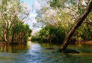
Liverpool River is a river in the Northern Territory of Australia. It is the largest of the tidal river systems of northern Arnhem Land, which includes two major tributaries, the Tomkinson and Mann Rivers.

<span class="mw-page-title-main">Keep River</span> River in the Northern Territory and Western Australia

The Keep River is a river located in the Victoria Bonaparte bioregion of Western Australia and the Northern Territory in Australia.

The Koolatong River is a river in the Northern Territory, Australia.

The Moyle River is a river in the Northern Territory, Australia.

<span class="mw-page-title-main">Goyder River</span> River in the Northern Territory of Australia

The Goyder River is a river in the Northern Territory of Australia.

The Walker River is a river in the Northern Territory, Australia.

The Rosie River also known as Rosie Creek is a river in the Northern Territory, Australia.

The Settlement Creek is a creek in the Northern Territory and the state of Queensland, Australia.

The Nicholson River is a river in the Northern Territory and the state of Queensland, Australia.

<span class="mw-page-title-main">Lynd River</span> River in Queensland, Australia

The Lynd River is a river located on the Cape York Peninsula in Far North Queensland, Australia.

The Jackey Jackey Creek, also often called Jacky Jacky Creek, is a creek in the Cape York Peninsula region of Far North Queensland, Australia.

The Garrwa people, also spelt Karawa and Garawa, are an Aboriginal Australian people living in the Northern Territory, whose traditional lands extended from east of the McArthur River at Borroloola to Doomadgee and the Nicholson River in Queensland.

References

  1. "Map of Robinson River, NT". Bonzle Digital Atlas of Australia. Retrieved 21 May 2015.
  2. "Robinson River, NT". Australian online Coastal Information. Commonwealth of Australia . Retrieved 22 May 2015.
  3. "Drainage Divisions" (PDF). Commonwealth of Australia. 2005. Archived from the original (PDF) on 1 April 2015. Retrieved 21 May 2015.
  4. "Robinson River" (PDF). TRaCK. 2009. Retrieved 21 May 2015.
  5. "Management Program for Cycads" (PDF). Northern Territory Government. 2003. Archived from the original (PDF) on 24 March 2015. Retrieved 23 May 2015.
  6. "Robinson River catchment". Fish Atlas of North Australia. Retrieved 23 May 2015.
  7. "Conservation assessment of Glyphis sp. A (speartooth shark), Glyphis sp. (northern river shark), Pristis microdon (freshwater sawfish) and Pristis zijsron (green sawfish)" (PDF). CSIRO. 1 June 2005. Retrieved 23 May 2015.
  8. "Gulf snapping turtle". Queensland Government. 29 August 2012. Retrieved 23 May 2015.
  9. "Garawa". AusAnthrop Australian Aboriginal tribal database. Ausanthrop. Retrieved 23 May 2015.
  10. "Gunindini". AusAnthrop Australian Aboriginal tribal database. Ausanthrop. Retrieved 23 May 2015.
  11. "Place Names Register Extract - Robinson River". NT Place Names Register. Northern Territory Government . Retrieved 23 May 2015.
  12. "Robinson River - About Robinson River". Roper Gulf Regional Council. Retrieved 23 May 2015.