Keep River

Last updated

Keep
Australia Northern Territory relief location map.png
Red pog.svg
Location of the Keep River mouth in the Northern Territory
EtymologyHenry Francis Keep
Location
Country Australia
Territory Northern Territory Western Australia
Region Victoria Bonaparte (IBRA)
Physical characteristics
Source 
  elevation132 m (433 ft)
Mouth  
  coordinates
15°08′45″S129°12′9″E / 15.14583°S 129.20250°E / -15.14583; 129.20250 Coordinates: 15°08′45″S129°12′9″E / 15.14583°S 129.20250°E / -15.14583; 129.20250
  elevation
0 m (0 ft)
Length258 km (160 mi)
Discharge 
  average15.8 m3/s (560 cu ft/s)
Basin features
Tributaries 
  leftMoriarty Creek, Dingo Creek, Knox Creek, Oakes Creek
  right Alligator Creek, Chinaman Creek, Flying Fox Creek
[1]
Keep River National Park, view from Gurrandalng Keep-River-Nationalpark, View from Gurrandalng.jpg
Keep River National Park, view from Gurrandalng

The Keep River is a river located in the Victoria Bonaparte bioregion of Western Australia and the Northern Territory in Australia.

Contents

Location and features

The river rises just south of the Newry Station homestead then flows in a northerly direction crossing the Victoria Highway and then flowing through the Keep River National Park and veering westward across the border into Western Australia then veering east back into the Northern Territory. It then continues north before discharging into the Joseph Bonaparte Gulf and the Timor Sea.

The river catchment occupies an area of 6,003 square kilometres (2,318 sq mi) and is wedged between the Ord River catchment to the west and the Victoria River catchment to the east. [2] The river has a mean annual outflow of 500 gigalitres (654,000,000 cu yd). [3]

Important wetlands are found in the lower reaches of the river, forming suitable habitat for waterfowl breeding colonies and roosting sites for migratory shorebirds. Large areas of rice-grass floodplain grasslands are also found along the river. [4]

The estuary formed at the river mouth is in near pristine condition. [5] It occupies an area of 230 square kilometres (89 sq mi) of open water. It is tide dominated in nature with a tide dominated delta having multiple channels and is surrounded by an area of 55.5 square kilometres (21 sq mi) covered with mangroves. [6]

Flora and fauna

Riparian vegetation found along the margins in the river include Melaleuca , Barringtonia acutangula , Nauclea orientalis , reeds and taro are common in the upper reaches. In pools along the river sponges such as Spongillidae can be found on rocks. [7] Toward the national park area aquatic vegetation such as species of Nymphea, Hydrilla verticillata and species of Chara become more frequent forming dense mats in some areas. Riparian vegetation includes Melaleuca, Barringtonia acutangula, Nauclea orientalis, Lysiphyllum cunninghamii and Pandanus spiralis .

Marine fauna found along the river include fish including freshwater sawfish, dwarf wawfish, ox-eye herring, bony bream, short-tail thryssa, several species of catfish such as Arius and Anodontiglanis dahli, freshwater longtom, species of rainbowfish, hardeyheads, species of glassfish, species of grunter, species of mullet, spotted archerfish, species of gudgeon, species of goby and baramundi. [7]

In February 2022, the Northern Territory Land Corporation released 67,500 hectares for a planned conversion of the landscape towards the cultivation of rice, cotton and various fruits like mangoes and bananas. The effects of this major project on the natural ecology and Aboriginal sacred sites are not yet known. [8]

History

The traditional owners of the area are the Kadjerong and Duulngari peoples [9] to the northern end and the Miriwoong people to the south. [10]

The origin of the name is not known but it is thought to have been named for Henry Francis Keep who was a store keeper in Wyndham. The first written record of the name was in the diary of explorer and pastoralist, Michael Durack, who wrote about a "trip to Keep River" in 1894. [11]

See also

Related Research Articles

Flinders River

The Flinders River is the longest river in Queensland, Australia, at approximately 1,004 kilometres (624 mi). It was named in honour of the explorer Matthew Flinders. The catchment is sparsely populated and mostly undeveloped. The Flinders rises on the western slopes of the Great Dividing Range in North West Queensland and flows generally north-west through the Gulf Country, across a large, flat clay pan, before entering the Gulf of Carpentaria.

Victoria River (Northern Territory) River in the Northern Territory, Australia

The Victoria River is a river in the Victoria Bonaparte bioregion of the Northern Territory, Australia.

Joseph Bonaparte Gulf Body of water between the Northern Territory and Western Australia

Joseph Bonaparte Gulf is a large body of water off the coast of the Northern Territory and Western Australia and part of the Timor Sea. It was named after Joseph Bonaparte, brother of Napoleon and King of Naples (1806-1808) and then Spain (1808-1813) by French explorer and naturalist Nicolas Baudin in 1803. It is also often referred to in Australia as the "Bonaparte Gulf".

Purple-crowned fairywren Species of songbird endemic to northern Australia in the family Maluridae

The purple-crowned fairywren is a species of bird in the Australasian wren family, Maluridae. It is the largest of the eleven species in the genus Malurus and is endemic to northern Australia. The species name is derived from the Latin word cǒrōna meaning "crown", owing to the distinctive purple circle of crown feathers sported by breeding males. Genetic evidence shows that the purple-crowned fairywren is most closely related to the superb fairywren and splendid fairywren. Purple-crowned fairywrens can be distinguished from other fairywrens in northern Australia by the presence of cheek patches and the deep blue colour of their perky tails.

Mary River (Northern Territory)

The Mary River flows in the Northern Territory of Australia and is a site of the Mary River National Park.

Buff-sided robin Species of bird

The buff-sided robin is a small, diurnal, insectivorous, perching (passerine) bird in the family Petroicidae, a group commonly known as the Australo-Papuan or Australasian robins. It is also known as the buff-sided fly-robin, buff-sided shrike-robin and Isabellflankenschnäpper (German). The buff-sided robin is endemic to northern Australia, where it primarily occurs in riparian forests and monsoon vine thickets from the Kimberly region of Western Australia to the north-west Queensland Gulf of Carpentaria. The plumage of the adult birds is characterised by a dark hood and back with a prominent white stripe on the supercilium; a white throat, white wing and tail bars, and a striking buff to orange patch on the flank below the wings. Adult birds are not sexually dimorphic; however, males are generally larger and can be separated from females based on morphological measurements. Buff-sided robins predominantly take insects from the ground by sallying from an observational perch. Insect prey are also occasionally taken by hawking on the wing or by gleaning from the trunk or foliage of riparian vegetation.

The Calvert River is a river in the Northern Territory of Australia.

Victoria Plains tropical savanna

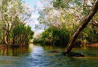
The Victoria Plains tropical savanna is a tropical and subtropical grasslands, savannas, and shrublands ecoregion in northwestern Australia.

Buckingham River is a river in the Northern Territory of Australia.

The Wickham River is an ephemeral river, located in the Victoria Bonaparte bioregion of the Northern Territory in Australia.

The Koolatong River is a river in the Northern Territory, Australia.

The Moyle River is a river in the Northern Territory, Australia.

The Goomadeer River is a river in the Northern Territory, Australia.

Goyder River River in Australia

The Goyder River is a river in the Northern Territory, Australia.

The Walker River is a river in the Northern Territory, Australia.

The Robinson River is a river in Australia's Northern Territory.

The Nicholson River is a river located in the Northern Territory and the state of Queensland, Australia.

The Lynd River is a river located on the Cape York Peninsula in Far North Queensland, Australia.

The Kendall River is a river located in Far North Queensland, Australia.

Proserpine River

The Proserpine River is a river in Whitsunday Region of Queensland, Australia.

References

  1. "Map of Keep River, NT". Bonzle Digital Atlas of Australia. Retrieved 3 May 2015.
  2. "Drainage Divisions" (PDF). Commonwealth of Australia. 2005. Archived from the original (PDF) on 1 April 2015. Retrieved 3 May 2015.
  3. "Keep River" (PDF). TRaCK. 2009. Retrieved 12 May 2015.
  4. "Victoria Bonaparte Bioregional Description". Northern Territory Government. Archived from the original on 27 March 2015. Retrieved 3 May 2015.
  5. "Australian Catchment, River and Estuary Assessment" (PDF). Natural Heritage Trust. 2002. Archived from the original (PDF) on 13 February 2014. Retrieved 3 May 2015.
  6. "Keep River, NT". Australian online Coastal Information. Commonwealth of Australia . Retrieved 24 May 2015.
  7. 1 2 Helen Larson (4 February 1999). "Keep river Aquatic Fauna survey" (PDF). Museums and Art Galleries of the Northern Territory. Archived from the original (PDF) on 6 April 2015. Retrieved 3 May 2015.
  8. Royce Kurmelovs,‘Water isn’t endless’: the controversial plan to extend irrigated agriculture in NT’s tropical savannah The Guardian 10 April 2022
  9. "Duulngari". AusAnthrop Australian Aboriginal tribal database. Ausanthrop. 2005. Archived from the original on 27 September 2015. Retrieved 3 May 2015.
  10. "Miriwung". AusAnthrop Australian Aboriginal tribal database. Ausanthrop. 2005. Archived from the original on 11 September 2015. Retrieved 3 May 2015.
  11. "Place Names Register Extract - Keep River". NT Place Names Register. Northern Territory Government . Retrieved 2 May 2015.