Alligator Rivers

Last updated

Alligator
USGS Map of Northern Territory Uranium Mines.png
Location of key Northern Territory uranium mines
Australia Northern Territory relief location map.png
Red pog.svg
Location of the South Alligator River mouth in the Northern Territory
Location
Country Australia
Territory Northern Territory
Physical characteristics
Mouth  
  location
Australia
  coordinates
12°14′22″S132°24′11″E / 12.23944°S 132.40306°E / -12.23944; 132.40306 Coordinates: 12°14′22″S132°24′11″E / 12.23944°S 132.40306°E / -12.23944; 132.40306
[1]

Alligator Rivers is the name of an area in an Arnhem Land region of the Northern Territory of Australia, containing three rivers, the East, West, and South Alligator Rivers. It is regarded as one of the richest biological regions in Australia, with part of the region in the Kakadu National Park. It is an Important Bird Area (IBA), lying to the east of the Adelaide and Mary River Floodplains IBA. It also contains mineral deposits, especially uranium, and the Ranger Uranium Mine is located there. The area is also rich in Australian Aboriginal art, with 1500 sites. The Kakadu National Park is one of the few World Heritage sites on the list because of both its natural and human heritage values. They were explored by Lieutenant Phillip Parker King in 1820, who named them in the mistaken belief that the crocodiles in the estuaries were alligators.

Contents

Rivers

East Alligator River Crossing (Cahills Crossing) Kakadu 2403.jpg
East Alligator River Crossing (Cahills Crossing)

The East Alligator River is about 160 km (99 mi) long. After rising in the northern part of the Arnhem Land Plateau, it flows with tributary streams towards the northwest, through canyons towards the Van Diemen Gulf, which it meets at Point Farewell. The river has a total catchment area of 15,876 km2 (6,130 sq mi) [2] and has many tributaries, including Magela Creek, Tin Camp Creek, and Cooper Creek. [3] The catchment is surrounded by the South Alligator River catchment to the west and Goomadeer and Liverpool River catchments to the east and the Daly River catchment to the south. The river has an annual average discharge of 6,870 gigalitres (8.986×10⁹ cu yd) per year. [4]

The South Alligator River is also about 160 km (99 mi) long. It rises north of Mount Stow, on the Arnhem Land Plateau. It flows northwesterly in a valley containing a number of disused uranium mines developed between 1955 and 1965. It also flows out into the Van Diemen Gulf of the Timor Sea. The catchment area occupies an area of 11,917 km2 (4,601 sq mi) and has the East Alligator River catchment to the east, the Wildman and Mary River catchments to the west, and the Daly River catchment to the south. [2]

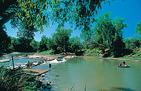
The West Alligator River rises in the lowlands and is 80 km (50 mi). The Wildman River also flows in the region. The river system has a number of spectacular waterfalls, including the Jim Jim Falls on Jim Jim Creek and the Twin Falls on Twin Falls Creek.

The rivers have created the alluvial plains, including the mangrove swamps, in the past 20,000 years.

Climate

Waterfall - Kakadu National Park after rain. Kakadu 2432.jpg
Waterfall - Kakadu National Park after rain.
Panorama from Ubirr Rock Ubirr Panorama.jpg
Panorama from Ubirr Rock

Like much of northern Australia, the Alligator Rivers region has a monsoon climate. The dry season lasts between May and September while the wet season lasts between November and March. April and October are transitional periods between the two seasons. Annual rainfall at Jabiru is around 1.54 m (5.1 ft), with almost all of it falling during the wet season. During the wet season, the prevailing winds are westerly to northwesterly, while they are easterly to southeasterly during the dry season.

The three Alligator Rivers are perennial rivers flowing even during the dry season, as is the Wildman River. All of the tributaries dry up in places during that period. The land dries out, and the wildlife concentrates around the permanent water sources such as the rivers, springs, waterholes, and billabongs. The duration of the dry period depends on the rainfall during the wet season. In a normal year, the tributaries start flowing around the middle of December and finish at the end of June, but the flow starts in November and finishes in August if the rainfall has been particularly heavy.

During the wet season, the savanna turns green, the wildlife spreads out, the bird life returns, and the streams flood into adjacent lands turning them into swamps. The flood plains leave behind silt when they gradually dry up during the wet season.

During the wet season, the water has a higher temperature and is relatively low in turbidity. In the dry season, an increase in turbidity occurs, especially in the shallower water sources.

The Alligator Rivers region is also subject to cyclones between October and May, like other parts of the Australian Indian Southeast region.

Wildlife

Salt water crocodile - Kakadu National Park Kakadu 3620.jpg
Salt water crocodile - Kakadu National Park

The region takes its name from the crocodiles in the lower reaches of the rivers. However, the region features a wide diversity of plant and animal habitats. More than 1,500 species of plants have been recorded in a range of tropical habitats including mangrove, monsoon forest, tropical grassland, and woodland. The 46 species of fish in the river system represent about a quarter of all known species existing in Australia.

The region also features high populations of the dusky rat and its predator the water python. New vertebrate species are still being discovered in the region, notably the Kakadu dunnart and the Kakadu Pebble-mound Mouse. The potential for discovery of invertebrate species, such as ants is even greater.

Some threat to the ecosystems exists from introduced flora and fauna. Introduced species of plants such as the giant sensitive plant ( Mimosa pigra ) [5] and mission grass are threatening habitats. Invasive species such as feral water buffalo and cane toads are also causing problems.

Birds

The Alligator Rivers floodplains are of world importance for magpie geese. Magpie Goose taking off.jpg
The Alligator Rivers floodplains are of world importance for magpie geese.

The region features a wide variety of birdlife, with over one in three of Australia's species having been sighted in the region. In particular, the Alligator Rivers area is known for its rich collection of waterfowl such as magpie geese, ducks, herons, ibises, and spoonbills. The Alligators Rivers floodplains form a 383,000-ha IBA which it is estimated to support some five million waterbirds, including over 1% of the global population of 22 species, significant numbers of three near threatened species, with another 11 restricted-range or savanna-biome-restricted species. [6]

Aboriginal culture

Aboriginal people have lived continuously in the Alligator Rivers region for 50,000 years. The region accordingly has a rich heritage with cave paintings and rock carvings common with over 1500 sites. Many Aboriginal artefacts have been found in old camping grounds in the region.

The southern part of Kakadu contains a number of sites relating to Bula, [7] a god associated with creation, and these sites are considered to be both sacred and dangerous to the aboriginal people because of this association. Also, art relating to contact with Makassan traders and Europeans is found there.

At Ubirr Rock near Cahill's Crossing on the East Alligator River, some paintings dating from 20,000 years ago have figures throwing spears and wearing headdresses to first contact with European settlement.

The Gagudju people live in the area between the East and South Alligator Rivers. They share responsibility for Kakadu National Park which lies within their country. Gunbalanya (formerly Oenpelli), a settlement in the area, is run by an Aboriginal council and is an important centre for arts and crafts. The Gagudju language is no longer widely spoken, but was common until the early 20th century.

The Jawoyn people live in the South Alligator and South Mary regions, as well as around Katherine. The Jawoyn negotiated an agreement in 1993 for the Coronation Hill uranium mine where they would allow further exploration of the area in return for employment and training for the Jawoyn and a partnership arrangement.

The Kunwinjku people live between the Liverpool River and the East Alligator River. Traditional beliefs remain important to the Kunwinjku with Ngalyod, [8] the Rainbow Serpent, playing an important part in their art and traditions. The Kunwinjku have received royalties from the Nabarlek Uranium Mine in recent years. The Kunwinjku live in Gunbalanya and Maningrida.

Modern history

Precambrian geologic map of the Pine Creek Geosyncline: Uranium deposits: R=Ranger, K=Koongarra, N=Nabarlek, and J=Jabiluka. Stippling indicates the Kombolgie Formation of Middle Proterozoic sandstones with some volcanics, crosses indicate the Nanambu Complex of Archean granites and gneisses, and the unmarked outlined region indicates the Cahill Formation of Proterozoic metamorphic rocks. USGS Pine Creek Geosyncline.png
Precambrian geologic map of the Pine Creek Geosyncline: Uranium deposits: R=Ranger, K=Koongarra, N=Nabarlek, and J=Jabiluka. Stippling indicates the Kombolgie Formation of Middle Proterozoic sandstones with some volcanics, crosses indicate the Nanambu Complex of Archean granites and gneisses, and the unmarked outlined region indicates the Cahill Formation of Proterozoic metamorphic rocks.

Exploration

The explorer Phillip Parker King was the first English navigator to enter the Gulf of Carpentaria. He made a number of explorations in the area between 1818 and 1822 and named the rivers after the crocodiles which he mistook for alligators as his journals note. "On our course up and down the river, we encountered several very large alligators and some were noticed sleeping on the mud. This was the first time we had seen these animals, excepting that at Goulburn Island, and, as they appeared to be very numerous and large, it was not thought safe to stop all night up the River." [9]

Ludwig Leichhardt was the first European explorer to visit the area in 1845 en route to Port Essington. Leichhardt followed a creek down from the Arnhem Land escarpment before crossing the South and East Alligator Rivers. John McDouall Stuart also visited the area in 1862.

Settlement

See Kakadu National Park for more information on settlement.

Crocodile Hotel at Jabiru Kakadu 2427.jpg
Crocodile Hotel at Jabiru
Ranger Uranium Mine viewed from the road Kakadu's Ranger Uranium Mine viewed from the road.jpg
Ranger Uranium Mine viewed from the road

The settlement of the area by Europeans was slow and sporadic as it was very remote and illnesses were also a problem. The commercial harvesting of water buffalo hides and horns had begun by the 1880s. Paddy Cahill, who came to the area to set up a cattle station, was the first buffalo hunter to operate in the region. The buffalo industry lasted around 70 years until the late 1950s until the development of synthetic substitutes. Crocodile hunting was also operating in the area until the hunting of freshwater crocodile was made illegal in 1964 and estuarine crocodiles in 1971.

Paddy Cahill had established his cattle station at Oenpelli by 1906, and by 1913, it had become successful. Indeed, Cahill's success at Oenpelli was often cited as an example for others to follow. Other stations were set up, but did not always enjoy the same success. Goodparla operated as a cattle and buffalo station and operated with mixed success until the federal government acquired the land as part of Kakadu National Park.

Missionaries provided much of the schooling for the Aboriginal people for much of the 20th century. The Kapalga Native Industrial Mission was established in 1899 near the South Alligator River, but only lasted four years. The Church of England Missionary Society established a mission station in 1925 at Oenpelli which lasted for 45 years. In 1975, an Aboriginal town council took over responsibility for running the township of Oenpelli.

Small-scale gold mining started in the region in the 1920s at Imarlkba near Barramundi Creek and at Moline in the 1930s. However, the discovery of uranium at the headlands of the South Alligator River in 1953 started the mining industries. By 1957, 13 uranium mines were operating, employing 150 people including at Coronation Hill. Following the discovery of large uranium mines at Jabiluka, Ranger, Nabarlek, and Koongarra, the federal government established the Ranger Uranium Environmental Inquiry otherwise known as the Fox Inquiry which recommended the development of the Ranger site, consideration of the other two sites, and establishment of Jabiru as a support centre. Royalties are paid to the traditional owners in compensation for the loss of their country.

See also

Related Research Articles

In Australian Aboriginal mythology, Mamaragan or Namarrkon is a lightning Ancestral Being who speaks with thunder as his voice. He rides a storm-cloud and throws lightning bolts to humans and trees. He lives in a puddle.

<span class="mw-page-title-main">Kakadu National Park</span> Protected area in the Northern Territory, Australia

Kakadu National Park is a protected area in the Northern Territory of Australia, 171 km (106 mi) southeast of Darwin. It is a World Heritage Site. Kakadu is also gazetted as a locality, covering the same area as the national park, with 313 people recorded living there in the 2016 Australian census.

<span class="mw-page-title-main">Top End</span> Region in the Northern Territory, Australia

The Top End of Australia's Northern Territory is a geographical region encompassing the northernmost section of the Northern Territory, which aside from the Cape York Peninsula is the northernmost part of the Australian continent. It covers a rather vaguely defined area of about 245,000 km² behind the northern coast from the Northern Territory capital of Darwin across to Arnhem Land with the Indian Ocean on the west, the Arafura Sea to the north, and the Gulf of Carpentaria to the east, and with the almost waterless semi-arid interior of Australia to the south, beyond the huge Kakadu National Park.

<span class="mw-page-title-main">Jabiru, Northern Territory</span> Town in the Northern Territory, Australia

Jabiru is a town in the Northern Territory of Australia. Built in 1982, the town is completely surrounded by Kakadu National Park. At the 2016 census, Jabiru had a population of 1,081. It is named after the black-necked stork often seen in the wetlands and billabongs of Kakadu, which is commonly referred to in Australia as a Jabiru.

<span class="mw-page-title-main">Gunbalanya, Northern Territory</span>

Gunbalanya is an Aboriginal Australian town in west Arnhem Land in the Northern Territory of Australia, about 300 kilometres (190 mi) east of Darwin. The main language spoken in the community is Kunwinjku. At the 2021 Australian census, Gunbalanya had a population of 1,177.

Bininj Kunwok is an Australian Aboriginal language which includes six dialects: Kunwinjku, Kuninjku, Kundjeyhmi, Manyallaluk Mayali (Mayali), Kundedjnjenghmi, and two varieties of Kune. Kunwinjku is the dominant dialect, and also sometimes used to refer to the group. The spellings Bininj Gun-wok and Bininj Kun-Wok have also been used in the past, however Bininj Kunwok is the current standard orthography.

<span class="mw-page-title-main">Oenpelli python</span> Species of snake

The Oenpelli python or Oenpelli rock python is a species of large snake in the family Pythonidae. The species is endemic to the sandstone massif area of the western Arnhem Land region in the Northern Territory of Australia. There are no subspecies that are recognised as being valid. It has been called the rarest python in the world. Two notable characteristics of the species are the unusually large size of its eggs and its ability to change colour.

<span class="mw-page-title-main">Agile wallaby</span> Species of marsupial

The agile wallaby, also known as the sandy wallaby, is a species of wallaby found in northern Australia and southern New Guinea. It is the most common wallaby in north Australia. The agile wallaby is a sandy colour, becoming paler below. It is sometimes solitary and at other times sociable and grazes on grasses and other plants. The agile wallaby is not considered threatened.

<span class="mw-page-title-main">Black wallaroo</span> Species of marsupial

The black wallaroo, also known as Woodward's wallaroo, is a species of macropod restricted to a small, mountainous area in Arnhem Land, Northern Territory, Australia, between South Alligator River and Nabarlek. It classified as near threatened, mostly due to its limited distribution. A large proportion of the range is protected by Kakadu National Park.

<span class="mw-page-title-main">Jim Jim Falls</span> Waterfall in Northern Territory, Australia

The Jim Jim Falls is a plunge waterfall on the Jim Jim Creek that descends over the Arnhem Land escarpment within the UNESCO World Heritage–listed Kakadu National Park in the Northern Territory of Australia. The Jim Jim Falls area is registered on the Australian National Heritage List.

<span class="mw-page-title-main">Flora of Kakadu National Park</span>

This is a list of plants commonly found in Kakadu National Park, Northern Territory of Australia. Where known, common names are given in English and in Gun-djeihmi, a commonly spoken indigenous language in the area, are given in parentheses.

<span class="mw-page-title-main">Kunwinjku people</span> Australian Aboriginal people of West Arnhem Land

The Kunwinjku people are an Australian Aboriginal people, one of several groups within the Bininj people, who live around West Arnhem Land to the east of Darwin, Northern Territory. Kunwinjku people generally refer to themselves as "Bininj" in much the same way that Yolŋu people refer to themselves as "Yolŋu".

Kune is a dialect of Bininj Kunwok, an Australian Aboriginal language. The Aboriginal people who speak Kune are the Bininj people, who live primarily in western Arnhem Land. Kune is spoken primarily in the south-east of the Bininj Kunwok speaking areas, particularly in the Cadell River district south of Maningrida. This includes outstations such as Korlobidahdah, Buluhkaduru and Bolkdjam. Grammatically Kune is closely related to other varieties of Bininj Kunwok, however there are many differences in vocabulary.

Kunwinjku is a dialect of Bininj Kunwok, an Australian Aboriginal language. The Aboriginal people who speak Kunwinjku are the Bininj people, who live primarily in western Arnhem Land. As Kunwinjku is the most widely spoken dialect of Bininj Kunwok, 'Kunwinjku' is sometimes used to refer to Bininj Kunwok as a whole. Kunwinjku is spoken primarily in the west of the Bininj Kunwok speaking areas, including the town of Gunbalanya, as well as outstations such as Mamardawerre, Kumarrirnbang, Kudjekbinj and Manmoyi.

The Goomadeer River is a river in the Northern Territory, Australia.

The Maung people, or Warruwi, are an Aboriginal Australian people living on the Goulburn Islands, in the Arafura sea off the coast of the Northern Territory.

The Giimbiyu were an indigenous Australian people of the Northern Territory. Their descendants having adopted the Kunwinjku language.

The Bininj are an Aboriginal Australian people of Western Arnhem land in the Northern Territory. The sub-groups of Bininj are sometimes referred to by the various language dialects spoken in the region, that is, the group of dialects known as Bininj Kunwok; so the people may be named the Kunwinjku, Kuninjku, Kundjeyhmi (Gundjeihmi), Manyallaluk Mayali, Kundedjnjenghmi and Kune groups.

The Gaagudju, also known as the Kakadu, are an Aboriginal Australian people of the Northern Territory. There are four clans, being the Bunitj or Bunidj, the Djindibi, and two Mirarr clans. Three languages are spoken among the Mirarr or Mirrar clan: the majority speak Kundjeyhmi, while others speak Gaagudju and others another language.

Mayali or Manyallaluk Mayali is a dialect of Bininj Kunwok, an Australian Aboriginal language. The Aboriginal people who speak Mayali are the Bininj people, who live primarily in western Arnhem Land. Mayali is spoken primarily in south-west Arnhem Land, particularly around Pine Creek, Katherine and Manyallaluk. Occasionally the term "Mayali" is used to refer to all Bininj Kunwok dialects collectively, however this is not generally accepted usage. Speakers of the Kundjeyhmi dialect of Bininj Kunwok often regard Mayali as similar to, or even the same as, Kundjeyhmi.

References

  1. "Map of South Alligator River, NT". Bonzle Digital Atlas of Australia. Retrieved 5 May 2015.
  2. 1 2 "Drainage Divisions" (PDF). Commonwealth of Australia. 2005. Archived from the original (PDF) on 1 April 2015. Retrieved 7 May 2015.
  3. Mike Saynor and Wayne Erskine. "Downstream changes in river reaches from the catchment to the sea in the East Alligator River basin, northern Australia" . Retrieved 7 May 2015.
  4. Murray Smith; Dr Mohsin Hafeez. "Optimising Australia's contribution to Asia's food bowl" (PDF). Archived from the original (PDF) on 18 May 2015. Retrieved 9 May 2015.
  5. "Moth joins Kakadu weed battle". CSIRO. Archived from the original on 21 October 2013. Retrieved 14 August 2013.
  6. "IBA: Alligator Rivers Floodplains". Birdata. Birds Australia. Archived from the original on 19 July 2011. Retrieved 19 May 2011.
  7. Garde, Murray. "bula". Bininj Kunwok online dictionary. Bininj Kunwok Regional Language Centre. Retrieved 16 June 2019.
  8. Garde, Murray. "ngalyod". Bininj Kunwok online dictionary. Bininj Kunwok Regional Language Centre. Retrieved 16 June 2019.
  9. Lieutenant Phillip Parker King, Narrative of a Survey of the intertropical and western coasts of Australia 1826 entry for 6 May 1818 cited in Webster World 23 October 2005