Goyder | |
---|---|
Location of the Goyder River mouth in the Northern Territory | |
Etymology | George Goyder |
Location | |
Country | Australia |
Territory | Northern Territory |
Physical characteristics | |
Source | Mitchell Ranges |
• location | Arnhem Land, Australia |
• elevation | 63 m (207 ft) |
Mouth | Glyde river |
• location | Arnhem Land, Australia |
• coordinates | 12°28′58″S134°57′58″E / 12.48278°S 134.96611°E Coordinates: 12°28′58″S134°57′58″E / 12.48278°S 134.96611°E |
• elevation | 1 m (3 ft 3 in) |
Length | 171 km (106 mi) |
Basin size | 10,391 km2 (4,012 sq mi) |
Discharge | |
• average | 25 m3/s (880 cu ft/s) |
• minimum | 0.001 m3/s (0.035 cu ft/s) |
• maximum | 1,413 m3/s (49,900 cu ft/s) |
Basin features | |
Tributaries | |
• left | Annie Creek |
• right | Sheridan Creek, Gulbuwangay River |
[1] [2] |
The Goyder River is a river in the Northern Territory of Australia.
The headwaters of the river rise at the base of the Mitchell Ranges and are fed by spring discharge from an extensive dolomite aquifer [3] that supports areas of rainforest along the banks. The river then flows north west before crossing the Central Arnhem Road then veering north and later forming multiple braided channels and feeding the Arafura Swamp [4] before eventually discharging into the Glyde River which in turn empties into Castlereagh Bay and the Arafura Sea.
The swamp area occupies an area of 700 square kilometres (270 sq mi) in the dry season and is of great cultural significance to the Yolngu people, in particular the Ramingining community, which is located on the edge of the swamp. [5]
The river catchment occupies an area of 10,391 square kilometres (4,012 sq mi) and is wedged between the Blyth River catchment to the west, the Walker and Roper River catchments to the south, and the Buckingham and Koolatong River catchments to the east. [2]
Three tributaries discharge into the Goyder; Annie Creek, Sheridan Creek and the Gulbuwangay River.
The Goyder has a mean average discharge of 788,940 megalitres (1.032×10⁹ cu yd) with a maximum flow of 1,413 cubic metres (49,900 cu ft) per second and a minimum flow of 1,830 litres (483 US gal) per second. [6] It is the ninth largest river system in the Northern Territory but has the second highest end of dry season flow-rate. [7]
A range of fauna are found in the river, there are 39 species of fish including Macleay's glassfish, barred grunter, fly-specked hardyhead, freshwater sole, golden goby, northern trout gudgeon, Gulf saratoga, barramundi, oxeye herring, rainbowfish, black-banded rainbowfish, bony bream, salmon catfish, Berney's catfish, freshwater longtom, seven-spot archerfish and the sleepy cod. [8]
The traditional owners of the area are the Dalabon, Daikui and Djinba peoples, [9] who have inhabited the area for thousands of years.
Thought to have been named in 1868 by Captain Francis Cadell during his expedition on HMS Firefly, the river is named for George Goyder, the Surveyor General of South Australia. [10]
The explorer, David Lindsay, named the Glyde Inlet in 1883 while on expedition in Arnhem Land. [10]
The MacCartney family started the Florida cattle station in the 1880s, but after constant clashes with local Aboriginal peoples the station was abandoned in 1893. The Arafura cattle station was established in 1903 by the Eastern, African and Cold Store Company on the 50,000-square-kilometre (19,305 sq mi) lease along the Goyder and Glyde Rivers. Joseph Bradshaw overlanded 5,000 cattle to stock the station from further south but five years later the station was abandoned also. [11]
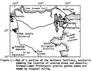
Alligator Rivers is the name of an area in an Arnhem Land region of the Northern Territory of Australia, containing three rivers, the East, West, and South Alligator Rivers. It is regarded as one of the richest biological regions in Australia, with part of the region in the Kakadu National Park. It is an Important Bird Area (IBA), lying to the east of the Adelaide and Mary River Floodplains IBA. It also contains mineral deposits, especially uranium, and the Ranger Uranium Mine is located there. The area is also rich in Australian Aboriginal art, with 1500 sites. The Kakadu National Park is one of the few World Heritage sites on the list because of both its natural and human heritage values. They were explored by Lieutenant Phillip Parker King in 1820, who named them in the mistaken belief that the crocodiles in the estuaries were alligators.
Ramingining is an Aboriginal Australian community of mainly Yolngu people in the Northern Territory, Australia, 560 kilometres (350 mi) east of Darwin. It is on the edge of the Arafura Swamp in Arnhem Land. Wulkabimirri is a tiny outstation (homeland) nearby, and Murwangi, further south, is part of the Ramingining Homelands. Marwuyu Gulparil, also known as Gulparil Marwuyu or just Marwuyu, is another remote community to the south of Ramingining.
The Mary River flows in the Northern Territory of Australia and is a site of the Mary River National Park.
The Arafura Swamp is a large inland freshwater wetland in Arnhem Land, in the Top End of the Northern Territory of Australia. It is a near pristine floodplain with an area of 700 square kilometres (270 sq mi) that may expand to 1,300 km2 (500 sq mi) by the end of the wet season, making it the largest wooded swamp in the Northern Territory and, possibly, in Australia. It has a strong seasonal variation in depth of water. The area is of great cultural significance to the Yolngu people, in particular the Ramingining community. It was the filming location for the film Ten Canoes.
The Fitzmaurice River is a river in the Northern Territory of Australia.
The Calvert River is a river in the Northern Territory of Australia.
Buckingham River is a river in the Northern Territory of Australia.
Liverpool River is a river in the Northern Territory of Australia. It is the largest of the tidal river systems of northern Arnhem Land, which includes two major tributaries, the Tomkinson and Mann Rivers.
The Goromuru River is a river, located in the Northern Territory in Australia.
The Keep River is a river located in the Victoria Bonaparte bioregion of Western Australia and the Northern Territory in Australia.
The Blyth River is a river in the Northern Territory, Australia.
The Koolatong River is a river in the Northern Territory, Australia.
The Moyle River is a river in the Northern Territory, Australia.
The Goomadeer River is a river in the Northern Territory, Australia.
The Walker River is a river in the Northern Territory, Australia.
The Towns River is a river in the Northern Territory, Australia.
The Robinson River is a river in Australia's Northern Territory.
The Settlement Creek is a creek located in the Northern Territory and the state of Queensland, Australia.
The Djinang are an Aboriginal Australian people of the Northern Territory.
The Djinba are an Aboriginal Australian group of the Yolngu people of the Northern Territory.