Adinasara | |
|---|---|
village | |
| Country | |
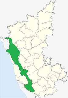
| State | Karnataka |
| District | Shimoga |
| Talukas | Tirthahalli |
| Government | |
| • Body | Village Panchayat |
| Languages | |
| • Official | Kannada |
| Time zone | UTC+5:30 (IST) |
| Nearest city | Shimoga |
| Civic agency | Village Panchayat |
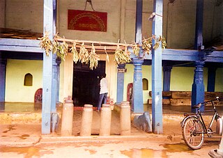
Adinasara is a village in the southern state of Karnataka, India. [1] [2] It is located in the Tirthahalli taluk of Shimoga district in Karnataka.

Karnataka is a state in the south western region of India. It was formed on 1 November 1956, with the passage of the States Reorganisation Act. Originally known as the State of Mysore, it was renamed Karnataka in 1973. The state corresponds to the Carnatic region. The capital and largest city is Bangalore.

India is a country in South Asia. It is the seventh-largest country by area, the second-most populous country, and the most populous democracy in the world. Bounded by the Indian Ocean on the south, the Arabian Sea on the southwest, and the Bay of Bengal on the southeast, it shares land borders with Pakistan to the west; China, Nepal, and Bhutan to the north; and Bangladesh and Myanmar to the east. In the Indian Ocean, India is in the vicinity of Sri Lanka and the Maldives; its Andaman and Nicobar Islands share a maritime border with Thailand and Indonesia.

Shivamogga district is a district in the Karnataka state of India. A major part of Shivamoga district lies in the Malnad region or the Sahyadri. Shivamogga city is its administrative centre. Jog Falls is a major tourist attraction. As of 2011 Shivamogga district has a population of 1,755,512. There are seven taluks: Bhadravathi, Sagara, Shivamogga, Shikaripura, Soraba and Thirthahalli.