The Huastec or Téenek are an indigenous people of Mexico, living in the La Huasteca region including the states of Hidalgo, Veracruz, San Luis Potosí and Tamaulipas concentrated along the route of the Pánuco River and along the coast of the Gulf of Mexico.

Altun Ha is the name given to the ruins of an ancient Maya city in Belize, located in the Belize District about 50 kilometres (31 mi) north of Belize City and about 10 kilometres (6.2 mi) west of the shore of the Caribbean Sea. The site covers an area of about 8 square kilometres (3.1 sq mi).

Seibal, known as El Ceibal in Spanish, is a Classic Period archaeological site of the Maya civilization located in the northern Petén Department of Guatemala, about 100 km SW of Tikal. It was the largest city in the Pasión River region.

Mesoamerican chronology divides the history of prehispanic Mesoamerica into several periods: the Paleo-Indian ; the Archaic, the Preclassic or Formative (2500 BCE – 250 CE), the Classic (250–900 CE), and the Postclassic (900–1521 CE); as well as the post European contact Colonial Period (1521–1821), and Postcolonial, or the period after independence from Spain (1821–present).

Tak'alik Ab'aj is a pre-Columbian archaeological site in Guatemala. It was formerly known as Abaj Takalik; its ancient name may have been Kooja. It is one of several Mesoamerican sites with both Olmec and Maya features. The site flourished in the Preclassic and Classic periods, from the 9th century BC through to at least the 10th century AD, and was an important centre of commerce, trading with Kaminaljuyu and Chocolá. Investigations have revealed that it is one of the largest sites with sculptured monuments on the Pacific coastal plain. Olmec-style sculptures include a possible colossal head, petroglyphs and others. The site has one of the greatest concentrations of Olmec-style sculpture outside of the Gulf of Mexico, and was made a World Heritage Site in 2023 because of its long history of occupation.

Mesoamerican pyramids form a prominent part of ancient Mesoamerican architecture. Although similar in some ways to Egyptian pyramids, these New World structures have flat tops and stairs ascending their faces, more similar to ancient Mesopotamian Ziggurats. The largest pyramid in the world by volume is the Great Pyramid of Cholula, in the east-central Mexican state of Puebla. The builders of certain classic Mesoamerican pyramids have decorated them copiously with stories about the Hero Twins, the feathered serpent Quetzalcoatl, Mesoamerican creation myths, ritualistic sacrifice, etc. written in the form of Maya script on the rises of the steps of the pyramids, on the walls, and on the sculptures contained within.
Izapa is a very large pre-Columbian archaeological site located in the Mexican state of Chiapas; it is best known for its occupation during the Late Formative period. The site is situated on the Izapa River, a tributary of the Suchiate River, near the base of the volcano Tacaná, the sixth tallest mountain in Mexico.
Nakbe is one of the largest early Maya archaeological sites. Nakbe is located in the Mirador Basin, in the Petén region of Guatemala, approximately 13 kilometers south of the largest Maya city of El Mirador. Excavations at Nakbe suggest that habitation began at the site during the Early Formative period and continued to be a large site until its collapse during the Terminal Formative period. The fall of Nakbe and El Mirador took place at roughly the same time.
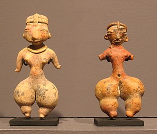
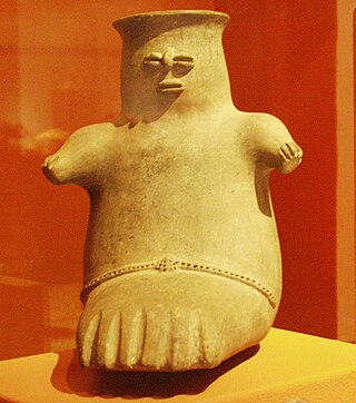
Tlatilco culture is a culture that flourished in the Valley of Mexico between the years 1250 BCE and 800 BCE, during the Mesoamerican Early Formative period. Tlatilco, Tlapacoya, and Coapexco are the major Tlatilco culture sites.

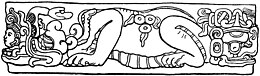
E-Groups are unique architectural complexes found among a number of ancient Maya settlements. They are central components to the settlement organization of Maya sites and, like many other civic and ceremonial buildings, could have served for astronomical observations.

The Museo Popol Vuh is home to one of the major collections of Maya art in the world. It is located on the campus of the Universidad Francisco Marroquín in Zone 10, Guatemala City. The museum is known for its extensive collection of pre-Columbian and colonial art of the Maya culture.
The Southern Maya Area is a region of Pre-Columbian sites in Mesoamerica. It is long believed important to the rise of Maya civilization, during the period that is known as Preclassic. It lies within a broad arc going southeast from Chiapa de Corzo in Mexico to Copán and Chalchuapa, in Central America.
Cuello is a Maya archaeological site in northern Belize. The site is that of a farming village with a long occupational history. It was originally dated to 2000 BC, but these dates have now been corrected and updated to around 1200 BC. Its inhabitants lived in pole-and-thatch houses that were built on top of low plaster-coated platforms. The site contains residential groups clustered around central patios. It also features the remains of a steam bath dating to approximately 900 BC, making it the oldest steam bath found to date in the Maya lowlands. Human burials have been associated with the residential structures; the oldest have no surviving burial relics, but from 900 BC onwards, they were accompanied by offerings of ceramic vessels.
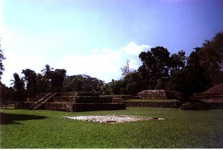
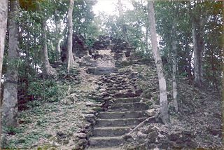
The Preclassic period in Maya history stretches from the beginning of permanent village life c. 1000 BC until the advent of the Classic Period c. 250 AD, and is subdivided into Early, Middle, and Late. Major archaeological sites of this period include Nakbe, Uaxactun, Seibal, San Bartolo, Cival, and El Mirador.
Chupícuaro is an important prehispanic archeological site from the late preclassical or formative period. The culture that takes its name from the site dates to 400 BC to 200 AD, or alternatively 500 BC to 300 AD., although some academics suggest an origin as early as 800 BC.
Mesa de Cacahuatenco is a Mesoamerican pre-Columbian archeological site, located in the municipality of Ixhuatlán de Madero in northern Veracruz, Mexico, south of the Vinasca River.
Baking Pot is a Maya archaeological site located in the Belize River Valley on the southern bank of the river, northeast of modern-day town of San Ignacio in the Cayo District of Belize; it is 6 kilometres (3.7 mi) downstream from the Barton Ramie and Lower Dover archaeological sites. Baking Pot is associated with an extensive amount of research into Maya settlements, community-based archaeology, and of agricultural production; the site possesses lithic workshops, and possible evidence of cash-cropping cacao as well as a long occupation from the Preclassic through to the Postclassic period.
Kʼo is one of several Mayan ceremonial center sites around and associated with the Classic Mayan city of Holmul located in modern-day Guatemala. Currently, the site boasts what may be the royal tomb of the earliest known Mayan ruler.
The Preclassic or Formative Period of Belizean, Maya, and Mesoamerican history began with the Maya development of ceramics during 2000 BC – 900 BC, and ended with the advent of Mayan monumental inscriptions in 250 AD.

The Mesoamerican Preclassic period began in about 2500 B. C. It dates from the probable date of the first Mesoamerican ceramics and lasted until around 200 A. D, the date of the fall of Cuicuilco, located south of Mexico City, where the circular pyramid built by this culture remains. Attributing its disappearance to the eruption of the volcano Xitle, located a few kilometers south of the pyramid. The eruption covered a radius of approximately 20 kilometers, in some cases up to 30 meters thick.