Ajeromi-Ifelodun

Last updated

Ajeromi-Ifelodun
LGA
LGA Mapa de Ajeromi-Ifelodun, Lagos.PNG
Location within Lagos Metropolitan Area
CountryFlag of Nigeria.svg  Nigeria
State Lagos State
Government
  The Executive Chairman and the Head of the Local Government CouncilHon. Fatai Adekunle Ayoola
Area
  Total4.82 sq mi (12.49 km2)
Population
 (2022)
  Total1,017,500
  Density210,000/sq mi (81,000/km2)
Time zone UTC+1 (WAT)
Ajeromi-Ifelodun

Ajeromi-Ifelodun is a Local Government Area in Badagry Division, Lagos State. It has some 80,000 inhabitants per square kilometer, among if not the world's densest. [1]

Contents

Ajeromi Ifelodun accommodates various ethnic groups, with the Yoruba tribe prevailing. The predominant religions are Christianity and Islam, and the commonly spoken languages are Yoruba and English. [2] [1]

History

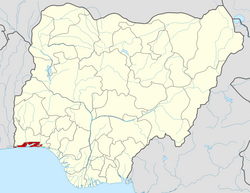
Ajeromi-Ifelodun was Established on October 1, 1976, it derives its name from two notable towns within its confines, namely Ajeromi and Ifelodun.

The local government area spans approximately 12.4 square kilometers and accommodates a population exceeding 800,000 individuals, as per the 2006 census.

Climate/Geography

Ajeromi Ifelodun experiences an average temperature of 27 degrees Celsius, accompanied by an estimated humidity of 88 percent. The primary seasons include the dry season and the rainy season, the latter marked by intermittent heavy showers. [3]

Ajegunle has a cloudy wet season, a partly cloudy dry season, and consistently hot and oppressive weather throughout the year. Temperatures typically range from 75°F to 91°F, seldom dropping below 70°F or exceeding 94°F. [4]

The period with high temperatures spans 4.7 months, running from December 6 to April 29, where the daily high averages above 89°F. March stands out as the hottest month, with an average high of 91°F and a low of 79°F. [5]

Conversely, the cooler season extends for 3.0 months, starting from June 26 to September 28, featuring daily highs averaging below 84°F. August emerges as the coldest month, with an average low of 75°F and a high of 82°F. [6]

Economy

Ajeromi Ifelodun Local Government Area has trade as its major economic activity with markets such as the Boundary market, the Wilmer market, and the Odunade market providing an avenue for the exchange of a variety of goods and services in the area. [2]

Locality

Towns,Areas under Ajeromi Ifelodun Local Government Area: [7]

Related Research Articles

Ajegunle, popularly known as "AJ City" or simply "AJ", is a neighbourhood located in the heart of Lagos, Lagos State, Nigeria. It is located in the Ajeromi-Ifelodun local government area of Lagos. Ajegunle in the Yoruba language means "A place where riches dwells."

Suleja is a city in Niger State, Nigeria, pop. (2016) local government area, 260,240, just north of Abuja, capital of the Suleja Emirate. It is sometimes confused with the nearby city of Abuja, due to its proximity, and the fact that it was originally called Abuja before the Nigerian government adopted the name from the then Emir Sulayman Bal for its new federal capital in 1976.

Bida is a Local Government Area in Niger State, Nigeria and a city on the A124 highway which occupies most of the area.

<span class="mw-page-title-main">Gboko</span> LGA in Benue state

Gboko is a Local Government Area in Benue state, North-central Nigeria. It is headquartered in the town of Gboko.

Agaie is a Local Government Area in Niger State, Nigeria. Its headquarters are in the town of Agaie on the A124 highway.

Oye is a town and headquarter of Oye Local Government Area in Ekiti State, Nigeria. Oye Local Government Area was carved out from the defunct Ekiti North Local Government on 17 May 1989.

Ankpa is a Local Government Area in Kogi State, Nigeria. Its headquarters are in the town of Ankpa on the A233 highway in the west of the area at7°22′14″N7°37′31″E.

Demsa is a Local Government Area of Adamawa State, Nigeria with headquarters located in Demsa. Demsa lies on the Benue River.

<span class="mw-page-title-main">Ganye</span> LGA and town in Adamawa State, Nigeria

Ganye is a town and Local Government Area of Adamawa State, Nigeria. Jada and Toungo Local Governments were carved out from Ganye local government area of Adamawa state Nigeria. Ganye is bordered by Jada Local Government Area to the North and East, Toungo Local Government Area to the South and Taraba State to the West. It is the headquarter of the Sama (Chamba) people worldwide.

Gombi is the Local Government Headquarter of Gombi Local Government Area of Adamawa State, Nigeria.

Aba South is a Local Government Area of Abia State, Nigeria. Its headquarters are in the city of Aba.

Alkaleri is a Local Government Area of Bauchi State, Nigeria. Its headquarters are in the town of Alkaleri on the A345 highway in the northern part of the Local Government Area.

Ise/Orun is a Local Government Area of Ekiti State, Nigeria. Its headquarters are in the town of Ise Ekiti.

<span class="mw-page-title-main">Akko, Nigeria</span> LGA in Gombe State, Nigeria

Akko is a local government area of Gombe, Gombe State, Nigeria. Its headquarters is in Kumo town on the A345 highway south of the state capital Gombe, about 40 km away. Kumo (headquarter) is a cosmopolitan communities of more than 30 differents tribes, ranging from the dominant Fulani tribe to Tangale, Tera, Hausa and other minorities.

Billiri is one of the 11 Local Government Areas of Gombe State, Nigeria bordered to the north by Akko Local Government Area, south and east by Shongom as well as North-East by Kaltungo Local Government Area. It is a historical settlement of the Tangales which is located South of Gombe It has an area of 737 km2 and a population of 202,144 at the 2006 census. Apart from Tangale language, Fulfulde and Hausa are commonly spoken The postal code of the area is 771.

Augie is a Local Government Area in Kebbi State, Nigeria. Its headquarters are in the town of Augie.

Karu is a Local Government Area in Nasarawa State, central Nigeria. It is close in proximity to the Federal Capital Territory of Nigeria. It has an area of 2,640 km2. Karu local government has its headquarters in New Karu town. It was originally built to house the capital's civil servants and lower income families, but had no running water or good sanitation system. Karu has grown in population beyond its original planned capacity. Ensure Administrative convenience and bring government closer to the grass root people, Karshi Development Area was created with its administrative secretariat at Uke.

<span class="mw-page-title-main">Keffi</span> LGA and Town in Nasarawa State, Nigeria

Keffi Local Government Area and also is a traditional or commercial town in Nasarawa north central Nigeria Its headquarters are in the town of Keffi. Keffi is 50 kilometers from Abuja. Nasarawa State university is located in Keffi sitting along Keffi-Akwanga express way.

Anka is a Local Government Area in Zamfara State, Nigeria. Its headquarters is in the town of Anka at 12°06′30″N5°56′00″E.

Shinkafi is a Local Government Area in Zamfara State of Nigeria. Its headquarters is in the town of Shinkafi an area of about 674mk2 and population of 135,649. It shares boundaries with Isa Local Government Area and Niger Republic from the north, Zurmi Local Government Area to the South and South-East, Maradun Local Government Area and Raba Local Government Area by the west. Distance from the State Capital, Gusau is approximately 116 km.

References

  1. 1 2 "Nigeria: Administrative Division (States and Local Government Areas) - Population Statistics, Charts and Map".
  2. 1 2 "Ajeromi/Ifelodun Local Government Area". www.manpower.com.ng. Retrieved 2023-11-20.
  3. "Ajegunle Climate, Weather By Month, Average Temperature (Nigeria) - Weather Spark". weatherspark.com. Retrieved 2023-11-20.
  4. "Hourly weather forecast for Ajeromi/Ifelodun". Yr. 2023-11-20. Retrieved 2023-11-20.
  5. "Category 6 Sets Its Sights Over the Rainbow". www.wunderground.com. Retrieved 2023-11-20.
  6. "Ajeromi/Ifelodun, Nigeria - Today's Weather Forecast | Clime". climeradar.com. Retrieved 2023-11-20.
  7. places (1970-01-01). "Towns & Villages in Ajeromi-Ifelodun « Lagos State « Nigeria". Towns & Villages. Retrieved 2023-11-20.

6°26′41″N3°20′02″E / 6.4448°N 3.3339°E / 6.4448; 3.3339