Sacramento is the capital city of the U.S. state of California and the seat of Sacramento County. Located at the confluence of the Sacramento and American Rivers in Northern California's Sacramento Valley, Sacramento's 2020 population of 524,943 makes it the fourth-most populous city in Northern California, sixth-most populous city in the state, and the ninth-most populous state capital in the United States. Sacramento is the seat of the California Legislature and the Governor of California.

Bernard Ralph Maybeck was an American architect in the Arts and Crafts Movement of the early 20th century. He worked primarily in the San Francisco Bay Area, designing public buildings, including the Palace of Fine Arts in San Francisco, and also private houses, especially in Berkeley, where he lived and taught at the University of California. A number of his works are listed on the National Register of Historic Places.
Elmhurst is a historic residential neighborhood located in the eastern part of Sacramento, California. Elmhurst is known for its large elm, ash, and oak trees that provide shady canopy for the neighborhood.
East Sacramento is a neighborhood in Sacramento, California, United States, that is east of downtown and midtown. East Sacramento is bounded by U.S. Route 50 to the south, Business Loop 80 to the west and north, Elvas Avenue to the northeast and east, and California State University, Sacramento and the American River to the southeast. East Sacramento residential development began in the 1890s, and the area was annexed into Sacramento in 1911. East Sacramento was also home to the Alhambra Theatre. East Sacramento also includes McKinley Park and the "Fabulous Forties" neighborhood.
The Central or Midtown section of Norwalk, Connecticut is an urbanized area in roughly the geographic center of the city, north of the South Norwalk neighborhood and the Connecticut Turnpike. Wall Street, West Avenue and Belden Avenue are the main thoroughfares. It has also been called "Norwalk Center" or "Downtown Norwalk".
Gillette Historic District (GHD) is a residential area in the Midtown section of Tulsa, Oklahoma. It consists of the homes on Gillette Avenue and Yorktown Place, and is bounded by 15th Street on the north, the alley between Gillette Street and Lewis Avenue on the east, 17th Street on the south and the alley between Yorktown Place and Yorktown Avenue. It contains 31 single-family homes and 6 duplexes that were constructed between 1924 and 1941. The district were named for James Max Gillette, a merchant, real estate entrepreneur and oilman who built his home in what is now the district in 1921.

Mill Hill is a historic neighborhood located within the city of Trenton in Mercer County, in the U.S. state of New Jersey. It is considered to be part of Downtown Trenton. The Mill Hill Historic District was added to the National Register of Historic Places in 1977.

Brainerd Jones was an American architect who designed and built most of the architecturally-significant buildings in Petaluma, California.

The California Governor's Mansion is the official residence of the governor of California, located in Sacramento, the capital of California. Built in 1877, the estate was purchased by the Californian government in 1903 and has served as the executive residence for 14 governors. The mansion was occupied by governors between 1903–1967 and 2015–2019. Since 1967, the mansion has been managed by California State Parks as the Governor's Mansion State Historic Park.

Glenville Historic District, also known as Sherwood's Bridge, is a 33.9 acres (13.7 ha) historic district in the Glenville neighborhood of the town of Greenwich, Connecticut. It is the "most comprehensive example of a New England mill village within the Town of Greenwich". It "is also historically significant as one of the town's major staging areas of immigrants, predominantly Irish in the 19th century and Polish in the 20th century" and remains "the primary settlement of Poles in the town". Further, "[t]he district is architecturally significant because it contains two elaborate examples of mill construction, designed in the Romanesque Revival and a transitional Stick-style/Queen Anne; an excellent example of a Georgian Revival school; and notable examples of domestic and commercial architecture, including a Queen Anne mansion and an Italianate store building."

Mesick House is a historic home constructed in 1875 in the Second Empire and Italianate Victorian architecture styles. It is one of four High Victorians remaining in Sacramento that display a mansard roof.

This is a list of the National Register of Historic Places listings in Mendocino County, California.

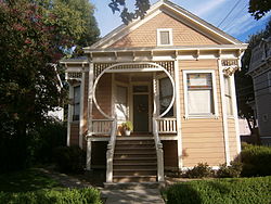
Winters House is a historic house in Sacramento, California. It is a Victorian era Stick/Eastlake Queen Anne style wooden residence built in 1890 by businessman Herman Winters.
Southside Park is a neighborhood in Sacramento, California, located immediately south of Downtown Sacramento. Its official borders are R Street to the north, W-X Freeway to the south, I-5 to the west, and 12th Street to the east.

The Jacob P. Mesick House is located on Van Wyck Lane in Claverack-Red Mills, New York, United States. It is a wooden house in the Greek Revival architectural style built in the mid-19th century.

The Holden–Leonard Workers Housing Historic District encompasses a collection of mill-related tenement houses, plus a former mill store, in Bennington, Vermont. They are located on Benmont and Holden Avenues, near the former Holden–Leonard Mill Complex, Bennington's largest employer in the late 19th century. The district was listed on the National Register of Historic Places in 2011.

The Springwells Park Historic District is a historic residential neighborhood located in Dearborn, Michigan and bounded by Rotunda Drive, the Michigan Central Railroad line, and Greenfield and Eastham Roads. The district was listed on the National Register of Historic Places in 2015.
Samuel Newsom was a Canadian-born American architect. Together with his brother Joseph Cather Newsom founded the architecture firm Newsom and Newsom, practicing in Northern and Southern California. Their most celebrated house is the Carson Mansion in Eureka, California.

Sheldon Grist Mill Site, is historical site in Sloughhouse, California in Sacramento County. The site is a California Historical Landmark No. 604 listed on June 2, 1949. The water powered gristmill, was used turn grain into flour, was on Rancho Omochumnes. The gristmill was built by Jared Dixon (Joaquin) Sheldon. Sheldon was grant then five square league of land on Rancho Omochumnes by the First Mexican Republic in 1843 by Mexican Governor Manuel Micheltorena as payment for carpenter work on the Monterey Custom House. Sheldon born on January 8, 1813, in Vermont and travelled to California 1832, working as a carpenter and millwright. Sheldon married Catherine Rhoads, the daughters of Thomas Rhoads in March 1847. Sheldon and his partner, William Daylor, also did some gold mining. Sheldon built a dam on Clark's Bar river on the his Sheldon Grant to irrigate the crops on his lands. The dam flood a California Gold Rush miners' claims. The angry miners' shot Sheldon on July 11, 1851. The conflict with Sheldon and the miners is called the Riot on the Cosumnes. In the conflict Sheldon was not the only one shot. Also Killed was James M. Johnson of Lancaster, Iowa and Edward Cody of Fox River, Illinois. Three were wounded: Calvin Dickerson of Berrien County, Michigan, Emanuel Bush of Des Moines County, Iowa and one unnamed miner. The Sheldon Grant was boarded on the south by the Cosumnes River and north by Deer Creek, 17 miles long between the rivers. The Sheldon Grist Mill was just west of the Sloughhouse Pioneer Cemetery, where Sheldon and his partner William Daylor and are buried. The site today is still mostly farmland.

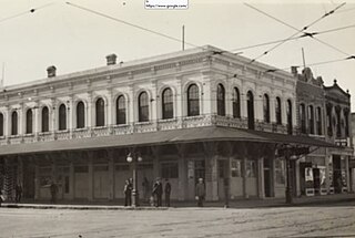
Overton Building was a historical two-story building in Sacramento, California. The site of former Overton Building is a California Historical Landmark No. 610 listed on May 22, 1956. This site is now a Parking lot near the corner of 2nd street and J Street in Old Sacramento State Historic Park. The Overton Building was removed when the Interstate 5 freeway was built in the 1960s. The historical Western Hotel, D.O. Mills Bank and the original Sacramento Bee building were also taken down for the I-5 freeway. The Overton Building first housed a number of California state offices including: the California Governor's Office and the California Secretary of State. The building, on the lot before the Overton Building, was lost in a fire on November 2, 1852. The first California State Library was housed on the second floor from 1853 to 1856. The building was built by the bankers, Read & Company at a cost $105,000 in 1852. In the 1950s and early 1960s Overton Building was the Rialto Hotel and Rialto Cafe.


