Fair Oaks Bridge | |
---|---|
| |
Coordinates | 38°38′11″N121°15′54″W / 38.636271°N 121.265109°W |
Crosses | American River |
Locale | Sacramento, California, United States |
Official name | Fair Oaks Bridge |
Named for | Fair Oaks, California |
NBI number | [1] |
Characteristics | |
Design | Pennsylvania Truss bridge |
History | |
Constructed by | Western Bridge and Construction Company |
Built | 1907-09 |
Location | |
![]() |
The Fair Oaks Bridge is a truss bridge over the lower banks of the American River, connecting Fair Oaks to the greater Sacramento, California region. The current bridge, built 1907-1909 at a cost of $63,000, [2] is the third bridge at this location.
The first bridge, which opened in 1901, helped to transform the small semi-rural community into a turn-of-the-century agricultural powerhouse. The present bridge, built 1907-1909, helped to transform the citrus colony into one of the leading bedroom communities of Sacramento by the 1940s. It is now a pedestrian and bicycle-only bridge.
Brevet Brigadier General Charles Henry Howard and James W. Wilson of the Howard-Wilson Publishing Company of Chicago acquired rights to sell land from California Senator Frederick K. Cox and businessman Crawford W. Clarke in 1895. The Howard-Wilson Company had the land surveyed and mapped and began to promote Fair Oaks as one of their "Sunset Colonies". The Howard-Wilson Company advertised Fair Oaks as an innovative and growing citrus colony after destructive freezes in Southern California and Florida and a national depression hitting in 1893. Many of the purchasers were professionals and other friends of the investors. Thus, the Fair Oaks community became initially composed of mostly businessmen and other professionals, including bankers and engineers.
Three hundred permanent settlers resided in Fair Oaks by 1897 and bought land in 5, 10, and 20-acre (8.1 ha) tracts at an average of $30 per acre. These pioneers planned to sustain themselves by planting and cultivating fruit orchards although the majority of them had little experience with farming. Promises of a bridge being built over the American River to better transport the new colony's fruit to the booming markets in Sacramento and beyond further sustained this hope. The following year, however, investment began to diminish and the Howard-Wilson Company withdrew from the colony and with it went unfulfilled promises of a bridge over the American River and railroad service from Sacramento.
Businessmen in Chicago and Sacramento who had an investment (land or fruit) in the newborn colony and Orangevale formed the Chicago-Fair Oaks Club in 1899. Local businessmen, including Valentine S. McClatchy (the co-owner of the Sacramento Bee ), incorporated the Fair Oaks Development Company in 1900. These boosters shamelessly proclaimed Fair Oaks to be the "crown of the [Sacramento] valley", in the "heart of California". Together, in 1901, these two groups convinced the County of Sacramento's Chamber of Commerce, which McClatchy's business partners from Orangevale created and chaired, to build a bridge across the American River at Fair Oaks and persuaded the Southern Pacific Rail Road Company to build a railroad spur to the bridge. In the summer of 1901 the spur and railroad station were built. The station was named Fair Oaks Bridge Depot. The spur to the main line of the Southern Pacific Railroad Co. helped Fair Oaks farmers and fruit companies prosper by enabling growers to distribute fresh fruit to a vast market.
Fair Oaks grew rapidly with the completion of the Fair Oaks Bridge and the railroad line. This first Fair Oaks Bridge, however, was washed out in a flood in March 1907. An 850-foot steel cable was then borrowed from the Folsom Development Company to use with a ferry boat across the river. The Sacramento County Board of Supervisors also authorized the construction of a temporary bridge. Actually, Myrtle Shaw Lord, in his officially sanctioned history of the Chamber of Commerce, A Sacramento Saga: Fifty Years of Achievement—Chamber of Commerce Leadership, writes that after the flooding of 1906 and 1907 that the Sacramento Chamber of Commerce committed itself to dealing with the problems of flooding in Sacramento generally and sponsored the rebuilding of a bridge at Fair Oaks: "With destruction as a teacher, Sacramento learned an expensive lesson and determined there should be no repetition." By the end of the year the Western Bridge and Construction Company of Omaha, Nebraska began the double truss bridge that still survives and services the community today. In fact, because of its historical and architectural significance, it was placed on the National Register of Historic Places in September 2006. [3]
The Fair Oaks Bridge's usefulness, however, diminished with the construction of bridges at Watt Avenue (to the west) in 1959 and Hazel Avenue (to the east) in 1967, as well the widening of the Sunrise Bridge (less than half a mile west) in 1968. The Fair Oaks Bridge was closed to traffic in 1967 and became the property of the Sacramento County Parks and Recreation Department after serving more than fifty years as the major crossing over the lower American River. Parks and Recreation re-decked and painted the bridge in 1973 and opened it as a pedestrian and bicycle crossing that currently connects to the American Parkway Trail along the lower banks of the American River.
The Fair Oaks Bridge is an excellent example of bridge construction and technology advancement in the mid- to late 19th century. It is a Pennsylvania Petit through Pratt truss bridge that extends nearly 500 feet (150 m) across a wide bend in the American River and is the second oldest out of ten surviving bridges of this type in the state of California (behind the historic truss bridge in Folsom that connects to Orangevale, built in 1893). The Sacramento County Surveyor hoped to minimize the number of piers in this dangerous current that necessitated very long main spans. The Pennsylvania Petit specifically addressed such applications. The two 200 ft spans were quite daring for their time. The bridge is also a rare example of the Western Bridge and Construction Company of Omaha that built truss bridges throughout the West but only rarely in California.
A truss bridge is any bridge whose individual members are connected in a triangular pattern. Truss bridges date back to at least the 16th century, although the metal truss bridge, such as the Fair Oaks Bridge, dates only to the 1840s. These metal truss bridges, especially the Pratt and Warren trusses, facilitated the enormous expansion of railroad lines in the late 19th century and were instrumental in turn-of-the-century highway construction as well. The trusses form vertical sides to the bridge, connected to one another by traverse beams, and by stingers and other members which support the deck. Each truss always includes a top and bottom chord, the major beams which resist the bending induced by stresses on the bridge. The top and bottom are connected by some combination of vertical and/or diagonal members, usually both, as well as by major beams at each end, called endposts.
The Pratt truss form, invented in 1844 by Thomas and Caleb Pratt, is the most common truss form in California and the United States. This form first appeared as a "combination truss" built in wood and iron with wooden vertical members, chords, and endposts, and iron tension diagonals. The basic form changed to all-metal construction by the 1880s.
It retained the light metal diagonals but substituted heavier metal beams, posts, and chords for the wooden members. The most common Pratt type is the through truss in which the deck is carried on the lower chord, with overhead lateral supports connecting the top chords. Finally, the Pennsylvania Petit is a Pratt truss with a polygonal top chord and includes reinforcing sub-struts and sub-ties. These half-length members reinforced the diagonals and helped resist stresses.
The current Fair Oaks Bridge is the third manifestation of an overpass over the American River and connects Fair Oaks to the greater Sacramento region. Once a major crossing over the American River, it has been bypassed by the construction of bridges at Sunrise and Hazel in the 1950s and 1960s. The bridge, however, continues to serve as a pedestrian and bicycle crossing and remains a cultural icon for the local community. On September 25, 2006, the keeper of the National Register of Historic Places listed the Old Fair Oaks Bridge as a National Historic Site. The bridge successfully listed under the Register's criterion A (associative history) and C (architectural significance).
Sacramento is the capital city of the U.S. state of California and the seat of Sacramento County. Located at the confluence of the Sacramento and American Rivers in Northern California's Sacramento Valley, Sacramento's 2020 population of 524,943 makes it the fourth-most populous city in Northern California, the sixth-most populous in the state, the ninth-most populous state capital,and the 35th most populous in the United States. Sacramento is the seat of the California Legislature and the governor of California. Sacramento is also the cultural and economic core of the Greater Sacramento area, which at the 2020 census had a population of 2,680,831, the fourth-largest metropolitan area in California.
Vacaville is a city located in Solano County, California, United States. It is located 35 miles (56 km) from Sacramento and 55 miles (89 km) from San Francisco, it is on the edge of the Sacramento Valley in Northern California. The city was founded in 1851 and is named after Juan Manuel Vaca.
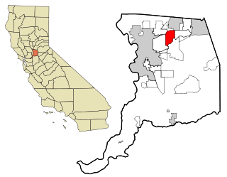
Carmichael is a census-designated place (CDP) in Sacramento County, California, United States. It is an unincorporated suburb in the Greater Sacramento metropolitan area. The population was 79,793 at the 2020 census.
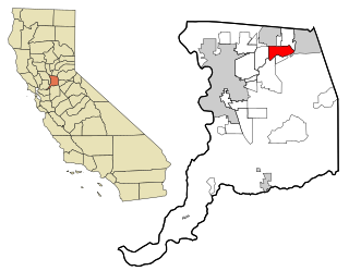
Fair Oaks is a census-designated place (CDP) in Sacramento County, California, United States. It is part of the Sacramento–Arden-Arcade–Roseville Metropolitan Statistical Area. The population was 32,514 at the 2020 census, up from 30,912 at the 2010 census. The Fair Oaks zip code is 95628 and its area codes are 916 and 279. It is bordered to the west by Carmichael, north by the city of Citrus Heights, to the east by Orangevale, and to the south by the American River.
The Sacramento Bee is a daily newspaper published in Sacramento, California, in the United States. Since its foundation in 1857, The Bee has become the largest newspaper in Sacramento, the fifth largest newspaper in California, and the 27th largest paper in the U.S. It is distributed in the upper Sacramento Valley, with a total circulation area that spans about 12,000 square miles (31,000 km2): south to Stockton, California, north to the Oregon border, east to Reno, Nevada, and west to the San Francisco Bay Area.
KFBK is a commercial AM radio station in Sacramento, California. It is simulcast on KFBK-FM 93.1 MHz. KFBK-AM-FM air a news-talk radio format and are owned by iHeartMedia, Inc. The studios and offices are on River Park Drive in North Sacramento, near the Arden Fair Mall.
Bella Vista High School is a public high school in Fair Oaks, California. It is a member of the San Juan Unified School District and serves eastern Fair Oaks and southern Orangevale. In 2003, the California Department of Education's School Recognition Program honored Bella Vista High School as a "California Distinguished School". It was also the only school in Sacramento County to receive this honor in 2003. In 2009, it received the same recognition again from the California Department of Education. On November 18, 2010, the school celebrated its 50th anniversary with a special presentation for all past and current students. The presentation included a guided tour of the school spotlighting where changes have been made throughout the campus since the school's foundation in 1960.
The Niles Canyon Railway (NCRy) is a heritage railway running on the first transcontinental railroad alignment through Niles Canyon, between Sunol and the Niles district of Fremont in the East Bay of the San Francisco Bay Area, in California, United States. The railway is listed on the National Register of Historic Places as the Niles Canyon Transcontinental Railroad Historic District. The railroad is operated and maintained by the Pacific Locomotive Association which preserves, restores and operates historic railroad equipment. The NCRy features public excursions with both steam and diesel locomotives along a well-preserved portion of the first transcontinental railroad.
The Sacramento Northern Railway was a 183-mile (295 km) electric interurban railway that connected Chico in northern California with Oakland via the state capital, Sacramento. In its operation it ran directly on the streets of Oakland, Sacramento, Yuba City, Chico, and Woodland. This involved multiple car trains making sharp turns at street corners and obeying traffic signals. Once in open country, SN's passenger trains ran at fairly fast speeds. With its shorter route and lower fares, the SN provided strong competition to the Southern Pacific and Western Pacific Railroad for passenger business and freight business between those two cities. North of Sacramento, both passenger and freight business was less due to the small town agricultural nature of the region and due to competition from the paralleling Southern Pacific Railroad.
California's 3rd congressional district is a U.S. congressional district in California. It includes the northern Sierra Nevada and northeastern suburbs of Sacramento, stretching south to Death Valley. It encompasses Alpine, Inyo, Mono, Nevada, Placer, Plumas, and Sierra counties, as well as parts of El Dorado, Sacramento, and Yuba counties. It includes the Sacramento suburbs of Roseville, Folsom, Orangevale, Rocklin, Auburn, and Lincoln, along with the mountain towns of Quincy, South Lake Tahoe, Truckee, Mammoth Lakes, and Bishop. The district is represented by Republican Kevin Kiley.
The history of Sacramento, California, began with its founding by Samuel Brannan and John Augustus Sutter, Jr. in 1848 around an embarcadero that his father, John Sutter, Sr. constructed at the confluence of the American and Sacramento Rivers a few years prior.
Roger Niello is an American politician who is currently in the California State Senate representing the 6th district, which includes portions of Sacramento and Placer counties. He is a Republican who had also served in the California State Assembly from 2004 to 2010.
Oak Park is a neighborhood in Sacramento, California. The McGeorge School of Law, University of the Pacific Sacramento Campus, Sacramento High School, and Christian Brothers High School are located in this neighborhood.
Susan Peters is a Republican who serves on the Sacramento County Board of Supervisors. Supervisor Peters has served on the Board since January 4, 2005.
The California Governor's Mansion is the official residence of the governor of California, located in Sacramento, the capital of California. Built in 1877, the estate was purchased by the State of California in 1903 and has served as the executive residence for 14 governors. The mansion was occupied by governors between 1903–1967 and 2015–2019. Since 1967, the mansion has been managed by California State Parks as the Governor's Mansion State Historic Park.
Jurupa Valley is a city in the northwest corner of Riverside County, California, United States. It was the location of one of the earliest non-native settlements in the county, Rancho Jurupa. The Rancho was initially an outpost of the Mission San Gabriel Arcángel, then a Mexican land grant in 1838. The name is derived from a Native American village that existed in the area prior to the arrival of Europeans.
Frederick William Henshaw was an American attorney and Associate Justice of the Supreme Court of California from December 29, 1894, to January 1, 1918, whose 23-year tenure is among the longest on the high court.
Andreas Borgeas is an American attorney, politician, and academic who served as a member of the California State Senate from the 8th district, which included parts of the Central Valley and the Sierra Nevada. Prior to being elected to the state Senate, he was a member of the Fresno County Board of Supervisors. He represented all or portions of Amador, Calaveras, Fresno, Inyo, Madera, Mariposa, Mono, Sacramento, Stanislaus, Tulare, and Tuolumne counties.
Samuel Altshuler was a clothing merchant, mine owner, and industrial developer in the states of Washington and California. He opened and owned clothing stores in Whatcom, Washington, and his native San Francisco, California, and built several business buildings in both cities.
{{cite web}}
: CS1 maint: archived copy as title (link)While not meant to be an exhaustive list, see the following sources for more on the history of Fair Oaks, including the bridge:
Late 19th through early 20th centuries
1890s
1900s
1910s
1920s
1930s
1940s
1950s
1960s
1970s
1980s
1990s
2000s