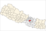
Lamjung District, a part of Gandaki Pradesh, is one of the 77 districts of Nepal. The district, with Besisahar as its district headquarters, covers an area of 1,692 square kilometres (653 sq mi) and as of 2011 had a population of 167,724. Lamjung lies in the mid-hills of Nepal spanning tropical to trans-Himalayan geo-ecological belts, including the geographical midpoint of the country. It has mixed habitation of casts and ethnicities. It is host to probably the highest density of the Gurung ethnic population in the country.

Jaluke (जलुके) is a small town in Arghakhanchi District in the Lumbini Zone of southern Nepal. At the time of the 2011 Nepal census it had a population of 6,142 and had 1242 houses in the town. It is located approximately 234 km/145 mi from the Nepal's capital, Kathmandu.
Pedku is a village in Sindhupalchok District in the Bagmati Zone of central Nepal. At the time of the 2013 Nepal census it had a population of 2284 and had 408 houses in the village. In 2011 the population was 1600 in 391 households.
Chhaling is a village and former Village Development Committee that is now part of Changunarayan Municipality in Province No. 3 of central Nepal. At the time of the 2011 Nepal census it had a population of 8,129 with 1,817 houses in it.It is situated at about a distance of 20 kilometers from the capital city Kathmandu.

Gundu was Village Development Committee in Bhaktapur District in the Bagmati Zone of central Nepal.However, now it is a part of Suryabinayak Municipality. The whole Gundu VDC is now ward no. 7 of the Suryabinayak Municipality. Ward Chairperson of Gundu is Rabindra Sapkota. Rabindra Sapkota has won the local election held on Baisakh 31st 2074.He is representing CPN(UML). At the time of the 1991 Nepal census it had a population of 5,689 with 1,257 houses in it.
Katunje is a village and former Village Development Committee that is now part of Suryabinayak Municipality in Province No. 3 of central Nepal. At the time of the 2011 Nepal census it had a population of 19,497 with 4,692 houses in it.
Aalapot is a village and former Village Development Committee that is now part of Kageshwari-Manohara Municipality in Kathmandu District in Province No. 3 of central Nepal. At the time of the 2011 Nepal census it had a population of 3,159 and had 671 houses in it.

Balambu is a village and former Village Development Committee that is now part of Chandragiri Municipality in Kathmandu District in Province No. 3 of central Nepal. At the time of the 2011 Nepal census it had a population of 7,323 and had 1734 houses in it.
Baluwa is a village and former Village Development Committee that is now part of Gokarneshwar Municipality in Kathmandu District in Province No. 3 of central Nepal. At the time of the 2011 Nepal census it had a population of 5,467 and had 1204 houses in it. It is located at north-east side from the capital city of Nepal. It touch Nuwakot District to the north and Gorkna VDC to the south. In east side, there is Nayapati VDC and in west Kapan VDC.

Bhadrabas is a village and former Village Development Committee that is now part of Kageshwari-Manohara Municipality in Kathmandu District in Province No. 3 of central Nepal, located approximately 15 kilometres (9 mi) northeast of Kathmandu. At the time of the 2011 Nepal census it had a population of 2,388 and had 503 houses in it. The oldest high school in the eastern Kathmandu Valley, Adarsh Madhayamik Vidhalaya is located in Bhadrabas. The Nepal Red Cross Society is active in Bhadrabas and it has notable health centre. In 1984, a tobacco smoking World Health Organization questionnaire was given to the inhabitants of Bhadrabas to survey smoking trends in the country.
Dharmasthali is a village and former Village Development Committee that is now part of Tarakeshwar Municipality in Kathmandu District in Province No. 3 of central Nepal. At the time of the 2011 Nepal census it had a population of 6,530 and had 1,421 households in it.
Gongabu is a village and former Village Development Committee that is now part of Tokha Municipality in Kathmandu District in Province No. 3 of central Nepal. At the time of the 2011 Nepal census it had a population of 54,410 and had 14,456 households in it in an area just 270 hectares in size
Gothatar is a village and former Village Development Committee that is now part of Kageshwari-Manohara Municipality in Kathmandu District in Province No. 3 of central Nepal. It being handled By ward Secretary name Rameshwor Dahal. At the time of the 2011 Nepal census it had a population of 26,169 and had 6,749 households in it. The newly built Bagmati bridge connects Gothatar with the roadway to Jorpati. The Krishna Parnami Mandir is one of the major attractions in Gothatar. In between 2007-2010, the density of population has rapidly increased as more and more houses are being constructed. The majority of the population in Gothatar consists of Hindu Brahmins and Kshetris. The natives are mainly farmers who still have cowsheds in their homes despite being very close to the rush of the metropolitan Kathmandu.
Ichangu Narayan is a village and former Village Development Committee that is now part of Nagarjun Municipality in Province No. 3 of central Nepal. At the time of the 2011 Nepal census it had a population of 24,425 and had 6,288 households in it.
Indrayani is a village and former Village Development Committee that is now part of Shankharapur Municipality in Kathmandu District in Province No. 3 of central Nepal. At the time of the 1991 Nepal census it had a population of 2635 and had 467 households in it. As per 2011 Nepal census it had a population of 3,361 and had 717 households in it.
Kapan is a village and former Village Development Committee that is now part of Budanilkantha Municipality in Kathmandu District in Province No. 3 of central Nepal. It is situated in the northern part of Kathmandu. At the time of the 2011 Nepal census it had a population of 48,463 in 12,324 households. Kapan Sangit Sarowar, Kapan Monastery, Kapan Aani Gumba etc. are tourist places situated at Kapan. Kapan consists of several settlements, e. g.: Mahankal, New Colony, Jyotinagar, Saraswatinagar, Golphutar or Baluwakhani. Kapan has recently developed very high number of Paying Guest Houses for local-tourism.
Dhamir is a village in Gulmi District in the Lumbini Zone of Western Nepal. It is located at latitude 28°12′7.81″ N and longitude 83°9′32.66″ E. It lies 1143 meters above sea level. According to 2011 Nepal census, the total population of this village is 3,588 individuals living in 768 households. The census also noted some absent people; most are foreign employees employed overseas and in the Middle East. The male population is 1,563 and the female population is 2,025, causing a sex ratio of 77.19.
Simli is a village development committee in Rukum District in the Rapti Zone of western Nepal. At the time of the 2011 Nepal census it had a population of 5316 people living in 1044 individual households.
Mukundapur is a town in Gaidakot Municipality in eastern part of Nawalparasi District in the Lumbini Zone of southern Nepal. It became a municipality in May 2014 by merging the existing Mukundapur, Amarapuri, Gaidakot, Nawalparasi, VDCs. At the time of the 1991 Nepal census it had a population of 7631. According to the 2011 Nepal census, the VDC had a population of 13,027 living in 3,023 houses. The VDC is historically important as the "Mukundasen Palace" built by King Madimukundasen of Palpa lies here. The VDC is named after this Palace.
Nepal conducted a widespread national census in 2011 by the Nepal Central Bureau of Statistics. Working with the 58 municipalities and the 3915 Village Development Committees at a district level, they recorded data from all the municipalities and villages of each district. The data included statistics on population size, households, sex and age distribution, place of birth, residence characteristics, literacy, marital status, religion, language spoken, caste/ethnic group, economically active population, education, number of children, employment status, and occupation.