Gonggabu

Last updated
Gongabu

गोंगबु
Village of Tokha Municipality
Nepal adm location map.svg
Red pog.svg
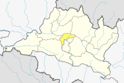
Gongabu
Location in Nepal
Coordinates: 27°45′N85°19′E / 27.75°N 85.32°E / 27.75; 85.32 Coordinates: 27°45′N85°19′E / 27.75°N 85.32°E / 27.75; 85.32
CountryFlag of Nepal.svg    Nepal
Province No. 3
District Kathmandu District
Population
 (2011)
  Total54,410
Time zone UTC+5:45 (Nepal Time)

Gongabu is a village and former Village Development Committee that is now part of Tokha Municipality in Kathmandu District in Province No. 3 of central Nepal. At the time of the 2011 Nepal census it had a population of 54,410 and had 14,456 households in it in an area just 270 hectares in size [1]

Village Small clustered human settlement smaller than a town

A village is a clustered human settlement or community, larger than a hamlet but smaller than a town, with a population ranging from a few hundred to a few thousand. Though villages are often located in rural areas, the term urban village is also applied to certain urban neighborhoods. Villages are normally permanent, with fixed dwellings; however, transient villages can occur. Further, the dwellings of a village are fairly close to one another, not scattered broadly over the landscape, as a dispersed settlement.

Tokha Municipality in Province No. 3, Nepal

Tokha is a municipality in Kathmandu District in the Province No. 3 of Nepal that was established on 2 December 2014 by merging the former Village development committees Dhapasi, Jhor Mahankal, Gongabu, Tokha Chandeshwari and Tokha Saraswati on 2 December 2014. The municipality derives its name from the historical town of Tokha.

Kathmandu District District in Province No. 3, Nepal

Kathmandu District is a district located in Kathmandu Valley, Province No. 3 of Nepal, a landlocked country in South Asia. It is one of the 77 districts of Nepal, covers an area of 395 km2 (153 sq mi), and is the most densely populated district of Nepal with 1,081,845 inhabitants in 2001 and 1,744,240 in 2011. The district's headquarter is Kathmandu Metropolitan City, also the capital of Nepal. It is also a famous tourist spot as there are many religious temples, attracting places.

Related Research Articles

Lumbini city in Province No. 5, Nepal

Lumbinī is a Buddhist pilgrimage site in the Rupandehi District of Province No. 5 in Nepal. It is the place where, according to Buddhist tradition, Queen Mahamayadevi gave birth to Siddhartha Gautama in 563 BCE. Gautama, who achieved Enlightenment some time around 528 BCE, became the Buddha and founded Buddhism. Lumbini is one of many magnets for pilgrimage that sprang up in places pivotal to the life of the Buddha.

Tamang people ethnic group

The Tamangཏ་མང are the largest Tibetic ethnic group of Nepalis and Indian Gorkhas. Traditionally Buddhist by religion, they Constitute 5.6% of the Nepalese population at over 1.3 million in 2001, increasing to 1,539,830 as of 2011 census, yet contested. Indian Tamangs are also a significant number in Sikkim and Darjeeling District of West Bengal, India as permanent settlers; their languages are the fifth most spoken in Nepal. They are considered as one of the indigenous people of Nepal and India.

Village development committee (Nepal) lower administrative part of Nepals local development ministry

A Village Development Committee (VDC) in Nepal was the lower administrative part of its Ministry of Federal Affairs and Local Development. Each district had several VDCs, similar to municipalities but with greater public-government interaction and administration. There were 3,157 village development committees in Nepal. Each VDC was further divided into several wards depending on the population of the district; the average being nine wards.

Gundu, Nepal Ward No. 7 of Suryabinayak Municipality in Bagmati Zone, Nepal

Gundu was Village Development Committee in Bhaktapur District in the Bagmati Zone of central Nepal.However, now it is a part of Suryabinayak Municipality. The whole Gundu VDC is now ward no. 7 of the Suryabinayak Municipality. Ward Chairperson of Gundu is Rabindra Sapkota. Rabindra Sapkota has won the local election held on Baisakh 31st 2074.He is representing CPN(UML). At the time of the 1991 Nepal census it had a population of 5,689 with 1,257 houses in it.

Kautunje Village of Suryabinayak Municipality in Province No. 3, Nepal

Katunje is a village and former Village Development Committee that is now part of Suryabinayak Municipality in Province No. 3 of central Nepal. At the time of the 2011 Nepal census it had a population of 19,497 with 4,692 houses in it.

Aalapot Village of Kageshwari-Manohara Municipality in No. 3, Nepal

Aalapot is a village and former Village Development Committee that is now part of Kageshwari-Manohara Municipality in Kathmandu District in Province No. 3 of central Nepal. At the time of the 2011 Nepal census it had a population of 3,159 and had 671 houses in it.

Bajrayogini Village of Shankharapur Municipality in No. 3, Nepal

Bajrayogini is a village and former Village Development Committee that is now part of Shankharapur Municipality in Kathmandu District in Province No. 3 of central Nepal. At the time of the 1991 Nepal census it had a population of 3798 and had 632 houses in it. As per 2011 Nepal census it had a population of 4,333 and had 328 houses in it.

Balambu Village of Chandragiri Municipality in No. 3, Nepal

Balambu is a village and former Village Development Committee that is now part of Chandragiri Municipality in Kathmandu District in Province No. 3 of central Nepal. At the time of the 2011 Nepal census it had a population of 7,323 and had 1734 houses in it.

Baluwa, Kathmandu Village of Gokarneshwar Municipality in No. 3, Nepal

Baluwa is a village and former Village Development Committee that is now part of Gokarneshwar Municipality in Kathmandu District in Province No. 3 of central Nepal. At the time of the 2011 Nepal census it had a population of 5,467 and had 1204 houses in it. It is located at north-east side from the capital city of Nepal. It touch Nuwakot District to the north and Gorkna VDC to the south. In east side, there is Nayapati VDC and in west Kapan VDC.

Bhadrabas Village of Kageshwari-Manohara Municipality in No. 3, Nepal

Bhadrabas is a village and former Village Development Committee that is now part of Kageshwari-Manohara Municipality in Kathmandu District in Province No. 3 of central Nepal, located approximately 15 kilometres (9 mi) northeast of Kathmandu. At the time of the 2011 Nepal census it had a population of 2,388 and had 503 houses in it. The oldest high school in the eastern Kathmandu Valley, Adarsh Madhayamik Vidhalaya is located in Bhadrabas. The Nepal Red Cross Society is active in Bhadrabas and it has notable health centre. In 1984, a tobacco smoking World Health Organization questionnaire was given to the inhabitants of Bhadrabas to survey smoking trends in the country.

Budhanilkantha Municipality in Bagmati Zone, Nepal

Budhanilkantha is a municipality in Kathmandu District in the Province No. 3 of Nepal that was established on 2 December 2014 by merging the former Village development committees Khadga Bhadrakali, Chapali Bhadrakali, Mahankal, Bishnu, Chunikhel and Kapan. The city is situated at the foot of Shivapuri hill. At the time of the 2011 Nepal census, it had a population of 15,421.

Dharmasthali Village of Tarakeshwar Municipality in No. 3, Nepal

Dharmasthali is a village and former Village Development Committee that is now part of Tarakeshwar Municipality in Kathmandu District in Province No. 3 of central Nepal. At the time of the 2011 Nepal census it had a population of 6,530 and had 1,421 households in it.

Gothatar Village of Kageshwari-Manohara Municipality in No. 3, Nepal

Gothatar is a village and former Village Development Committee that is now part of Kageshwari-Manohara Municipality in Kathmandu District in Province No. 3 of central Nepal. It being handled By ward Secretary name Rameshwor Dahal. At the time of the 2011 Nepal census it had a population of 26,169 and had 6,749 households in it. The newly built Bagmati bridge connects Gothatar with the roadway to Jorpati. The Krishna Parnami Mandir is one of the major attractions in Gothatar. In between 2007-2010, the density of population has rapidly increased as more and more houses are being constructed. The majority of the population in Gothatar consists of Hindu Brahmins and Kshetris. The natives are mainly farmers who still have cowsheds in their homes despite being very close to the rush of the metropolitan Kathmandu.

Ichangu Narayan Village of Nagarjun Municipality in Province No. 3, Nepal

Ichangu Narayan is a village and former Village Development Committee that is now part of Nagarjun Municipality in Province No. 3 of central Nepal. At the time of the 2011 Nepal census it had a population of 24,425 and had 6,288 households in it.

Indrayani Village of Shankharapur Municipality in No. 3, Nepal

Indrayani is a village and former Village Development Committee that is now part of Shankharapur Municipality in Kathmandu District in Province No. 3 of central Nepal. At the time of the 1991 Nepal census it had a population of 2635 and had 467 households in it. As per 2011 Nepal census it had a population of 3,361 and had 717 households in it.

Kapan is a village and former Village Development Committee that is now part of Budanilkantha Municipality in Kathmandu District in Province No. 3 of central Nepal. It is situated in the northern part of Kathmandu. At the time of the 2011 Nepal census it had a population of 48,463 in 12,324 households. Kapan Sangit Sarowar, Kapan Monastery, Kapan Aani Gumba etc. are tourist places situated at Kapan. Kapan consists of several settlements, e. g.: Mahankal, New Colony, Jyotinagar, Saraswatinagar, Golphutar or Baluwakhani. Kapan has recently developed very high number of Paying Guest Houses for local-tourism.

Dhamir Village Development Committee in Lumbini Zone, Nepal

Dhamir is a village in Gulmi District in the Lumbini Zone of Western Nepal. It is located at latitude 28°12′7.81″ N and longitude 83°9′32.66″ E. It lies 1143 meters above sea level. According to 2011 Nepal census, the total population of this village is 3,588 individuals living in 768 households. The census also noted some absent people; most are foreign employees employed overseas and in the Middle East. The male population is 1,563 and the female population is 2,025, causing a sex ratio of 77.19.

Pyaugha Village development committee in Rapti Zone, Nepal

Pyaugha is a village development committee in Rukum District in the Rapti Zone of western Nepal. At the time of the 2011 Nepal census it had a population of 4595 people living in 819 individual households.

Simli Village development committee in Rapti Zone, Nepal

Simli is a village development committee in Rukum District in the Rapti Zone of western Nepal. At the time of the 2011 Nepal census it had a population of 5316 people living in 1044 individual households.

Mukundapur Place in Lumbini Zone, Nepal

Mukundapur is a town in Gaidakot Municipality in eastern part of Nawalparasi District in the Lumbini Zone of southern Nepal. It became a municipality in May 2014 by merging the existing Mukundapur, Amarapuri, Gaidakot, Nawalparasi, VDCs. At the time of the 1991 Nepal census it had a population of 7631. According to the 2011 Nepal census, the VDC had a population of 13,027 living in 3,023 houses. The VDC is historically important as the "Mukundasen Palace" built by King Madimukundasen of Palpa lies here. The VDC is named after this Palace.

References

  1. "Archived copy" (PDF). Archived from the original (PDF) on 2013-07-31. Retrieved 2012-11-01.CS1 maint: archived copy as title (link)