Gothatar

Last updated
Gothatar
गोठाटार
Nickname: 
Bhaimal
Nepal adm location map.svg
Red pog.svg
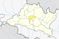
Gothatar
Location in Nepal
Coordinates: 27°42′N85°23′E / 27.70°N 85.38°E / 27.70; 85.38
CountryFlag of Nepal.svg    Nepal
Province No. 3
District Kathmandu
Government
Population
 (2011)
  Total26,169
Time zone UTC+5:45 (Nepal Time)

Gothatar is a village and former Village Development Committee that is now part of Kageshwari-Manohara Municipality in Kathmandu District in Province No. 3 of central Nepal. It is divided into three wards: 7, 8, and 9. Previously there were 9 wards when it was the Village Development Committee but now it has been changed to Municipality and divided. Old wards 1, 2, 3, and 4 have been changed to ward number 8. Old ward number 5 have been changed to ward number 7 combined with Mulpani and Old 6, 7, 8, and 9 have been changed to ward number 9 under Kageshwori Manohara Municipality. At the time of the 2011 Nepal census it had a population of 26,169 and had 6,749 households in it. [1] The Bagmati bridge on the north side connects Gothatar with the roadway to Jorpati. The roadway to the west side connects with Old Sinamangal (Pepsicola) via the road to Jadibuti the east side roadway connects to Mulpani, and the south side borders Kathmandu and Bhaktapur.

One of the major attractions in Gothatar is the Krishna Parnami Mandir. Historically, there was a palace named Manohara Durbar, built in 1879 by Commanding General Jagat Jung Rana, the son of Jung Bahadur Rana. It served as his private residence. However, the palace no longer exists.

As local people said the name Gothatar is derived from the word “गोठ” (cattle house) of the Rana family. Between 2007 and 2010, the population density increased rapidly as more houses were constructed. The majority of Gothatar’s population consists of Hindu Brahmins and Kshetris, with many natives still engaging in farming and maintaining cowsheds despite the proximity to metropolitan Kathmandu.

There is often confusion between Gothatar and Kadaghari, but Kadaghari falls under Gothatar. Gothatar has maintained its unique identity since ancient times.

View from Gothatar Height Panoramic view of Naya Basti from Gothatar-2.jpg
View from Gothatar Height


The public transportation in this area mainly consists of Nepal Yatayat and much more transportation has been added like Gothatar Yatayat, Riddhi Siddhi Yatayat, and Force bus transportation, On a clear day, a beautiful panorama of the Ganesh Himal can be seen from here. And you can see a clear view of Phulchowki tower. Tribhuvan International Airport also joins Gothatar and you can see that the part of Airport radar area that part was taken by the Airport to increase its size and Gothatar lost its size on the map. Gothatar is located on the banks of the Holy Bagmati River the soil of this region is found fertile.

Related Research Articles

<span class="mw-page-title-main">Kathmandu</span> Capital and largest city in Nepal

Kathmandu, officially Kathmandu Metropolitan City, is the capital and most populous city of Nepal with 845,767 inhabitants living in 105,649 households as of the 2021 Nepal census and approximately 4 million people in its urban agglomeration. It is located in the Kathmandu Valley, a large valley in the high plateaus in central Nepal, at an altitude of 1,400 metres.

<span class="mw-page-title-main">Bagmati River</span> River in Nepal

The Bagmati River flows through the Kathmandu valley of Nepal, separating the cities of Kathmandu and Patan, before flowing through Madesh Province of southern Nepal and joining the Kamla River in the Indian state of Bihar. It is considered holy by both Hindus and Buddhists. A number of Hindu temples are located on its banks.

<span class="mw-page-title-main">Lalitpur, Nepal</span> City in Bagmati Province, Nepal

Lalitpur Metropolitan City is a metropolitan city and fourth most populous city of Nepal with 299,843 inhabitants living in 49,044 households per the 2021 census. It is located in the south-central part of Kathmandu Valley, a large valley in the high plateaus in central Nepal, at an altitude of 1,400 metres.

<span class="mw-page-title-main">Bharatpur, Nepal</span> Metropolitan City in Bagmati Province, Nepal

Bharatpur is a city in south central Nepal. It is the third most populous city of Nepal after Kathmandu and Pokhara with 369,377 inhabitants in 2021. It is also the second largest metropolitan city in Nepal by area. It is the district headquarter of the Chitwan District.

<span class="mw-page-title-main">Duwakot</span> Village of Changunarayan Municipality in Bagmati Province, Nepal

Duwakot is a settlement and former Village Development Committee—now part of Changunarayan municipality, located in Bhaktapur district of Bagmati Province in central Nepal. At the time of the 1991 Nepal census, it had a population of 5,157 with 905 houses in it.

Kageshwori Manohara Municipality was incorporated on Mangsir 16, 2071 as the decision of the council of ministers of Government of Nepal. It was formed by combining six village development committees: Gothatar, Mulpani, Danchhi, Bhadrabas, Alapot, and Gagalfedi. Kathmandu valley comprises three cities: Kathmandu, Bhaktapur, and Lalitpur. Kageshwori Manohara is one of the municipalities situated at northeast of Kathmandu.

Danchhi is a village and former Village Development Committee that is now part of Kageshwari-Manohara Municipality in Kathmandu District in Province No. 3 of central Nepal. At the time of the 2011 Nepal census, it had a population of 11,246 and had 2,593 households in it. Danchhi is now included in Kageswori Manohara Municipality. Danchhi/Thali is bounded by Bagmati and Manohara river. The major places include Thali/थली, Nayapati, Bhadrawas, Hariyalinagar, Dumakhal, and Gajarkot. The major government schools are Shree Sahid Aadarsha Uchha MaVi, Shree Kanti Bhairab MaVi, and Shree Chaulanarayan PraVi. Private schools include Miniland English High School, Mount Everest Secondary School, Pragya Sadan School, Alpine Academy, and Hindu Vidhya Peeth.

<span class="mw-page-title-main">Koteshwor</span> Neighbourhood in Kathmandu, Province No. 3, Nepal

Koteshwor is a place, located in Kathmandu District. In 1991, Kathmandu Metropolitan City was expanded by incorporating Koteshwor as Ward No. 32. It encompasses 395 hectares and is bounded by the Manohara river in the east and south, the Bagmati river in the west, and share borders with Gothatar in the north, Madhyapur Thimi municipality of Bhaktapur District in east and Lalitpur metropolitan city in the south. With respect to basic services, almost all homes in the ward have access to electricity, but the same cannot be said about drinking water. At the time of the 1991 Nepal census it had a population of 5,787 living in 1,154 households. The ward contains 8,716 households. The population in 2001 was 35,184.

Mulpani is a village and former Village Development Committee that is now part of Kageshwari-Manohara Municipality in Kathmandu District in Province No. 3 of central Nepal. Mulpani was previously known as Bhaimal, meaning "no fear". At the time of the 1991 Nepal census it had a population of 4,718 living in 843 households. The main occupation of the people in the village is agriculture. Mulpani is surrounded by Bagmati and Manohara river. Mulpani is famous for the Nepal's biggest International Cricket Ground, known as Mulpani Cricket Stadium, which is under construction. In recent years, Mulpani has seen much change in its infrastructure and people as well. The main occupation in Mulpani was agriculture but now employment is more diverse.

<span class="mw-page-title-main">Sundarijal</span> Village of Gokarneshwar Municipality in No. 3, Nepal

Sundarijal is a village and former Village Development Committee that is now part of Gokarneshwar Municipality in Kathmandu district in Province No. 3 of central Nepal.

Gamhariya was a village development committee in Rautahat District in the Narayani Zone of south-eastern Nepal.

Jagatpur is a village development committee in Chitwan District, Bagmati Province, Central Development Region, Nepal. At the time of the 2011 Nepal census it had a population of 11,195 people living in 2,635 individual households.

<span class="mw-page-title-main">Thapathali Durbar</span> Building in Kathmandu, Nepal

Thapathali Durbar was a palace complex in Kathmandu, the capital of Nepal. Thapathali means abode of the Thapas. It was initially built by Nain Singh Thapa of the Thapa dynasty but was later occupied by Jung Bahadur Rana, as prime minister, the executive head of Nepal. The palace complex, located north of the Bagmati river, encompasses an impressive and vast array of courtyards, gardens, and buildings. Many palaces and buildings were built throughout late 1840s to 1900, initially by Nain Singh Thapa, a member of the aristocratic Thapa family and brother of Bhimsen Thapa, and later was acquired by Nain Singh Thapa's grandson Jung Bahadur Rana. Further additions were made by successive Ranas up to the 19th century.

<span class="mw-page-title-main">Babar Mahal</span> Building in Kathmandu, Nepal

Babar Mahal, Baber Mahal is a Rana palace in Kathmandu, the capital of Nepal. The palace complex, located north of the Bagmati river, was incorporated in an impressive and vast array of courtyards, gardens and buildings. Initially, the palace was under Jung Bahadur Rana's Thapathali Durbar but was later separated, demolished and rebuilt by Chandra Shumsher Jang Bahadur Rana, as prime minister and the executive leader of Nepal.

<span class="mw-page-title-main">Kageshwari-Manohara</span> Municipality in Bagmati, Nepal

Kageshwori-Manohara is a municipality in Kathmandu District in the Bagmati Province of Nepal that was established on 2 December 2014 by merging the former Village development committees of Aalapot, Bhadrabas, Danchhi, Gagalphedi, Gothatar and Mulpani. The office of the municipality is in Thali Danchhi in Ward No. 5.

<span class="mw-page-title-main">Bagmati Province</span> Province in central Nepal

Bagmati Province is one of the seven provinces of Nepal established by the constitution of Nepal. Bagmati is Nepal's second-most populous province and fifth largest province by area. It is bordered by Tibet Autonomous Region of China to the north, Gandaki Province to the west, Koshi Province to the east, Madhesh Province and the Indian state of Bihar to the south. With Hetauda as its provincial headquarters, the province is also the home to the country's capital Kathmandu, is mostly hilly and mountainous, and hosts mountain peaks including Gaurishankar, Langtang, Jugal, and Ganesh.

<span class="mw-page-title-main">Municipalities of Nepal</span> Type of local-level administrative subdivision of Nepal

A municipality in Nepal is an administrative division in the Provinces of Nepal. The urban population of Nepal refers to the inhabitants residing in the designated municipal area. Population size has been taken as the principal criteria in the declaration of urban areas in Nepal since 1961. Municipalities can therefore also include rural areas. It functions as a sub-unit of a district. Nepal currently has 293 municipalities, which given the 2011 population estimate of 16,656,057.

<span class="mw-page-title-main">Sinamangal</span> Neighborhood in Kathmandu in Kathmandu District, Bagmati Province, Nepal

Sinamangal is a residential area of Kathmandu, the capital city of Nepal, on the banks of Bagmati River. It borders Baneshwor and Gaucharan. Tribhuvan International Airport located in Sinamangal divides Eastern side Purano Sinamangal, Pepsicola from Western side Sinamangal both belonging to Kathmandu Metropolitan City. One of the residential area of Kathmandu, Pepsicola Town planning is located in Purano Sinamangal.

<span class="mw-page-title-main">Kathmandu 2 (constituency)</span> Parliamentary constituency in Nepal

Kathmandu 2 is one of 10 parliamentary constituencies of Kathmandu District in Nepal. Kathmandu 2(A) consisting Koteshwor and Pepsicola of Kathmandu Metropolitan City. Kathmandu 2(B) consisting areas of Kageshwari-Manohara Municipality and Shankharapur Municipality. This constituency came into existence on the Constituency Delimitation Commission (CDC) report submitted on 31 August 2017.

References

  1. "Archived copy" (PDF). Archived from the original (PDF) on 2013-07-31. Retrieved 2012-11-01.{{cite web}}: CS1 maint: archived copy as title (link)