Chalnakhel

Last updated
Chalnakhel
चाल्नाखेल
Village of Dakshinkali Municipality Ward 1
Nepal adm location map.svg
Red pog.svg
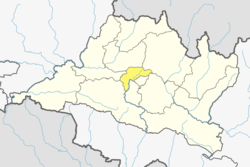
Chalnakhel
Location in Nepal
Coordinates: 27°38′24″N85°16′12″E / 27.64000°N 85.27000°E / 27.64000; 85.27000
CountryFlag of Nepal.svg   Nepal
Province No. 3
District Kathmandu District
Population
 (2011)
  Total
4,365
  Religions
Hindu
Time zone UTC+5:45 (Nepal Time)
Bagmati river at Chalnakhel 2013 Bagmati river at Chalnakhel 2013.jpg
Bagmati river at Chalnakhel 2013
Foggy Chalnakhel in Winter 2009 Chalnakhel in Winter 2009 by Ashish Lohorung.jpg
Foggy Chalnakhel in Winter 2009

Chalnakhel is a village and former Village Development Committee that is now part of Dakshinkali Municipality in Kathmandu District in Province No. 3 of central Nepal. At the time of the 2011 Nepal census it had a population of 4,365 living in 1,005 households. [1]

Contents

Toponymy

Linguistic origin

Etymology

“Chalna” means to walk or move. “Khel” refers to an open area, field, or playground. It is said that the place got its name because travelers used to rest there before continuing their journey.

Chalna (चल्ना) means “to walk, to move” and comes from Sanskrit चल (chala) meaning “moving, mobile”. It evolved into Hindi/Nepali verb root चल- (chal-). Khel (खेल) means “field, open ground, play area” and comes from Sanskrit क्रीडा (krīḍā) meaning “play,” but in Nepali it can also refer to a “flat open space.” The toponym is of descriptive origin, indicating a transit or resting place in an open area, associated with movement and travelers [2]

References

  1. "National Population and Housing Census 2011" (PDF). Government of Nepal, National Planning Commission Secretariat, Central Bureau of Statistics. Archived from the original (PDF) on 2013-01-24. Retrieved 28 March 2014.
  2. Sthaan Naam Kosh.