Chunikhel

Last updated

Chunikhel
चुनिखेल
Village of Budanilkantha Municipality
Nepal adm location map.svg
Red pog.svg
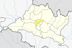
Chunikhel
Location in Nepal
Coordinates: 27°46′N85°23′E / 27.76°N 85.38°E / 27.76; 85.38 Coordinates: 27°46′N85°23′E / 27.76°N 85.38°E / 27.76; 85.38
CountryFlag of Nepal.svg    Nepal
Province No. 3
District Kathmandu District
Population
 (2011)
  Total4,449
Time zone UTC+5:45 (Nepal Time)

Chunikhel is a village and former Village Development Committee that is now part of Budanilkantha Municipality in Kathmandu District in Province No. 3 of central Nepal. At the time of the 2011 Nepal census it had a population of 4,449 living in 859 households. [1] Chunikhel it has 15 VDC in total. It is located in 27°45'31.1"N 85°22'17.0"E just few kilometre away from heart of kathmandu. Chunikhel is gate for entering Shivapuri National park.

Related Research Articles

Choukati Village development committee in Bagmati Zone, Nepal

Chaukati is a village in Sindhupalchok District in the Bagmati Zone of central Nepal. At the time of the 1991 Nepal census it had a population of 2346 and had 539 houses in the village. By 2011 the population had become 2497 in 627 households.

Maneshwara Village development committee in Bagmati Zone, Nepal

Maneshwara is a village in Sindhupalchok District in the Bagmati Zone of central Nepal. At the time of the 1991 Nepal census, it had a population of 3,065, and had 642 houses in the village. By 2011 the population had become 3,393 in 789 households.

Pagretar Village development committee in Bagmati Zone, Nepal

Pagretar is a village development committee in Sindhupalchowk District in the Bagmati Zone of central Nepal. Kothe is a populated location within the committee area. In 1991, there were 633 houses, and at the time of the 2001 Nepal census Pagretar had a population of 3,352. By 2011, the population had become 2,952 in 762 households.

Pedku Village development committee in Bagmati Zone, Nepal

Pedku is a village in Sindhupalchok District in the Bagmati Zone of central Nepal. At the time of the 2013 Nepal census it had a population of 2284 and had 408 houses in the village. In 2011 the population was 1600 in 391 households.

Baluwa, Kathmandu Village of Gokarneshwar Municipality in Bagmati Province, Nepal

Baluwa is a village and former Village Development Committee that is now part of Gokarneshwar Municipality in Kathmandu District in Bagmati Province of central Nepal. At the time of the 2011 Nepal census it had a population of 5,467 and had 1,204 houses in it. It is located at north-east side from the capital city of Nepal. It touch Nuwakot District to the north and Gorkna VDC to the south. In east side, there is Nayapati VDC and in west Kapan VDC.

Chalnakhel Village of Dakshinkali Municipality in No. 3, Nepal

Chalnakhel is a village and former Village Development Committee that is now part of Dakshinkali Municipality in Kathmandu District in Province No. 3 of central Nepal. At the time of the 2011 Nepal census it had a population of 4,365 living in 1,005 households.

Chapali Bhadrakali Village of Budanilkantha Municipality in No. 3, Nepal

Chapali Bhadrakali is a village and former Village Development Committee that is now part of Budanilkantha Municipality in Kathmandu District in Province No. 3 of central Nepal. At the time of the 2011 Nepal census it had a population of 10,827 and had 2,574 households in it.

Chhaimale Village of Dakshinkali Municipality in No. 3, Nepal

Chhaimale is a village and former Village Development Committee that is now part of Dakshinkali Municipality in Kathmandu District in Province No. 3 of central Nepal. At the time of the 2011 Nepal census it had a population of 4,216 living in 968 households.

Goldhunga Village of Tarakeshwar Municipality in No. 3, Nepal

Goldhunga is a village and former Village Development Committee that is now part of Tarakeshwar Municipality in Kathmandu District in Province No. 3 of central Nepal. According to National Population and Housing Census 2011, there are 3,806 households in the VDC and the total population is 16,174.

Jhor Mahankal Tokha village in Bagmati Province, Nepal

Jhor Mahankal is a village and former village development committee which is part of the Tokha municipality in Kathmandu District, Bagmati Province of central Nepal. It had a population of 4,103 in the 2011 Nepal census, with 873 households. Jhor Mahankal is known for Baruneshwar Gufa and its waterfalls. A number of clans live there, primarily the Adhikaris, Lamichanne, Dulals, Bidari, and Tamang. Jhor Mahankal is 7 kilometres (4.3 mi) from Kathmandu, with bus service from the Jhor bus station to Simalchour Syampati and Samakhushi and Ratna Park in Kathmandu.

Jitpurphedi Village of Tarakeshwar Municipality in No. 3, Nepal

Jitpurphedi is a village and former Village Development Committee that is now part of Tarakeshwar Municipality in Kathmandu District in Province No. 3 of central Nepal. At the time of the 1991 Nepal census it had a population of 5,135 and had 1,103 households in it.

Jorpati Village of Gokarneshwar Municipality in No. 3, Nepal

Jorpati is a village and former Village Development Committee that is now part of Gokarneshwar Municipality in Kathmandu District in Province No. 3 of central Nepal. At the 2011 census it had a population of 84,567 making it one of the largest villages in the world. At the time of the 1991 Nepal census it had a population of 10,796 and had 1988 households in it.

Ramkot, Nepal Village of Nagarjun Municipality in Province No. 3, Nepal

Ramkot is a village of the Nagarjun Municipality, Bagmati Province, Nepal. The 2011 Nepal census recorded that Ramkot had a population of 6,303 people in 1,427 independent households.

Thankot Village of Chandragiri Municipality in No. 3, Nepal

Thankot is a village and former Village Development Committee that is now part of Chandragiri Municipality in Kathmandu District in Province No. 3 of central Nepal. It lies in the lap of Chandragiri Hill. According to the 2011 Nepal census it has a population of 12,047 and has 2,820 households.

Tinthana Village of Chandragiri Municipality in No. 3, Nepal

Tinthana is a village and former Village Development Committee that is now part of Chandragiri Municipality in Kathmandu District in Province No. 3 of central Nepal. At the time of the 2011 Nepal census it had a population of 9,726.

Tokha Saraswati Village of Tokha Municipality in No. 3, Nepal

Tokha Saraswati is a village and former Village Development Committee that is now part of Tokha Municipality in Kathmandu District in Province No. 3 of central Nepal. At the time of the 2011 Nepal census it had a population of 5152.

Gauradaha Municipality Municipality in Province No. 1, Nepal

Gauradaha is a municipality in Jhapa District in the Province No. 1 of eastern Nepal. After the government announcement the municipality was established on 19 September 2015 by merging the existing Maharanijhoda, Baigundhura, Juropani, Kohabara and Gauradaha village development committees (VDCs). The center of the municipality is establish in the mid of Gauradaha, Dhobiniya chowk. At the time of the 2011 Nepal census after merging the four VDCs population it had a total population of 47,393 persons. After the government decision the number of municipalities has reached 217 in Nepal.

Siddhicharan Municipality Municipality in Nepal

Siddhicharan is a municipality and the district headquarter of Okhaldhunga District in Province No. 1 of Nepal that was established in May 2014 by merging the two former Village development committees Andheri, Thulachhap, Jyamire, Salleri, Rumjatar and Okhaldhunga. It is named after the Nepali poet Siddhicharan Shrestha. At the time of the 2011 Nepal census it had a population of 27,995 people living in 6,994 individual households.

Gokarneshwar municipality in Kathmandu District, Nepal

Gokarneshwar is a municipality in Kathmandu District in the Bagmati Province of Nepal that was established on 2 December 2014 by merging the former Village development committees Sundarijal, Nayapati, Baluwa, Jorpati and Gokarna. The office of the municipality is that of the former Jorpati village development committee. The river Bagmati has its origin as the name Bagh Dwar situated in the middle of the Shivapuri jungle in this municipality. In the village on the banks of the Bagmati River stands the Gokarna Mahadev temple, built in 1582. In late August or early September people go to this temple to bathe and make offerings in honor of their fathers, living or dead, on a day called Gokarna Aunsi.

Sundar Haraicha Municipality Municipality in Province No. 1, Nepal

Sundar Haraicha is a municipality in Morang District of Province No. 1 in Nepal that was established on 10 March 2017 by merging the former municipalities Sundar Dulari and Koshi Haraicha. At the time of the 2011 Nepal census, the localities formed had a joint population of 80,518 people living in 18,610 individual households.

References

  1. "National Population and Housing Census 2011" (PDF). Government of Nepal, National Planning Commission Secretariat, Central Bureau of Statistics. Archived from the original (PDF) on 24 January 2013. Retrieved 1 November 2012.