Nagarjun नागार्जुन | |
|---|---|
 Nagarjun municipality with Tarakeshwar and Budhanilkantha in background. | |
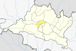
 Nagarjun Location in Nepal  Nagarjun Nagarjun (Nepal) | |
| Coordinates: 27°43′57″N85°15′24″E / 27.73250°N 85.25667°E | |
| Country | |
| Province | Bagmati |
| District | Kathmandu |
| Established | December 2014 |
| Government | |
| • Mayor | Mohan Basnet (NC) |
| • Deputy Mayor | Sushila Adhikari (NCP) |
| Area | |
• Total | 29.8 km2 (11.5 sq mi) |
| Population | |
• Total | 115,437 |
| • Density | 3,870/km2 (10,000/sq mi) |
| • Ethnicities | |
| Time zone | UTC+5:45 (Nepal Time) |
| Website | www |
Nagarjun is a municipality in Kathmandu District in Bagmati Province of Nepal. It was formed on 2 December 2014 by merging the former VDCs of Bhimdhunga, Ichangu Narayan, Ramkot, Syuchatar and Sitapaila. [1] [2] The office of the municipality is located at Harisiddhi, Sitapaila. There are ten wards in the municipality.