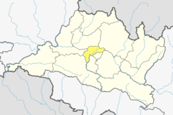
Bhimdhunga

Last updated
Bhimdhunga
भीमढुंगा
Village of Nagarjun Municipality
Nepal adm location map.svg
Red pog.svg
Bhimdhunga
Location in Nepal
Coordinates: 27°43′48″N85°14′24″E / 27.73000°N 85.24000°E / 27.73000; 85.24000 Coordinates: 27°43′48″N85°14′24″E / 27.73000°N 85.24000°E / 27.73000; 85.24000
CountryFlag of Nepal.svg    Nepal
Province Province No. 3
District Kathmandu
Population (2011)
  Total 2,915
  Religions Hindu
Time zone UTC+5:45 (Nepal Time)

Bhimdhunga is a village and former Village Development Committee that is now part of Nagarjun Municipality in Province No. 3 of central Nepal. At the time of the 2011 Nepal census it had a population of 2,915 and had 619 houses in it. [1]

Village Small clustered human settlement smaller than a town

A village is a clustered human settlement or community, larger than a hamlet but smaller than a town, with a population ranging from a few hundred to a few thousand. Though villages are often located in rural areas, the term urban village is also applied to certain urban neighborhoods. Villages are normally permanent, with fixed dwellings; however, transient villages can occur. Further, the dwellings of a village are fairly close to one another, not scattered broadly over the landscape, as a dispersed settlement.

Nagarjun Municipality Municipality in Province No. 3, Nepal

Nagarjun is a municipality in Kathmandu District in the Province No. 3 of Nepal that was established on 2 December 2014 by merging the former Village development committees Bhimdhunga, Ichangu Narayan, Ramkot, Syuchatar and Sitapaila. The office of the municipality is located at Harisiddhi Sitapaila. Previously there were 14 wards in the municipality. After implementation of federalism, it has been now decreased to 10 wards.

Province No. 3 Province in Nepal

Province No. 3 is one of the seven provinces of Nepal established by the country's new constitution of 20 September 2015. Home to the country's capital Kathmandu, it is mostly hilly and mountainous, home to peaks including Gaurishankar, Langtang, Jugal, and Ganesh. The province covers an area of 20,300 km2, about 14% of the country's total area, and has an altitude low enough to support deciduous, coniferous, and alpine forest and woodland. Temperature varies with altitude. Rainfall takes place mainly during the summer.

Related Research Articles

The 1991 Nepal census was a widespread national census conducted by the Nepal Central Bureau of Statistics.

Batase, Sindhupalchok City in Bagmati Zone, Nepal

Batase is a village and market center of Chautara Sangachowkgadi Municipality in Sindhupalchok District in the Bagmati Zone of central Nepal. The formerly Village Development Committee was merged to the new Municipality in 2017. At the time of the 1991 Nepal census it had a population of 4764 and had 1002 houses in the village.

Irkhu City in Bagmati Zone, Nepal

Irkhu is a village and market center of Chautara Sangachowkgadi Municipality in Sindhupalchok District in the Bagmati Zone of central Nepal. The formerly Village Development Committee was merged to the new Municipality in 2017. At the time of the 1991 Nepal census it had a population of 2628 and had 480 houses in the village.

Kadambas, Nepal City in Bagmati Zone, Nepal

Kadambas is a village and market center of Chautara Sangachowkgadi Municipality in Sindhupalchok District in the Bagmati Zone of central Nepal. The formerly Village Development Committee was merged to the new municipality in 2017. At the time of the 1991 Nepal census it had a population of 3133 and had 571 houses in the village.

Siddheshwar, Baitadi Village development committee in Mahakali Zone, Nepal

Siddheshwar is a village development committee in Baitadi District in the Mahakali Zone of western Nepal. At the time of the 1991 Nepal census it had a population of 3,360 and had 563 houses in the village.

Gagalphedi Village of Kageshwari-Manohara Municipality in No. 3, Nepal

Gapalphedi is a village and former Village Development Committee that is now part of Kageshwari-Manohara Municipality in Kathmandu District in Province No. 3 of central Nepal. At the time of the 2011 Nepal census it had a population of 5,533 and had 1,166 households in it.

Jorpati Village of Gokarneshwar Municipality in No. 3, Nepal

Jorpati is a village and former Village Development Committee that is now part of Gokarneshwar Municipality in Kathmandu District in Province No. 3 of central Nepal. At the 2011 census it had a population of 84,567 making it one of the largest villages in the world. At the time of the 1991 Nepal census it had a population of 10,796 and had 1988 households in it.

Satungal Village of Chandragiri Municipality in No. 3, Nepal

Satungal is a village and former Village Development Committee that is now part of Chandragiri Municipality in Kathmandu District in Province No. 3 of central Nepal. Satungal is also known as Satyapur. At the time of the 1991 Nepal census it had a population of 2730 and had 464 households in it. At the time of the 2001 Nepal census Satungal had a population of 5834 and had 1375 households in it. Satungal had 5173 literate people i.e. 88.66%..

Lakshmanpur Village development committee in Bheri Zone, Nepal

Lakshmanpur is a town in Banke District in the Bheri Zone of south-western Nepal. At the time of the 1991 Nepal census it had a population of 3,416 and had 668 houses in the town.

Naubasta Village development committee in Bheri Zone, Nepal

Naubasta is a town in Banke District in the Bheri Zone of south-western Nepal. At the time of the 1991 Nepal census it had a population of 11,160 and had 1663 houses in the town.

Gumda Village development committee in Gandaki Zone, Nepal

Gumda is a village development committee in Gorkha District in the Gandaki Zone of northern-central Nepal. At the time of the 1991 Nepal census it had a population of 2,312 and had 481 houses in the village.

Prok, Nepal Village development committee in Gandaki Zone, Nepal

Prok is a village development committee in Gorkha District in the Gandaki Zone of northern-central Nepal. At the time of the 1991 Nepal census it had a population of 739 and had 219 houses in the village.

Bhimkhori Village development committee in Bagmati Zone, Nepal

Bhimkhori is a village development committee in Kabhrepalanchok District in the Bagmati Zone of central Nepal. At the time of the 1991 Nepal census it had a population of 4519 and had 764 houses in it.

Dhunkharka Bahrabise Village development committee in Bagmati Zone, Nepal

Bethanchwok GP-Dhunkharka is a village development committee in Kavrepalanchok District in the Bagmati Zone of central Nepal. At the time of the 1991 Nepal census it had a population of 4372 and had 747 houses in it.

Dolalghat Village development committee in Bagmati Zone, Nepal

Dolalghat is a village development committee in Kabhrepalanchok District in the Bagmati Zone of central Nepal.

Johang Village Development committee in Lumbini, Nepal

Johang is a Village Development Committee VDC in Gulmi District in the Lumbini Zone of Western Nepal. At the time of the 2011 Nepal census it had a population of about 10000 living in 1509 individual households.

Khadgakot Village Development Committee in Lumbini Zone, Nepal

Situated on the bank of Kaligandaki river, Khadgakot is a town and Village Development Committee, in Gulmi District in the Lumbini Zone of central Nepal. At the time of the 1991 Nepal census it had a population of 4297 persons living in 808 individual households.

Laxmipur is a former town and Village Development Committee in Ilam District in the Mechi Zone of eastern Nepal.

Mahuwa, Lumbini Village development committee in Lumbini Zone, Nepal

Mahuwa is a village development committee in Kapilvastu District in the Lumbini Zone of southern Nepal. At the time of the 1991 Nepal census it had a population of 4666.

Pathari-Sanischare Municipality Municipality in Kosi Zone, Nepal

Pathari Sanischare (पथरी-शनिश्चरे) is a Municipality in Morang District in the Koshi Zone of south-eastern Nepal. It was formed by merging two existing village development committees i.e. Pathari and Sanischare in May 2014.

References

  1. "Nepal Census 2001". Nepal's Village Development Committees. Digital Himalaya. Archived from the original on 12 October 2008. Retrieved 2008-08-28.