Jutpani is a village development committee in Chitwan District in Bagmati Province of southern Nepal. At the time of the 1991 Nepal census it had a population of 8,762 people living in 1,714 individual households.
Bhotechaur is a village in Sindhupalchok District in the Bagmati Zone of central Nepal. At the time of the 1991 Nepal census it had a population of 4995 and had 870 houses in the village.
Dilasaini is a former village development committee that is now a Rural Municipality in Baitadi District in Sudurpashchim Pradesh of western Nepal. At the time of the 1991 Nepal census it had a population of 4,828 and had 849 houses in the village. There is one plus two, two high schools and many primary schools in the VDC. This VDC is bordered by Mathairaj, Gokuleshwor, Rudreswor and Rim VDC and Darchula district in the northwest. Ths VDC is named after a local deity. The temple of this devi is located in Dhamigaun which is one of the wards of the VDC. This temple is famous in far-western Nepal for the sacrifice of huge number of bull buffaloes on occasion of Dashain.

Balambu is a village and former Village Development Committee that is now part of Chandragiri Municipality in Kathmandu District in Province No. 3 of central Nepal. At the time of the 2011 Nepal census it had a population of 7,323 and had 1,734 houses in it. Porters play a vital role in Nepal's tourism industry; every year they support thousands of tourists in tackling the iconic trails of the Everest region. Often climbing multiple time during the high season, the trekking industry provides an income that helps porters earn a living and support their families. However, they are also often the least valued on the mountain and because of the pressures to get an income can face exploitation and mistreatment from trekking operators. To address these issues, Kathmandu Environmental Education Program (KEEP) has created the Porter Awareness and Welfare training program. This provides porters with information about their work rights as well as health, hygiene and general First Aid skills. The program also offers guidance on appropriate trekking clothing and gear, and how to access KEEP's Porter Clothing Centre, which loans warm clothing and appropriate footwear to porters.
Jorpati is a village and former Village Development Committee that is now part of Gokarneshwar Municipality in Kathmandu District in Province No. 3 of central Nepal. At the 2011 census it had a population of 84,567 making it one of the largest villages in the world. At the time of the 1991 Nepal census it had a population of 10,796 and had 1,988 households in it.
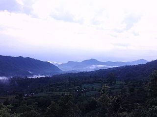
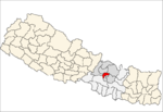
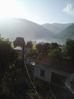
Mirkot is a village development committee in Gorkha District in the Gandaki Zone of northern-central Nepal. It is also known as Bhirkot, Gorkha. It lies on the western side of the headquarters of Gorkha. According to the National Population and Housing Census 2011, it had a population of 5261, and had 1388 households in the village. Its neighbourhood VDCs are Gaikhur, Dhuwakot, Khoplang, Chyangli, Palumtar, Chhoprak and Deurali. Such as Kotgadi, Lakang, Mahadev Temple are the most important places of Mirkot. The central part of Mirkot VDC is called Bagdanda, Where the main office of the VDC and Mirkot Higher Secondary School are located.
Lagmamdha Guthi, often shortened to 'Lagma', is a Village Development Committee (VDC) in Dhanusa District in the Janakpur Zone of south-eastern Nepal. At the time of the 1991 Nepal census, it had a population of 3,726 people living in 663 individual households.
Bisankhunarayan is a village and former Village Development Committee that is now part of Godawari Municipality in Province No. 3 of central Nepal. At the time of the 1991 Nepal census it had a population of 3867 in 707 individual households. Bishankhunarayan is a historic place because of Vishnu's temple called Bishankhu narayan, a popular Hindu god. Narayan is another name for Lord Vishnu. A small cave is located inside the temple.
Rupakot is a Village Development Committee (VDC) in Gulmi District in the Lumbini Zone of central Nepal. Its headquarters is in Myal pokhara. It is located in about the center of Gulmi District. It is surrounded by hills. Its main religion is Hinduism. There are many temples like Chhatra Thaan, Shiddababa temple, Shiva Temple, Ram Temple, Debi deurali temple etc. The main sources of revenue for the village are agriculture and foreign employment. At the time of the 2001 Nepal census, it had a population of 3521 persons residing in 704 individual households. 76.48% of students attend school. The most populated parts of this VDC is Damuka, Sota & Ekle Pipal.

Khokana is a former Village Development Committee (VDC) which has been merged with the neighbouring VDC's of Bungamati, Chhampi, Dukuchhap, Sainbu and other 38 VDC's to form the Metropolitan City of Lalitpur in Lalitpur District in the Bagmati Zone of central Nepal. At the time of the 1991 Nepal census, Khokana had a population of 4258 living in 699 individual households. According to 2011 Nepal census, Khokana had a population of 4927 living in 1056 individual households.
Sunkhani is a village development committee (VDC) in Nuwakot District in the Bagmati Zone of central Nepal. At the time of the 1991 Nepal census it had a population of 2340 people living in 437 individual households.

Marpha is a village in Mustang District in the Dhawalagiri Zone of northern Nepal. At the time of the 1991 Nepal census it had a population of 1630 people living in 434 individual households.

Matihani is a municipality situated in Mahottari District of Nepal. The Municipality is well known for its historical significance and its festivities. The municipality was formed in 2016 by occupying current 9 sections (wards) from previous 9 former VDCs. It occupies an area of 29.02 sq. km with a total population of 31,026.
Madar, Nepal is a village development committee in Siraha District in the Sagarmatha Zone of south-eastern Nepal. At the time of the 1991 Nepal census it had a population of 7247 people living in 1203 individual households, with the local Maithali language. Had one health post with minimum facility. Temples are Shree Mata Durga Bhagabati, Shree Mmata Kali, the oldest one shree ramjanki temple. This VDC is situated beside borderline of India.
Dhaulakot is a village development committee in Darchula District in the Mahakali Zone of western Nepal. At the time of the 1991 Nepal census it had a population of 2094 people living in 337 individual households.
Huti is a village development committee (VDC) in Darchula District in the Mahakali Zone of western Nepal. At the time of the 1991 Nepal census it had a population of 2317 people living in 417 individual households. It is named after the village of Huti. The Brama Devta temple is located there at Huti-2 and is visited by many pilgrims.
Jhalariझलारी is a Village Development Committee in Kanchanpur District in Sudurpashchim Pradesh of South-Far-Western Nepal. At the time of the 1991 Nepal census it had a population of 10,590 people living in 1702 individual households.
Prakashpur is a village development committee in Sunsari District in the Kosi Zone in southeastern Nepal. It is near the Indo-Nepal border.

Letang, "लेटाङ " is a Municipality in Morang District in the Province No. 1 of south-eastern Nepal. It was formed by merging the existing Village Development Committees of Letang, Jante, Warrangi and Bhogateni.
Edited by ABHASH

Mirkot is a village development committee in Gorkha District in the Gandaki Zone of northern-central Nepal. It lies on the western side of the headquarters of Gorkha. According to the National Population and Housing Census 2011, it had a population of 5261, and had 1388 households in the village. Its neighbourhood VDCs are Gaikhur, Dhuwakot, Khoplang, Chyangli, Palumtar, Chhoprak and Deurali. Such as Kotgadi, Lakang, Mahadev Temple are the most important places of Mirkot. The central part of Mirkot VDC is called Bagdanda, Where the main office of the VDC and Mirkot Higher Secondary School are located.