
The Kathmandu Valley, also known as the Nepal Valley or Nepa Valley, National (Federal) Capital city, is a bowl-shaped valley located in the Himalayan mountains in Nepal. It lies at the crossroads of ancient civilizations of the Indian subcontinent and the broader Asian continent, and has at least 130 important monuments, including several pilgrimage sites for Hindus and Buddhists. There are seven World Heritage Sites within the valley.

Dhading District, a part of Bagmati Province, is one of the seventy-seven districts of Nepal. The district, with Dhading Besi as its district headquarters, covers an area of 1,926 square kilometres (744 sq mi), had a population of 338,658 in 2001 and 336,067 in 2011.
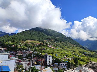
Tauthali is a village in Sindhupalchok District in Bagmati Province, central Nepal. Tauthali is 110 km away from Kathmandu.
Chalnakhel is a village and former Village Development Committee that is now part of Dakshinkali Municipality in Kathmandu District in Province No. 3 of central Nepal. At the time of the 2011 Nepal census it had a population of 4,365 living in 1,005 households.
Chapali Bhadrakali is a village and former Village Development Committee that is now part of Budanilkantha Municipality in Kathmandu District in Province No. 3 of central Nepal. At the time of the 2011 Nepal census it had a population of 10,827 and had 2,574 households in it.

Chobhar is a village in Kathmandu District in the Bagmati Zone of central Nepal and part of Kirtipur Municipality. At the time of the 1991 Nepal census it had a population of 5,627 living in 1,109 households.
Chunikhel is a village and former Village Development Committee that is now part of Budanilkantha Municipality in Kathmandu District in Province No. 3 of central Nepal. At the time of the 2011 Nepal census it had a population of 4,449 living in 859 households. Chunikhel it has 15 VDC in total. It is located in 27°45'31.1"N 85°22'17.0"E just few kilometre away from heart of kathmandu. Chunikhel is gate for entering Shivapuri National park.
Danchhi is a village and former Village Development Committee that is now part of Kageshwari-Manohara Municipality in Kathmandu District in Province No. 3 of central Nepal. At the time of the 2011 Nepal census, it had a population of 11,246 and had 2,593 households in it. Danchhi is now included in Kageswori Manohara Municipality. Danchhi/Thali is bounded by Bagmati and Manohara river. The major places include Thali/थली, Nayapati, Bhadrawas, Hariyalinagar, Dumakhal, and Gajarkot. The major government schools are Shree Sahid Aadarsha Uchha MaVi, Shree Kanti Bhairab MaVi, and Shree Chaulanarayan PraVi. Private schools include Miniland English High School, Mount Everest Secondary School, Pragya Sadan School, Alpine Academy, and Hindu Vidhya Peeth.
Jhor Mahankal is a village and former village development committee which is part of the Tokha municipality in Kathmandu District, Bagmati Province of central Nepal. It had a population of 4,103 in the 2011 Nepal census, with 873 households. Jhor Mahankal is known for Baruneshwar Gufa and its waterfalls. A number of clans live there, primarily the Adhikaris, Lamichanne, Dulals, Bidari, and Tamang. Jhor Mahankal is 7 kilometres (4.3 mi) from Kathmandu, with bus service from the Jhor bus station to Simalchour Syampati and Samakhushi and Ratna Park in Kathmandu.
Jorpati is a village and former Village Development Committee that is now part of Gokarneshwar Municipality in Kathmandu District in Province No. 3 of central Nepal. At the 2011 census it had a population of 84,567 making it one of the largest villages in the world. At the time of the 1991 Nepal census it had a population of 10,796 and had 1,988 households in it.
Kapan is a village and former Village Development Committee that is now part of Budanilkantha Municipality in Kathmandu District in Province No. 3 of central Nepal. It is situated in the northern part of Kathmandu. At the time of the 2011 Nepal census it had a population of 48,463 in 12,324 households. Kapan Sangit Sarowar, Kapan Monastery, Kapan Aani Gumba etc. are tourist places situated at Kapan. Kapan consists of several settlements, e. g.: Mahankal, New Colony, Jyotinagar, Saraswatinagar, Golphutar or Baluwakhani. Kapan has recently developed very high number of Paying Guest Houses for local-tourism.
Mulpani is a village and former Village Development Committee that is now part of Kageshwari-Manohara Municipality in Kathmandu District in Province No. 3 of central Nepal. Mulpani was previously known as Bhaimal, meaning "no fear". At the time of the 1991 Nepal census it had a population of 4,718 living in 843 households. The main occupation of the people living in this village is agriculture. Mulpani is surrounded by Bagmati and Manohara river. Mulpani is famous for the Nepal's biggest International Cricket Ground, known as Mulpani Cricket Stadium, which is under construction. In the recent years, Mulpani has seen much change in its infrastructure and people as well. The main occupation in Mulpani was agriculture but now employment is more diverse.

Ramkot is a village of the Nagarjun Municipality, Bagmati Province, Nepal. The 2011 Nepal census recorded that Ramkot had a population of 6,303 people in 1,427 independent households.
Sheshnarayan is a village and former Village Development Committee that is now part of Dakshinkali Municipality in Kathmandu District in Province No. 3 of central Nepal. At the time of the 1991 Nepal census it had a population of 2,867 and had 521 households in it. It is home to the Sheshnarayan Temple.

Sundarijal is a village and former Village Development Committee that is now part of Gokarneshwar Municipality in Kathmandu District in Province No. 3 of central Nepal.
Talku Dudechaur is a village and former Village Development Committee that is now part of Dakshinkali Municipality in Kathmandu District in Province No. 3 of central Nepal. At the time of the 2011 Nepal census it had a population of 2,858 and had 648 households in it.

Thankot is a village and former Village Development Committee that is now part of Chandragiri Municipality in Kathmandu District in Province No. 3 of central Nepal. It lies in the lap of Chandragiri Hill. According to the 2011 Nepal census it has a population of 12,047 and has 2,820 households.
Tokha Saraswati is a village and former Village Development Committee that is now part of Tokha Municipality in Kathmandu District in Province No. 3 of central Nepal. At the time of the 2011 Nepal census it had a population of 5,152.
Jagatpur is a village development committee in Chitwan District, Bagmati Province, Central Development Region, Nepal. At the time of the 2011 Nepal census it had a population of 11,195 people living in 2,635 individual households.

Gokarneshwor is a municipality in Kathmandu District in the Bagmati Province of Nepal that was established on 2 December 2014 by merging the former Village development committees Sundarijal, Nayapati, Baluwa, Jorpati and Gokarna. The office of the municipality is that of the former Jorpati village development committee. The river Bagmati has its origin as the name Bagh Dwar situated in the middle of the Shivapuri jungle in this municipality. In the village on the banks of the Bagmati River stands the Gokarna Mahadev temple, built in 1582. In late August or early September people go to this temple to bathe and make offerings in honor of their fathers, living or dead, on a day called Gokarna Aunsi.


