Goldhunga

Last updated
Goldhunga
गोलढुंगा
Nepal adm location map.svg
Red pog.svg
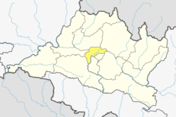
Goldhunga
Location in Nepal
Coordinates: 27°46′N85°17′E / 27.76°N 85.28°E / 27.76; 85.28
CountryFlag of Nepal.svg   Nepal
Province No. 3
District Kathmandu District
Population
 (2011)
  Total
16,174
Time zone UTC+5:45 (Nepal Time)

Goldhunga is a village and former Village Development Committee that is now part of Tarakeshwar Municipality in Kathmandu District in Province No. 3 of central Nepal. According to National Population and Housing Census 2011, there are 3,806 households in the VDC and the total population is 16,174. [1]

Contents

Toponymy

Linguistic origin

Etymology

“Gol” means round or circular. “Dhunga” means stone. Therefore, Goldhunga can be interpreted as “the place of the round stone” or “the circular rock.”

Gol (गोल) means “round, circular” and comes from Sanskrit गोल (gola) meaning ball, sphere, round object. Dhunga (ढुंगा) means “stone, rock” and comes from Sanskrit शिला (śilā) meaning stone, or स्थूण (sthūṇa) meaning lump/rock, adapted in modern Nepali as ढुंगा (dhungā). The toponym Goldhunga is descriptive in nature, meaning “place of the round stone,” likely referring to a local landmark or notable geological feature.

References

  1. "National Population and Housing Census 2011" (PDF). Government of Nepal, National Planning Commission Secretariat, Central Bureau of Statistics. Archived from the original (PDF) on 2013-07-31.