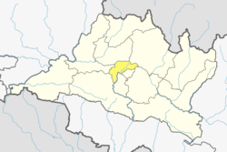
Balambu

Last updated
Balambu
बलम्बु
prnidhipuurnn mhaavihaar blmbu.JPG
Nepal adm location map.svg
Red pog.svg
Balambu
Location in Nepal
Coordinates: 27°42′N85°15′E / 27.700°N 85.250°E / 27.700; 85.250
CountryFlag of Nepal.svg    Nepal
Province No. 3
District Kathmandu District
Population
 (2011)
  Total7,323
  Religions
Hindu
Time zone UTC+5:45 (Nepal Time)

Balambu is a village and former Village Development Committee that is now part of Chandragiri Municipality in Kathmandu District in Province No. 3 of central Nepal. [1] At the time of the 2011 Nepal census it had a population of 7,323 and had 1,734 houses in it. [2] Porters play a vital role in Nepal's tourism industry; every year they support thousands of tourists in tackling the iconic trails of the Everest region. Often climbing multiple time during the high season, the trekking industry provides an income that helps porters earn a living and support their families. However, they are also often the least valued on the mountain and because of the pressures to get an income can face exploitation and mistreatment from trekking operators. To address these issues, Kathmandu Environmental Education Program (KEEP) has created the Porter Awareness and Welfare training program. This provides porters with information about their work rights as well as health, hygiene and general First Aid skills. The program also offers guidance on appropriate trekking clothing and gear, and how to access KEEP's Porter Clothing Centre, which loans warm clothing and appropriate footwear to porters.

Contents

Place to visit

Chandragiri Hills

Chandragiri Cable Car is a lift transportation system located in Kathmandu. Opened in 2016, the cable car runs from Thankot to Chandragiri Hills. The 2.4 km (9,095 ft) line has two stations. The cable car system consists of 38 gondolas. The Chandragiri Hills has Bhaleshwor Mahadev, one of the ancient temples which located in the hill above 2551 meters of sea level. Most of the tourists come to visit Thankot to visit Chandragiri Hills. The travelers are mostly from Kathmandu valley and outside of valley. It also promote tourism and helps the local livelihood. It also attracts foreign tourist. It costs 700 rupees for a round trip for locals and about $22 for foreigners. [3]

Tribhuwan Park

Tribhuwan Park is a park in Kathmandu. It is the most famous picnic destination inside Kathmandu Valley and on Saturdays is full picnic enjoying people. The rates to visit park is 40 rupees for local people with separate rates for picnics. The park was created to remember King Tribhuwan Bir Bikram Shaha Dev. It has plants of different species, gardens, and a view of the mountains and the valleys below. [3]

Matatirtha Temple

Matatirtha Temple is an iconic destination for religious tourism. It is located in Matatirtha. The word Matatirtha comes from two Sanskrit words, mata, meaning "mother" and tirtha meaning "sacred place". The VDC owes its name from a sacred pond in the VDC dedicated to mother. In Mother's day, people from different place visit temple because temple is delicated to mother and swim in the pond. [3]

Language

The language of Balambu is Nepal Bhasa's Lalitpur dialect with a few informal changes. [1]

Lalitpur standard dialectPronunciationBalambu informal changesPronunciationMeaning
अथेatheएकाःekaaLike that
थथेthatheथेकाःthekaaLike this
गथेgatheगेकाःgekaaLike what
मखू खँ ल्हाइम्हmakhu khan lhaaimhaगौरीgauriLiar

Related Research Articles

<span class="mw-page-title-main">Pokhara</span> Metropolitan city in Gandaki Province, Nepal

Pokhara is a metropolitan city in central Nepal, which serves as the capital of Gandaki Province. It is the second most populous city of Nepal after Kathmandu, with 599,504 inhabitants living in 120,594 households in 2021. It is the country's largest metropolitan city in terms of area. The city also serves as the headquarters of Kaski District. Pokhara is located 200 kilometres west of the capital, Kathmandu. The city is on the shore of Phewa Lake, and sits at an elevation of approximately 822m. The Annapurna Range, with three out of the ten highest peaks in the world—Dhaulagiri, Annapurna I and Manaslu—is within 15–35 mi (24–56 km) of the valley. The current mayor of Pokhara is Dhana Raj Acharya from CPN.

<span class="mw-page-title-main">Kathmandu District</span> District in Bagmati Province, Nepal

Kathmandu District is a district located in Kathmandu Valley, Bagmati Province of Nepal. It is one of the 77 districts of Nepal, covers an area of 413.69 km2 (159.73 sq mi), and is the most densely populated district of Nepal with 1,081,845 inhabitants in 2001, 1,744,240 in 2011 and 2,017,532 in 2021. The administrative headquarters of Kathmandu district is located in Kathmandu. The city has 21 post offices which handle mail from across the country and beyond, with Kathmandu DPO having 44,600 as its postal code for international mail delivery services like UPS or DHL Couriers etc.

<span class="mw-page-title-main">Rukum District</span> Former District in Nepal

Rukum District was a "hill" and "mountain" district some 280 km (170 mi) west of Kathmandu partially belonging to Lumbini Province and partially to Karnali Province before split into two districts Western Rukum and Eastern Rukum after the state's reconstruction of administrative divisions in 2017. Rukum covers an area of 2,877 km2 (1,111 sq mi) with population of 207,290 in 2011 Nepal census. Musikot was the district's administrative center.

<span class="mw-page-title-main">Tourism in Nepal</span> The tourist industry in Nepal

Tourism is the largest industry in Nepal and its largest source of foreign exchange and revenue. Possessing eight of the ten highest mountains in the world, Nepal is a hot spot destination for mountaineers, rock climbers and people seeking adventure. The Hindu and Buddhist heritage of Nepal and its cool weather are also strong attractions.

<span class="mw-page-title-main">Panauti</span> Municipality in Bagmati Province, Nepal

Panauti is a municipality in Kavrepalanchok District in Bagmati Province of Nepal located 32 km Southeast of the capital Kathmandu. The town is currently listed as a UNESCO tentative site since 1996.

<span class="mw-page-title-main">Pokhara Valley</span> Valley in the hilly region of western Nepal

Pokhara Valley is the second-largest valley in the hilly region of Nepal. It lies in the western part of Nepal. The cities of Pokhara and Lekhnath are in the valley. As of 2023, Pokhara has a population of 599,504. It is located in Gandaki zone, 203 kilometres (126 mi) west of Kathmandu Valley. The city of Pokhara is one of the major cities of Nepal and it, like Kathmandu Valley, is extremely vulnerable to earthquakes due to its clay soil and liquefaction potential.

Machhegaun is a village and former Village Development Committee that is now part of Chandragiri Municipality in Kathmandu District in Province No. 3 of central Nepal. At the time of the 1991 Nepal census it had a population of 2,871.

<span class="mw-page-title-main">Matatirtha</span> Village of Chandragiri Municipality in No. 3, Nepal

Matatirtha is a village and former Village Development Committee that is now part of Chandragiri Municipality in Kathmandu District in Province No. 3 of central Nepal. At the time of the 1991 Nepal census it had a population of 2,799 living in 506 households. Its population has now grown to 5,982 spread over 1,314 households. Santosh Khadka was elected as Ward Chairman of Matatirtha through a local election.

<span class="mw-page-title-main">Thankot</span> Village of Chandragiri Municipality in No. 3, Nepal

Thankot is a village and former Village Development Committee that is now part of Chandragiri Municipality in Kathmandu District in Province No. 3 of central Nepal. It lies in the lap of Chandragiri Hill. According to the 2011 Nepal census it has a population of 12,047 and has 2,820 households.

<span class="mw-page-title-main">Sankhar</span> Village development committee in Gandaki Province, Nepal

Sankhar is a village development committee in Chapakot Municipality of Syangja District in Gandaki Province of central Nepal. At the time of the 2011 Nepal census it had a population of 4,630 people residing in 1,055 individual households. Majuwa, Mohami, Bhattarai Danda, Keladighat, Patasar, Panglung, Salghari, Manechaur, Khasa Bankata, Pipalchhap, Khardi, Samakot, Tangle, Gahate, Ajingare, and Hadiban are major villages in Sankhar.

Chitlang is a village located in Thaha Municipality of Makwanpur District, Bagmati Province, Nepal. Religions of chitlang

<span class="mw-page-title-main">Rampur, Palpa</span> Municipality in Lumbini Province, Nepal

Rampur is a municipality in Palpa District in Lumbini Province of West southern Nepal. According to hindu mythology, Maharishi Vasistha taught Yogavasistha to lord Rama in the cave of Rampur. Rampur is 65 km northeast from the headquarter city Tansen. The valley is bounded by Syangja District in the north, Tanahun District in the northeast, and Nawalparasi District in the east. The popular religious river Kaligandaki disconnects the boundary in the northern part.

Devchuli Municipality is a municipality in Nawalpur District in the southern part of Gandaki Province in Nepal. At the time of the 2011 Nepal census it had a population of 42,603 people living in 916 individual households. The municipality was established on 18 May 2014 by merging the preexisting Devchuli, Dibyapuri, Pragatinagar VDCs and later Rajahar VDC. The Narayani River flows in the vicinity. Northern side of the municipality is covered by hills with major population of ethnic Magar people and their culture. Northern areas are also least developed, rural and lack basic infrastructures, such as roads, hospitals and clean drinking water supply. Southern plain areas are developing and has major concentration of population. Municipality has great ethnic and cultural diversity, made of indigenous Tharu, Magar and all other major ethnic groups and culture residing harmoniously.

<span class="mw-page-title-main">Tribhuvan Highway</span> Highway in Nepal

The Tribhuvan Highway connects the outskirts of Kathmandu, the capital of Nepal, with Birganj/Raxaul on the Nepal-India border. NH 28 and NH 28A links Raxaul with Lucknow/Barauni and other locations in India.

<span class="mw-page-title-main">Gupha Pokhari</span> Pond in Nepal

Gupha Pokhari also spelled Gufa Pokhari is a natural pond 2,890 metres (9,480 ft) above sea level in Gufa VDC of Sankhuwasabha District of Nepal, and a holy pilgrimage site for Hindus and Buddhists.

<span class="mw-page-title-main">Chandragiri Municipality</span> Municipality in Central, Nepal

Chandragiri is a municipality in Kathmandu District in Bagmati Province of Nepal that was declared as municipality on 2 December 2014 by merging the former Village Development Committees Baad Bhanjyang, Balambu, Dahachok, Mahadevsthan, Machhegaun, Matatirtha, Naikap Naya Bhanjyang, Naikap Purano Bhanjyang, Satungal, Thankot and Tinthana. The urban administration is located in Old-Balambu. The city's main attractions include Chandragiri Hill, Nepal with its Cable Car.

<span class="mw-page-title-main">Chandragiri Hill (Nepal)</span>

Chandragiri Hill is seven kilometres from Thankot, and lies on the south-west side of Kathmandu Valley which is 2551 metres above sea level. The hill provides panoramic views of Kathmandu Valley and the Himalayan ranges from Annapurna to Everest. Chandragiri Hill has cable car system to reach the temple of Bhaleshwor Mahadev. Chandragiri is where Prithivi Narayan Shah decided to annex the beautiful Nepal valley into his Gorkha Kingdom.

<span class="mw-page-title-main">Chandragiri Cable Car</span>

Chandragiri Cable Car is a gondola lift transportation system located in Chandragiri Municipality, Nepal. Opened in 2016, the Chandragiri Cable Car runs from Thankot to Chandragiri hills. The 2.4km (9,095ft) line has two stations. The cable car system consists of 38 gondolas that can carry 1,000 people per hour. Bhaleshwor Mahadev temple is situated at the top of Chandragiri hills.

<span class="mw-page-title-main">Bhaleshwor Mahadev</span> Hindu temple in Nepal

Bhaleshwor Mahadev is a Hindu temple located in Chandragiri hill in south-west side of Kathmandu Valley. It is dedicated to Lord Shiva. It is located at the altitude of 2551 meters above sea level. The temple was built by Chandragiri Hills on the historic and religious site. The temple was designed by the architect Shankar Nath Rimal. The temple is connected to the Kathmandu valley by a cable car.

<span class="mw-page-title-main">Matatirtha Temple</span> Hindu temple in Nepal

Matatirtha Temple is a Hindu temple in Matatirtha, Chandragiri Municipality, Nepal.

References

  1. 1 2 "The Intrepid Foundation". www.theintrepidfoundation.org. Retrieved 2020-04-11.
  2. "Archived copy" (PDF). Archived from the original (PDF) on 2013-07-31. Retrieved 2013-12-26.{{cite web}}: CS1 maint: archived copy as title (link)
  3. 1 2 3 "Top 3 Place To Visit In Thankot - TravelPointNepal". travelpointnepal.blogspot.com. Retrieved 2020-04-11.