Indrayani

Last updated
Indrayani
ईन्द्रायणी
Nepal adm location map.svg
Red pog.svg
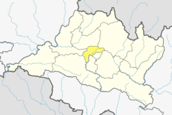
Indrayani
Location in Nepal
Coordinates: 27°44′N85°26′E / 27.73°N 85.44°E / 27.73; 85.44 Coordinates: 27°44′N85°26′E / 27.73°N 85.44°E / 27.73; 85.44
CountryFlag of Nepal.svg    Nepal
Province No. 3
District Kathmandu District
Population
 (2011)
  Total3,361
Time zone UTC+5:45 (Nepal Time)

Indrayani is a village and former Village Development Committee that is now part of Shankharapur Municipality in Kathmandu District in Province No. 3 of central Nepal. At the time of the 1991 Nepal census it had a population of 2,635 and had 467 households in it. As per 2011 Nepal census it had a population of 3,361 and had 717 households in it. [1]

Related Research Articles

Inaruwa Municipality City in Eastern, Nepal

Inaruwa is a municipality and headquarters of Sunsari District located 25 km (16 mi) east of the Koshi Barrage and 18.6 km (11.6 mi) east of Koshi Tappu Wildlife Reserve in Province No. 1, Nepal. It covers an area of 77.92 km2 (30.09 sq mi).

Pipra Rural Municipality Rural Municipality in Central, Nepal

Pipra (पिपरा) a village in Mahottari District, Janakpur Zone in the Central Region of Nepal.

Choukati Village development committee in Bagmati Zone, Nepal

Chaukati is a village in Sindhupalchok District in the Bagmati Zone of central Nepal. At the time of the 1991 Nepal census it had a population of 2346 and had 539 houses in the village. By 2011 the population had become 2497 in 627 households.

Maneshwara Village development committee in Bagmati Zone, Nepal

Maneshwara is a village in Sindhupalchok District in the Bagmati Zone of central Nepal. At the time of the 1991 Nepal census, it had a population of 3,065, and had 642 houses in the village. By 2011 the population had become 3,393 in 789 households.

Pagretar Village development committee in Bagmati Zone, Nepal

Pagretar is a village development committee in Sindhupalchowk District in the Bagmati Zone of central Nepal. Kothe is a populated location within the committee area. In 1991, there were 633 houses, and at the time of the 2001 Nepal census Pagretar had a population of 3,352. By 2011, the population had become 2,952 in 762 households.

Pedku Village development committee in Bagmati Zone, Nepal

Pedku is a village in Sindhupalchok District in the Bagmati Zone of central Nepal. At the time of the 2013 Nepal census it had a population of 2284 and had 408 houses in the village. In 2011 the population was 1600 in 391 households.

Bajrayogini Village of Shankharapur Municipality in No. 3, Nepal

Bajrayogini is a village and former Village Development Committee that is now part of Shankharapur Municipality in Kathmandu District in Province No. 3 of central Nepal. At the time of the 1991 Nepal census it had a population of 3,798 and had 632 houses in it. As per 2011 Nepal census it had a population of 4,333 and had 328 houses in it.

Chalnakhel Village of Dakshinkali Municipality in No. 3, Nepal

Chalnakhel is a village and former Village Development Committee that is now part of Dakshinkali Municipality in Kathmandu District in Province No. 3 of central Nepal. At the time of the 2011 Nepal census it had a population of 4,365 living in 1,005 households.

Dharmasthali Village of Tarakeshwar Municipality in No. 3, Nepal

Dharmasthali is a village and former Village Development Committee that is now part of Tarakeshwar Municipality in Kathmandu District in Province No. 3 of central Nepal. At the time of the 2011 Nepal census it had a population of 6,530 and had 1,421 households in it.

Gonggabu Village of Tokha Municipality in No. 3, Nepal

Gongabu is a village and former Village Development Committee that is now part of Tokha Municipality in Kathmandu District in Province No. 3 of central Nepal. At the time of the 2011 Nepal census it had a population of 54,410 and had 14,456 households in it in an area just 270 hectares in size

Gothatar Village of Kageshwari-Manohara Municipality in No. 3, Nepal

Gothatar is a village and former Village Development Committee that is now part of Kageshwari-Manohara Municipality in Kathmandu District in Province No. 3 of central Nepal. It being handled By ward Secretary name Rameshwor Dahal. At the time of the 2011 Nepal census it had a population of 26,169 and had 6,749 households in it. The newly built Bagmati bridge connects Gothatar with the roadway to Jorpati. The Krishna Parnami Mandir is one of the major attractions in Gothatar. In between 2007 and 2010, the density of population has rapidly increased as more and more houses are being constructed. The majority of the population in Gothatar consists of Hindu Brahmins and Kshetris. The natives are mainly farmers who still have cowsheds in their homes despite being very close to the rush of the metropolitan Kathmandu.

Ichangu Narayan Village of Nagarjun Municipality in Province No. 3, Nepal

Ichangu Narayan is a village and former Village Development Committee that is now part of Nagarjun Municipality in Province No. 3 of central Nepal. At the time of the 2011 Nepal census it had a population of 24,425 and had 6,288 households in it.

Jitpurphedi Village of Tarakeshwar Municipality in No. 3, Nepal

Jitpurphedi is a village and former Village Development Committee that is now part of Tarakeshwar Municipality in Kathmandu District in Province No. 3 of central Nepal. At the time of the 1991 Nepal census it had a population of 5,135 and had 1,103 households in it.

Jorpati Village of Gokarneshwar Municipality in No. 3, Nepal

Jorpati is a village and former Village Development Committee that is now part of Gokarneshwar Municipality in Kathmandu District in Province No. 3 of central Nepal. At the 2011 census it had a population of 84,567 making it one of the largest villages in the world. At the time of the 1991 Nepal census it had a population of 10,796 and had 1,988 households in it.

Kapan is a village and former Village Development Committee that is now part of Budanilkantha Municipality in Kathmandu District in Province No. 3 of central Nepal. It is situated in the northern part of Kathmandu. At the time of the 2011 Nepal census it had a population of 48,463 in 12,324 households. Kapan Sangit Sarowar, Kapan Monastery, Kapan Aani Gumba etc. are tourist places situated at Kapan. Kapan consists of several settlements, e. g.: Mahankal, New Colony, Jyotinagar, Saraswatinagar, Golphutar or Baluwakhani. Kapan has recently developed very high number of Paying Guest Houses for local-tourism.

Dhamir Village Development Committee in Lumbini Zone, Nepal

Ghamir is a village in Gulmi District in the Lumbini Zone of Western Nepal. It is located at latitude 28°12′7.81″ N and longitude 83°9′32.66″ E. It lies 1143 meters above sea level. According to 2011 Nepal census, the total population of this village is 3,588 individuals living in 768 households. The census also noted some absent people; most are foreign employees employed overseas and in the Middle East. The male population is 1,563 and the female population is 2,025, causing a sex ratio of 77.19.Also known as corrupted ward of Malika RM

Jungar, Nepal Village development committee in Rapti Zone, Nepal

Jungar is a village development committee in Rolpa District in the Rapti Zone of north-eastern Nepal. At the time of the 2011 Nepal census it had a population of 5,169 people living in 1,019 individual households.

Naxalbari (community development block) Community development block in West Bengal, India

Naxalbari is a community development block that forms an administrative division in the Siliguri subdivision of the Darjeeling district in the Indian state of West Bengal.

Nepal conducted a widespread national census in 2011 by the Nepal Central Bureau of Statistics. Working with the 58 municipalities and the 3915 Village Development Committees at a district level, they recorded data from all the municipalities and villages of each district. The data included statistics on population size, households, sex and age distribution, place of birth, residence characteristics, literacy, marital status, religion, language spoken, caste/ethnic group, economically active population, education, number of children, employment status, and occupation.

Sundar Haraicha Municipality Municipality in Province No. 1, Nepal

Sundar Haraicha is a municipality in Morang District of Province No. 1 in Nepal that was established on 10 March 2017 by merging the former municipalities Sundar Dulari and Koshi Haraicha. At the time of the 2011 Nepal census, the localities formed had a joint population of 80,518 people living in 18,610 individual households.

References

  1. "Archived copy" (PDF). Archived from the original (PDF) on 2013-07-31. Retrieved 2012-11-01.CS1 maint: archived copy as title (link)