Kasaragod is a municipal town and administrative headquarters of Kasaragod district of Kerala state in India. Established in the year 1966, Kasaragod was the first municipal town in Kasaragod district. It is the northernmost district of Kerala and is also known as Saptha Bhasha Sangama Bhoomi as seven languages namely, Malayalam, Tulu, Kannada, Marathi, Konkani, Beary, and Urdu are spoken. Situated in the rich biodiversity of Western Ghats, it is known for the Chandragiri and Bekal Forts, Chandragiri River, historic Kolathiri Rajas, natural environment of Ranipuram and Kottancheri Hills, historical and religious sites like the Madiyan Kulom temple, Madhur Temple, Ananthapuram Lake Temple and Malik Deenar Mosque. The historic hill of Ezhimala is located on the southern portion of Kavvayi Backwaters of Nileshwaram. Kasaragod is located 50 km south of the major port city & a commercial hub Mangalore and 364 km north of the major port city Kochi. Kasaragod district has the maximum number of rivers in Kerala - 12. Kasaragod town is located on the estuary where the Chandragiri River, which is also the longest river in the district, empties into Arabian Sea. Kasaragod is home to several forts which include Arikady fort, Bekal Fort, Chandragiri Fort, and Hosdurg Fort. Bekal Fort is also the largest fort in Kerala.
Dadeldhura district, a part of Sudurpashchim Province, is one of the seventy-seven districts of Nepal. The district, with Dadeldhura as its district headquarters, covers an area of 1,538 km2 (594 sq mi) and had a population of 126,162 in 2001 and 142,094 in 2011.

Dhankuta District is one of 14 districts of Province No. 1 of eastern Nepal. The district covers an area of 891 km2 (344 sq mi) and has a population (2011) of 163,412. Dhankuta is the district headquarters of Dhankuta District.

Baad Bhanjyang is a village and former Village Development Committee that is now part of Chandragiri Municipality in Kathmandu District in Province No. 3 of central Nepal. At the time of the 2011 Nepal census it had a population of 3,779 and had 817 houses in it.

Balambu is a village and former Village Development Committee that is now part of Chandragiri Municipality in Kathmandu District in Province No. 3 of central Nepal. At the time of the 2011 Nepal census it had a population of 7,323 and had 1734 houses in it. Porters play a vital role in Nepal's tourism industry; every year they support thousands of tourists in tackling the iconic trails of the Everest region. Often climbing multiple time during the high season, the trekking industry provides an income that helps porters earn a living and support their families. However, they are also often the least valued on the mountain and because of the pressures to get an income can face exploitation and mistreatment from trekking operators. To address these issues, Kathmandu Environmental Education Program (KEEP) has created the Porter Awareness and Welfare training program. This provides porters with information about their work rights as well as health, hygiene and general First Aid skills. The program also offers guidance on appropriate trekking clothing and gear, and how to access KEEP's Porter Clothing Centre, which loans warm clothing and appropriate footwear to porters.

Dahachok is a village and former Village Development Committee that is now part of Chandragiri Municipality in Kathmandu District in Province No. 3 of central Nepal. At the time of the 2011 Nepal census it had a population of 4,036. It is located in the west of Kathmandu. It has many small units of handwork embroidery, mainly immigrant Muslim workers. In the date of every Bhadra Sukla Purnima, this place takes the important of Indrasthan Mela.
Jitpurphedi is a village and former Village Development Committee that is now part of Tarakeshwar Municipality in Kathmandu District in Province No. 3 of central Nepal. At the time of the 1991 Nepal census it had a population of 5135 and had 1103 households in it.
Machhegaun is a village and former Village Development Committee that is now part of Chandragiri Municipality in Kathmandu District in Province No. 3 of central Nepal. At the time of the 1991 Nepal census it had a population of 2871.
Mahadevsthan is a village and former Village Development Committee that is now part of Chandragiri Municipality in Kathmandu District in Province No. 3 of central Nepal. At the time of the 1991 Nepal census it had a population of 4920 and had 867 households in it.

Matatirtha is a village and former Village Development Committee that is now part of Chandragiri Municipality in Kathmandu District in Province No. 3 of central Nepal. At the time of the [[2018 it had a population of 5982 and had 1314 households in it. Santosh Khadka was elected as Ward Chairman of Matatirtha through a local election.
Mulpani is a village and former Village Development Committee that is now part of Kageshwari-Manohara Municipality in Kathmandu District in Province No. 3 of central Nepal. Mulpani was previously known as Bhaimal, meaning "no fear". At the time of the 1991 Nepal census it had a population of 4718 and had 843 households in it. The main occupation of the people living in this village is agriculture. Mulpani is surrounded by Bagmati and Manohara river. Mulpani is famous for the Nepal's biggest International Cricket Ground, known as Mulpani Cricket Stadium, which is under construction. In the recent years, Mulpani has seen much change in its infrastructure and people as well. The main occupation in Mulpani was agriculture but now employment is more diverse.
Naikap Naya Bhanjyang is a village and former Village Development Committee that is now part of Chandragiri Municipality in Kathmandu District in Province No. 3 of central Nepal. At the time of the 1991 Nepal census it had a population of 4425.
Naikap Purano Bhanjyang is a village and former Village Development Committee that is now part of Chandragiri Municipality in Kathmandu District in Province No. 3 of central Nepal. At the time of the 1991 Nepal census it had a population of 3456. The highest terrains in this village locate westerly, in ward No.5. A panoramic beautiful scene of whole Kathmandu Valley from Sanga to Nagarkot and Swayambhunath to Kirtipur Chobar can be viewed very clearly. The height of this hilly region lies in between 1600 m to 1800 m. The whole Himalayan range from Langtang to Mahalangur can also be viewed.
Satungal is a village and former Village Development Committee that is now part of Chandragiri Municipality in Kathmandu District in Province No. 3 of central Nepal. Satungal is also known as Satyapur. At the time of the 1991 Nepal census it had a population of 2730 and had 464 households in it. At the time of the 2001 Nepal census Satungal had a population of 5834 and had 1375 households in it. Satungal had 5173 literate people i.e. 88.66%.
Tinthana is a village and former Village Development Committee that is now part of Chandragiri Municipality in Kathmandu District in Province No. 3 of central Nepal. At the time of the 2011 Nepal census it had a population of 9,726.
Kaskikot, commonly known as Kaski, is a Ward no. 24 of the Pokhara metropolitan city. It was earlier a part of the village development committee in Kaski District, a region in northern-central Nepal.
Nepal conducted a widespread national census in 2011 by the Nepal Central Bureau of Statistics. Working with the 58 municipalities and the 3915 Village Development Committees at a district level, they recorded data from all the municipalities and villages of each district. The data included statistics on population size, households, sex and age distribution, place of birth, residence characteristics, literacy, marital status, religion, language spoken, caste/ethnic group, economically active population, education, number of children, employment status, and occupation.

Gokarneshwar is a municipality in Kathmandu District in the Bagmati Pradesh of Nepal that was established on 2 December 2014 by merging the former Village development committees Sundarijal, Nayapati, Baluwa, Jorpati and Gokarna. The office of the municipality is that of the former Jorpati village development committee. The river Bagmati has its origin as the name Bagh Dwar situated in the middle of the Shivapuri jungle in this municipality. In the village on the banks of the Bagmati River stands the Gokarna Mahadev temple, built in 1582. In late August or early September people go to this temple to bathe and make offerings in honor of their fathers, living or dead, on a day called Gokarna Aunsi.

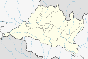
Chandragiri is a municipality in Kathmandu District in Bagmati Pradesh of Nepal that was declared as municipality on 2 December 2014 by merging the former Village Development Committees Baad Bhanjyang, Balambu, Dahachok, Mahadevsthan, Machhegaun, Matatirtha, Naikap Naya Bhanjyang, Naikap Purano Bhanjyang, Satungal, Thankot and Tinthana. The urban administration is located in Old-Balambu. The city's main attractions include Chandragiri Hill, Nepal with its Cable Car.

Arjundhara is a municipality in Jhapa District of Province No. 1 in Eastern Nepal. It was formed in 2014 by merging the former village development committees Arjundhara, Shanischare, and Khudunabari. It was named Shani-Arjun initially but was changed to Arjundhara again in January 2017. It is named after a holy place situated here, Arjundhara Temple. At the time of the 2011 Nepal census it had a population of 60,205 people living in 13,623 individual households.