Kageshwori-Manohara कागेश्वरी–मनोहरा | |
|---|---|
 Krishna Mandir at Jorpati, Kathmandu | |
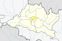
 Kageshwori-Manohara Location in Nepal  Kageshwori-Manohara Kageshwori-Manohara (Nepal) | |
| Coordinates: 27°43′33″N85°24′42″E / 27.72583°N 85.41167°E | |
| Country | |
| Province | Bagmati |
| District | Kathmandu |
| Established | December 2014 |
| Government | |
| • Type | Local Government |
| • Mayor | Upendra Karki (NC) |
| • Deputy mayor | Shanta Thapa (CPN-UML) |
| Area | |
• Total | 27.5 km2 (10.6 sq mi) |
| Population | |
• Total | 130,433 |
| • Density | 4,740/km2 (12,300/sq mi) |
| • Ethnicities | Newar Tamang Sherpa Hyolmo Bahun Chhetri Magar |
| Time zone | UTC+5:45 (NST) |
| Website | https://kageshworimanoharamun.gov.np |
Kageshwori-Manohara is a municipality in Kathmandu District in the Bagmati Province of Nepal that was established on 2 December 2014 by merging the former Village development committees of Aalapot, Bhadrabas, Danchhi, Gagalphedi, Gothatar and Mulpani. [1] [2] The office of the municipality is in Thali Danchhi in Ward No. 5. history finding