Barry, Illinois

Last updated

Barry
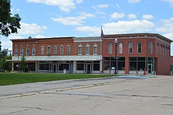
Public square in Barry, western side.jpg
Downtown buildings
Pike County Illinois Incorporated and Unincorporated areas Barry Highlighted.svg
Location of Barry in Pike County, Illinois.
Illinois in United States (US48).svg
Location of Illinois in the United States
Coordinates: 39°41′41″N91°02′27″W / 39.69472°N 91.04083°W / 39.69472; -91.04083
CountryUnited States
StateIllinois
County Pike
Township Barry
Government
  MayorShawn Rennecker
Area
[1]
  Total1.43 sq mi (3.71 km2)
  Land1.43 sq mi (3.71 km2)
  Water0.00 sq mi (0.00 km2)
Elevation
[2]
673 ft (205 m)
Population
 (2020)
  Total1,303
  Density909.92/sq mi (351.26/km2)
Time zone UTC-6 (CST)
  Summer (DST) UTC-5 (CDT)
ZIP Code(s)
62312
Area code 217
FIPS code 17-03948
GNIS feature ID2394070 [2]
Wikimedia CommonsBarry, Illinois
Website http://www.barryil.org

Barry is a city in Pike County, Illinois, United States. The population was 1,318 at the 2010 census, down from 1,368 in 2000.

Contents

Geography

According to the 2010 census, Barry has a total area of 1.41 square miles (3.65 km2), all land. [3]

Demographics

Historical population
CensusPop.Note
1880 1,392
1890 1,354−2.7%
1900 1,64321.3%
1910 1,6470.2%
1920 1,490−9.5%
1930 1,5061.1%
1940 1,5452.6%
1950 1,529−1.0%
1960 1,422−7.0%
1970 1,4441.5%
1980 1,4873.0%
1990 1,391−6.5%
2000 1,368−1.7%
2010 1,318−3.7%
2020 1,303−1.1%
U.S. Decennial Census [4]

2010 census

As of the census [5] of 2010, there were 1,318 people, 545 households, and 341 families living in the city.

2000 census

As of the census [6] of 2000, there were 1,368 people, 552 households, and 363 families living in the city. The population density was 1,198.0 inhabitants per square mile (462.6/km2). There were 623 housing units at an average density of 545.6 per square mile (210.7/km2). The racial makeup of the city was 99.42% White, 0.44% Asian, and 0.15% from two or more races. Hispanic or Latino of any race were 0.80% of the population.

There were 552 households, out of which 29.5% had children under the age of 18 living with them, 52.5% were married couples living together, 10.3% had a female householder with no husband present, and 34.2% were non-families. 32.4% of all households were made up of individuals, and 20.3% had someone living alone who was 65 years of age or older. The average household size was 2.32 and the average family size was 2.91.

In the city, the population was spread out, with 23.2% under the age of 18, 7.4% from 18 to 24, 24.3% from 25 to 44, 21.4% from 45 to 64, and 23.8% who were 65 years of age or older. The median age was 41 years. For every 100 females, there were 84.6 males. For every 100 females age 18 and over, there were 79.4 males.

The median income for a household in the city was $27,635, and the median income for a family was $37,143. Males had a median income of $26,607 versus $18,050 for females. The per capita income for the city was $18,097. About 9.2% of families and 11.5% of the population were below the poverty line, including 13.4% of those under age 18 and 14.0% of those age 65 or over.
Notable people

See also

Related Research Articles

<span class="mw-page-title-main">Diaz, Arkansas</span> City in Arkansas, United States

Diaz is a city in Jackson County, Arkansas, United States. The population was 1,318 at the 2010 census.

<span class="mw-page-title-main">Walford, Iowa</span> City in Iowa, United States

Walford is a city in Benton and Linn counties in the U.S. state of Iowa. The population was 1,366 at the time of the 2020 census. It is part of the Cedar Rapids Metropolitan Statistical Area.

<span class="mw-page-title-main">Lincolnshire, Kentucky</span> City in Kentucky, United States

Lincolnshire is a home rule-class city in Jefferson County, Kentucky, United States. The population was 148 at the 2010 census.

<span class="mw-page-title-main">West Gardiner, Maine</span> Town in the state of Maine, United States

West Gardiner is a town in Kennebec County, Maine, United States. The population was 3,671 at the 2020 census. West Gardiner is included in the Augusta, Maine micropolitan New England City and Town Area.

<span class="mw-page-title-main">Hastings, Michigan</span> City in Michigan, United States

Hastings is a city in the U.S. state of Michigan, the county seat of Barry County as well as the county's only city. The population was 7,514 at the 2020 census. The city borders Hastings Charter Township on the north, east, and south, and Rutland Charter Township on the west.

<span class="mw-page-title-main">Rockwood, Michigan</span> City in Michigan, United States

Rockwood is a city in southeastern Wayne County in the U.S. state of Michigan. The population was 3,289 at the 2010 census.

<span class="mw-page-title-main">Shorewood, Minnesota</span> City in Minnesota, United States

Shorewood is a city nestled in the woods along on the shores of Lake Minnetonka in Hennepin County, Minnesota, United States. The population was 7,307 at the 2010 census. The city was incorporated in 1956. Its area was originally part of the former Excelsior Township.

Clearwater Township is a township in Wright County, Minnesota, United States. The population was 1,368 at the 2000 census.

Monticello Township is a township in Wright County, Minnesota, United States. The population was 4,139 at the 2000 census.

<span class="mw-page-title-main">Hayti, Missouri</span> City in Missouri, United States

Hayti is a city in eastern Pemiscot County, Missouri, United States. The population was 2,493 at the 2020 census.

<span class="mw-page-title-main">Riverview, St. Louis County, Missouri</span> Village in Missouri, United States

Riverview is a village in St. Louis County, Missouri, United States. The population was 2,397 at the 2020 census.

<span class="mw-page-title-main">Washington Heights, New York</span> CDP in New York, United States

Washington Heights is a census-designated place (CDP) in Orange County, New York, United States. The population was 2,205 at the 2020 census.

<span class="mw-page-title-main">West Portsmouth, Ohio</span> Census-designated place in Ohio, United States

West Portsmouth is a census-designated place (CDP) in Scioto County, Ohio, United States. The population was 2,929 at the 2020 census.

<span class="mw-page-title-main">Harrisburg, Oregon</span> City in Oregon, United States

Harrisburg is a city in Linn County, Oregon, United States. The population was 3,567 at the 2010 census.

<span class="mw-page-title-main">Durham, Oregon</span> City in Oregon, United States

Durham is a city in Washington County, Oregon, United States. Incorporated in 1966, the city is surrounded by Tigard and Tualatin and is adjacent to the Bridgeport Village shopping complex. The population was 1,351 at the 2010 census.

<span class="mw-page-title-main">Rayne Township, Indiana County, Pennsylvania</span> Township in Pennsylvania, United States

Rayne Township is a township that is located in Indiana County, Pennsylvania, United States.

<span class="mw-page-title-main">Clear Lake, South Dakota</span> City in South Dakota, United States

Clear Lake is a city in and the county seat of Deuel County, South Dakota, United States. The population was 1,218 at the 2020 census.

<span class="mw-page-title-main">Spring Lake Park, Minnesota</span> City in Minnesota, United States

Spring Lake Park is a city in Anoka and Ramsey counties in the state of Minnesota. The population was 6,412 at the 2010 census. The city is located mainly within Anoka County. Minnesota State Highways 47 and 65 and County Highway 10 are three of the main routes in the city.

<span class="mw-page-title-main">Eagle Butte, South Dakota</span> City in South Dakota, United States

Eagle Butte is a city in Dewey and Ziebach counties in South Dakota, United States. The population was 1,258 at the 2020 census.

<span class="mw-page-title-main">Williamstown (CDP), Massachusetts</span> Census-designated place in Massachusetts, United States

Williamstown is a census-designated place (CDP) in the town of Williamstown in Berkshire County, Massachusetts, United States. The population of the CDP was 4,325 at the 2010 census, out of 7,754 in the entire town.

References

  1. "2020 U.S. Gazetteer Files". United States Census Bureau. Retrieved March 15, 2022.
  2. 1 2 U.S. Geological Survey Geographic Names Information System: Barry, Illinois
  3. "G001 - Geographic Identifiers - 2010 Census Summary File 1". United States Census Bureau. Archived from the original on February 13, 2020. Retrieved December 25, 2015.
  4. "Census of Population and Housing". Census.gov. Retrieved June 4, 2015.
  5. "American FactFinder". U.S. Census Bureau. Archived from the original on May 21, 2019. Retrieved December 24, 2011.
  6. "U.S. Census website". United States Census Bureau . Retrieved January 31, 2008.
  7. "Lottie Holman O'Neill (1878-1967)". National Women's History Museum. Archived from the original on September 6, 2015. Retrieved December 23, 2015.